Chest opened
+${chestReward.xp} XP
Explorer
NOUVEAU ×${chestReward.collectible.quantity}
tapez pour fermer
Chest locked

Open chests in the app

Around Us is built for your phone — chests unlock when you walk, explore and capture nearby places.

Enable Location

We need your location to show you interesting places around you

Discover nearby places

Find interesting locations and hidden gems around you

Precise directions

Get accurate directions and distances to places

Your location is never shared with other users. It's only used when you tap the location button.

Log in to your account

Start exploring — it's free

Trusted by 72,878 travelers worldwide

Continue with Google
Continue with Apple
or

We will send you a code to connect

By continuing, you accept our Terms and Conditions and our Privacy Policy

Check your inbox

We've sent a pincode in your inbox. Please enter the code below.

Municipal Borough of Brentford and Chiswick
Discussion Reviews Photo
3.1k Popularity

Municipal Borough of Brentford and Chiswick, Administrative district in Middlesex, England

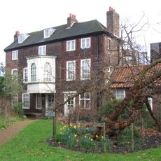
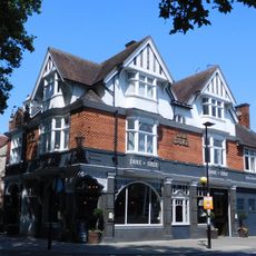
The Municipal Borough of Brentford and Chiswick was an administrative area along the River Thames in west London that joined together several long-established communities. The district spread across substantial land and contained different residential neighborhoods and types of landscape.

The area formed in 1927 when two separate urban administrative districts merged into one combined entity. This new unit lasted nearly 40 years before it became part of a larger London borough in 1965.

The name brings together two historic communities whose shared identity appears in local landmarks and place names throughout the area. The Rivers Thames and Brent shaped how residents connected with their surroundings over many generations.

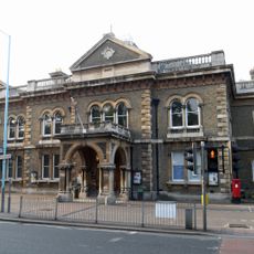
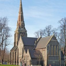
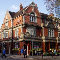
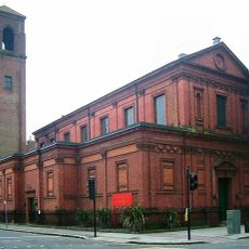
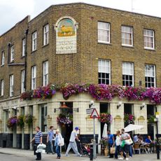
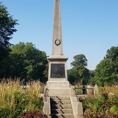
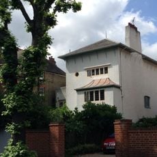
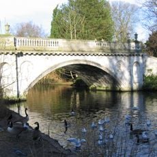
Visitors can still trace this former administrative area through street names, monuments, and local buildings today. A walk along the river provides a chance to understand the geographical features that defined the district.

The borough's coat of arms displayed religious and symbolic figures that reflected its creation as a merged community. The design blended images from multiple historical traditions to represent the new unified identity.

The community of curious travelers

AroundUs brings together thousands of curated places, local tips, and hidden gems, enriched daily by 60,000 contributors worldwide.

Start exploring
Location
GPS coordinates
51.49110,-0.26550
Latest update
March 6, 2026 16:53
Around this place
Hogarth's House
United Kingdom

Hogarth's House

640 m
Gunnersbury Triangle
United Kingdom

Gunnersbury Triangle

500 m
Tabard Theatre
United Kingdom

Tabard Theatre

892 m
Cathedral of the Dormition of the Most Holy Mother of God and Holy Royal Martyrs
United Kingdom

Cathedral of the Dormition of the Most Holy Mother of God and Holy Royal Martyrs

740 m
The Duke Of Sussex Public House
United Kingdom

The Duke Of Sussex Public House

583 m
Chiswick Town Hall
United Kingdom

Chiswick Town Hall

4 m
Church of Our Lady of Grace & St Edward, Chiswick
United Kingdom

Church of Our Lady of Grace & St Edward, Chiswick

330 m
Christ Church
United Kingdom

Christ Church

120 m
St Alban's Church, Acton Green
United Kingdom

St Alban's Church, Acton Green

553 m
Old Packhorse
United Kingdom

Old Packhorse

219 m
Chiswick Park Footbridge
United Kingdom

Chiswick Park Footbridge

715 m
St Michael's Church, Grove Park
United Kingdom

St Michael's Church, Grove Park

605 m
Hogarth's House
United Kingdom

Hogarth's House

855 m
Bedford Park War Memorial
United Kingdom

Bedford Park War Memorial

904 m
Our Lady Of Grace And St Edward Roman Catholic Church
United Kingdom

Our Lady Of Grace And St Edward Roman Catholic Church

326 m
Temple (rustic House) At End Of Yew Walk North East Of Chiswick House
United Kingdom

Temple (rustic House) At End Of Yew Walk North East Of Chiswick House

608 m
Crown And Anchor Public House
United Kingdom

Crown And Anchor Public House

223 m
Chiswick War Memorial
United Kingdom

Chiswick War Memorial

193 m
Bollo Lane Junction Signal Box
United Kingdom

Bollo Lane Junction Signal Box

848 m
Ionic Temple And Obelisk In Chiswick Park
United Kingdom

Ionic Temple And Obelisk In Chiswick Park

845 m
14, South Parade W4
United Kingdom

14, South Parade W4

664 m
Pillar Box In Bedford Road At Junction With The Orchard
United Kingdom

Pillar Box In Bedford Road At Junction With The Orchard

858 m
Classic Bridge In Chiswick Park
United Kingdom

Classic Bridge In Chiswick Park

738 m
Inigo Jones's Gateway In Chiswick Park
United Kingdom

Inigo Jones's Gateway In Chiswick Park

906 m
Doric Column In Chiswick Park North East Of Conservatory
United Kingdom

Doric Column In Chiswick Park North East Of Conservatory

770 m
Ornaments lining avenue to rear of Chiswick House
United Kingdom

Ornaments lining avenue to rear of Chiswick House

898 m
Deer House In Chiswick Park Near Italian Garden
United Kingdom

Deer House In Chiswick Park Near Italian Garden

802 m
Conservatory To Chiswick House
United Kingdom

Conservatory To Chiswick House

833 m
Show the full map
Reviews
Share your experience

No review yet

Discussions
Start a discussion...

No discussion yet

« Municipal Borough of Brentford and Chiswick - Administrative district in Middlesex, England » is provided by Around Us (aroundus.com). Images and texts are derived from Wikimedia project under a Creative Commons license. You are allowed to copy, distribute, and modify copies of this page, under the conditions set by the license, as long as this note is clearly visible.

Discover hidden gems everywhere you go!

From secret cafés to breathtaking viewpoints, skip the crowded tourist spots and find places that match your style. Our app makes it easy with voice search, smart filtering, route optimization, and insider tips from travelers worldwide. Download now for the complete mobile experience.

Around Us App Screenshot

A unique approach to discovering new places

Le Figaro

All the places worth exploring

France Info

A tailor-made excursion in just a few clicks

20 Minutes

Around Us
Travel Guide & Maps
Download

Send to your phone

QR Code
1

Open the camera app on your mobile.

2

Point at the QR code with your camera. A notification will appear.

3

Tap the notification to open the link.