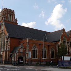
The London Mosque, Islamic mosque in Southfields, United Kingdom
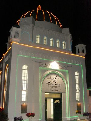
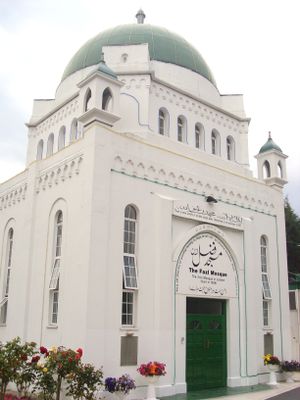
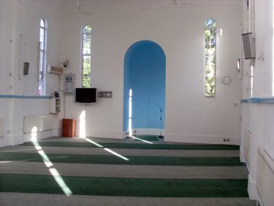
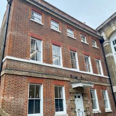
The London Mosque is a house of worship in Southfields with white walls, a central dome, and traditional Islamic geometric patterns adorning its exterior and prayer halls. The building accommodates around 150 worshippers and features separate entrances for men and women.
The building was constructed in 1926 under architect Thomas Hayton Mawson's direction and holds Grade II listed status. It stands as London's first structure purpose-built as a mosque.
The mosque functions as the international headquarters of the Ahmadiyya Muslim Community, drawing worshippers from around the world. Visitors can observe daily worship practices and community gatherings that reflect its role as a hub for this faith tradition.
The site sits near Southfields Underground Station, making it easily accessible by public transport. Visitors should wear modest clothing and check in advance about visiting hours, as access to prayer areas may be restricted during worship times.
The building merges British and Islamic architectural elements into a design from the early 1900s. This blend of styles makes it a rare example of how different building traditions can coexist within a single structure.
Location: London Borough of Wandsworth
Inception: 1926
Architects: Thomas Hayton Mawson
Architectural style: Islamic architecture
Capacity: 150
Address: 16 Gressenhall Road, London SW18 5QL
Phone: +442088745836
Website: http://ahmadiyya.org.uk
GPS coordinates: 51.45110,-0.20750
Latest update: December 7, 2025 19:29
Wandsworth Museum
826 m
De Morgan Centre
833 m
All Saints Church, Wandsworth
1.1 km
Wandsworth High Street
1.1 km
St Thomas a Becket, Wandsworth
798 m
Rosslyn Tower
1.1 km
23 Oakhill Road
927 m
Church Row, Wandsworth
1.1 km
25 Oakhill Road
930 m
155–171 Oakhill Road
1.1 km
Church of Holy Trinity
592 m
Church of St Michael and All Angels
404 m
Church Row
1.2 km
St Barnabas, Southfields
1.1 km
25 And 27, West Hill Sw18
833 m
Old County Court House
1.2 km
140-142, Wandsworth High Street
936 m
Riversdale School With Associated Caretaker's House, Boundary Wall And Iron Gates
804 m
22 And 24, Putney Bridge Road Sw18
1 km
29 And 31, West Hill Sw18
827 m
Milestone (Opposite Number 37)
802 m
23, West Hill Sw18
841 m
33, West Hill Sw18
809 m
35 And 37, West Hill Sw18
799 m
Fairlawn
1.1 km
70, Wandsworth High Street Sw18
1.2 km
Milestone, Tibbet's Comer
966 m
Royal Hospital for Neuro-disability
454 mVisited this place? Tap the stars to rate it and share your experience / photos with the community! Try now! You can cancel it anytime.
Discover hidden gems everywhere you go!
From secret cafés to breathtaking viewpoints, skip the crowded tourist spots and find places that match your style. Our app makes it easy with voice search, smart filtering, route optimization, and insider tips from travelers worldwide. Download now for the complete mobile experience.
A unique approach to discovering new places❞
— Le Figaro
All the places worth exploring❞
— France Info
A tailor-made excursion in just a few clicks❞
— 20 Minutes