Gaping Gill, Natural cave system in Yorkshire Dales, England
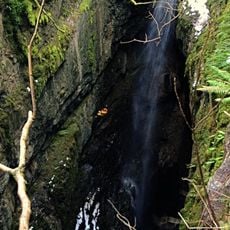
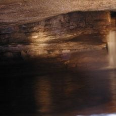
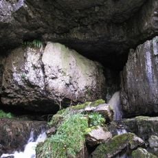
Gaping Gill is a cave system in the Yorkshire Dales of northern England, known for its large underground chamber and tall waterfall. The main chamber measures roughly 129 meters long, 31 meters high, and 25 meters wide, while the water from Fell Beck drops about 100 meters into the depths.
French explorer Edouard Martel completed the first successful descent in 1895 using a rope ladder and maintaining contact with the surface through a telephone line. Previous attempts had failed because the equipment was not adequate to handle the depth of the shaft.
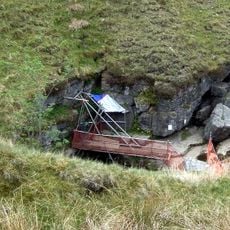
Since the late 19th century, regional potholing clubs have organized regular winch meets allowing visitors to descend in a metal cage. These events take place during the May and August bank holidays, when volunteers set up and operate the equipment for several days.
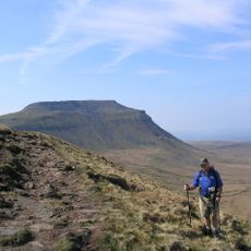
The access point lies roughly 90 minutes on foot from Clapham village via well-marked paths that pass Ingleborough Show Cave. The terrain is uneven and partly steep, so sturdy footwear is recommended and extra caution is needed in wet weather.
The underground chamber is large enough to fit the entire York Minster cathedral inside, making it one of the largest natural cavities in Britain. The unbroken drop of water forms the longest free fall of any waterfall in England and disappears immediately into the darkness below.
The community of curious travelers
AroundUs brings together thousands of curated places, local tips, and hidden gems, enriched daily by 60,000 contributors worldwide.