Taunton Stop Line, Military defensive line in Somerset, United Kingdom.
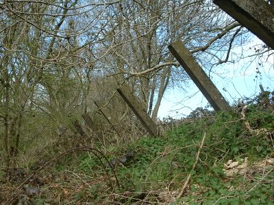
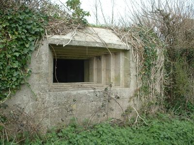
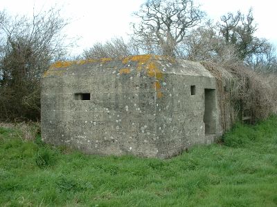
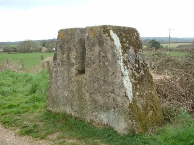
The Taunton Stop Line is a fortified defensive line running through Somerset, Dorset, and Devon that made use of rivers and canals as natural barriers. Concrete structures including pillboxes and anti-tank barriers remain scattered and visible across the landscape from Seaton to Highbridge.
This defensive system was built during World War II as protection against a potential invasion of southwestern England. The fortification network was constructed to create a strong barrier in case German forces attempted to advance through the region.
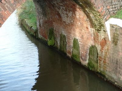
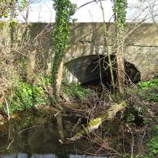
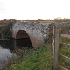
The defensive line incorporated existing infrastructure, including bridges fitted with demolition chambers and railway blocks to prevent potential enemy advancement.
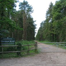
Many of these structures can be reached on foot as they are scattered across the countryside. Wear sturdy shoes since some sites sit on uneven ground and may be muddy depending on recent weather.
Bridges along the line were fitted with special chambers designed to demolish them if needed, preventing enemy crossings. This level of preparation reveals how thoroughly the defenders planned for every scenario.
GPS coordinates: 51.00000,-3.00000
Latest update: December 8, 2025 13:43
Hatch Court
1.9 km
Church of St John the Baptist, Hatch Beauchamp
1.8 km
Thurlbear Wood and Quarrylands
3.4 km
Church of St Peter & St Paul, North Curry
3.5 km
Curry and Hay Moors
5.1 km
Church of St James, Curry Mallet
3.9 km
Church of St Thomas
3.7 km
Church of St Mary
3.4 km
Church of St James, Beercrocombe
3.5 km
Church of the Holy Cross, Thornfalcon
2 km
Church of St George
4.3 km
Church of St Michael, Creech St Michael
3.5 km
Church of St Andrew
2.2 km
Henlade House
2.6 km
Charlton Bridge
3.9 km
Fosse Cottage
3.4 km
Creech St Michael War Memorial
3.6 km
Manor Farmhouse
2 km
Former Canal Bridge North East Of Lower Farmhouse
2.3 km
The Battlements
2.5 km
Hankridge Farmhouse
5.1 km
Knapp Bridge At Ngr St 3018 2604
3.3 km
North Curry War Memorial
3.2 km
Tuckers
3.5 km
Ashe Farmhouse
1.9 km
Stocks In Churchyard, About 22 Metres West Of West End, Church Of St Michael
3.6 km
Village Cross At Ngr St 2818 2381
2 km
Stable Block About 100 Metres East Of Henlade House
2.6 kmVisited this place? Tap the stars to rate it and share your experience / photos with the community! Try now! You can cancel it anytime.
Discover hidden gems everywhere you go!
From secret cafés to breathtaking viewpoints, skip the crowded tourist spots and find places that match your style. Our app makes it easy with voice search, smart filtering, route optimization, and insider tips from travelers worldwide. Download now for the complete mobile experience.
A unique approach to discovering new places❞
— Le Figaro
All the places worth exploring❞
— France Info
A tailor-made excursion in just a few clicks❞
— 20 Minutes