Chest opened
+${chestReward.xp} XP
Explorer
NOUVEAU ×${chestReward.collectible.quantity}
tapez pour fermer

See the monuments around you in AR Open chests in the app

Around Us is built for your phone — point your camera at the streets and discover the monuments and places around you in augmented reality. Around Us is built for your phone — chests unlock when you walk, explore and capture nearby places.

Enable Location

We need your location to show you interesting places around you

Discover nearby places

Find interesting locations and hidden gems around you

Precise directions

Get accurate directions and distances to places

Your location is never shared with other users. It's only used when you tap the location button.

Bannaventa

Log in to your account

Start exploring — it's free

Trusted by 83,963 travelers worldwide

Continue with Google
Continue with Apple
or

We will send you a code to connect

By continuing, you accept our Terms and Conditions and our Privacy Policy

Check your inbox

We've sent a pincode in your inbox. Please enter the code below.

Discussion Reviews 1 Photos
5.6k Popularity

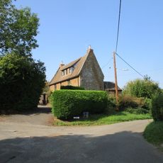
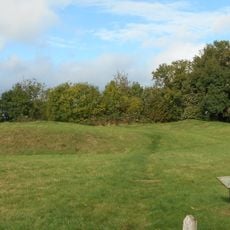
Bannaventa, Archaeological site in Northamptonshire, England

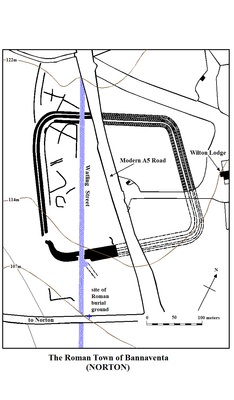
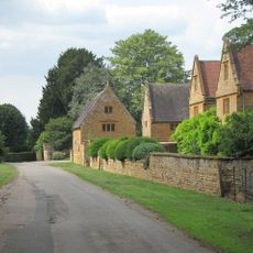
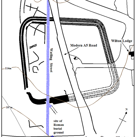
Bannaventa is an archaeological site situated along the historic Watling Street near Norton and Whilton villages. The location spans several acres and contains remnants of fortified boundaries from Roman times.

The site developed during Roman occupation as a military outpost positioned between two major settlements. It served as a waystation for travelers and merchants moving along key trade routes.

The name comes from Celtic language roots that reference geographical features. This naming reflects a layering of cultures across the settlement's long history.

The site remains on private land with no public access available. Archaeological research continues through authorized excavation programs.

Excavations have uncovered coins from the Constantinian period, pointing to extended human habitation. These findings reveal that people occupied this location across several centuries.

The community of curious travelers

AroundUs brings together thousands of curated places, local tips, and hidden gems, enriched daily by 60,000 contributors worldwide.
Start exploring
Location
Location
GPS coordinates
52.27530,-1.10219
Latest update
August 24, 2026 23:28
Around this place
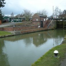
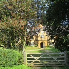
Whilton Locks
United Kingdom

Whilton Locks

514 m
Daventry Country Park
United Kingdom

Daventry Country Park

3.7 km
Borough Hill Roman villa
United Kingdom

Borough Hill Roman villa

3.3 km
Whilton Locks Garden Village
United Kingdom

Whilton Locks Garden Village

367 m
Muscott
United Kingdom

Muscott

1.7 km
Church of St Lawrence
United Kingdom

Church of St Lawrence

3.5 km
Church of St Peter and St Paul
United Kingdom

Church of St Peter and St Paul

2.7 km
Church of St Mary the Virgin
United Kingdom

Church of St Mary the Virgin

4 km
Church of All Saints
United Kingdom

Church of All Saints

1.3 km
Church of St Martin
United Kingdom

Church of St Martin

3.6 km
Church of St Andrew
United Kingdom

Church of St Andrew

2.3 km
The Porch House
United Kingdom

The Porch House

3.7 km
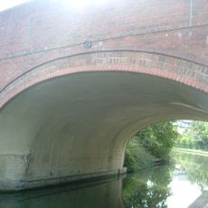
Grand Union Canal Bridge Number 10
United Kingdom

Grand Union Canal Bridge Number 10

1.6 km
Grand Union Canal Long Buckby Wharf Bridge Number 12
United Kingdom

Grand Union Canal Long Buckby Wharf Bridge Number 12

1.1 km
Grand Union Canal Lower Gate House
United Kingdom

Grand Union Canal Lower Gate House

517 m
Gatehouse At Muscott House
United Kingdom

Gatehouse At Muscott House

1.7 km
The Hall
United Kingdom

The Hall

2.7 km
The Old School House
United Kingdom

The Old School House

3.8 km
United Kingdom

Burnt Walls

4.3 km
Manor Farm, Cottage Used As Outbuilding
United Kingdom

Manor Farm, Cottage Used As Outbuilding

2.7 km
Long Buckby ringwork and bailey
United Kingdom

Long Buckby ringwork and bailey

3.3 km
Manor Farmhouse
United Kingdom

Manor Farmhouse

2.7 km
Grand Union Canal Leicester Line Milepost South Of Bridge Number 5 At Sp597 673
United Kingdom

Grand Union Canal Leicester Line Milepost South Of Bridge Number 5 At Sp597 673

3.3 km
Milespost 3 Metres West Of Windlass Cottage By Towpath Of Grand Union Canal
United Kingdom

Milespost 3 Metres West Of Windlass Cottage By Towpath Of Grand Union Canal

653 m
Grand Union Canal Long Buckby Wharf Milepost Approximately 16 Metres From Lock Number 9
United Kingdom

Grand Union Canal Long Buckby Wharf Milepost Approximately 16 Metres From Lock Number 9

757 m
United Kingdom

Gateway South West Of Church Of St Martin

3.6 km
United Kingdom

Grand Union Canal Milepost At Norton Junction, Beside Tow Path Of Leicester Branch Of Grand Union Canal

1.7 km
United Kingdom

Dragonfly

3.4 km
Show the full map
Reviews
Share your experience

No review yet

Discussions
Start a discussion...

No discussion yet

« Bannaventa - Archaeological site in Northamptonshire, England » is provided by Around Us (aroundus.com). Images and texts are derived from Wikimedia project under a Creative Commons license. You are allowed to copy, distribute, and modify copies of this page, under the conditions set by the license, as long as this note is clearly visible.

Discover hidden gems everywhere you go!

From secret cafés to breathtaking viewpoints, skip the crowded tourist spots and find places that match your style. Our app makes it easy with voice search, smart filtering, route optimization, and insider tips from travelers worldwide. Download now for the complete mobile experience.

Around Us App Screenshot

A unique approach to discovering new places

Le Figaro

All the places worth exploring

France Info

A tailor-made excursion in just a few clicks

20 Minutes

Around Us
Travel Guide & Maps
Download

Send to your phone

QR Code
1

Open the camera app on your mobile.

2

Point at the QR code with your camera. A notification will appear.

3

Tap the notification to open the link.