Enable Location

We need your location to show you interesting places around you

Discover nearby places

Find interesting locations and hidden gems around you

Precise directions

Get accurate directions and distances to places

Your location is never shared with other users. It's only used when you tap the location button.

Stocksbridge

Log in to your account

Start exploring — it's free

Trusted by 62,948 travelers worldwide

Continue with Google
Continue with Apple
or

We will send you a code to connect

By continuing, you accept our Terms and Conditions and our Privacy Policy

Check your inbox

We've sent a pincode in your inbox. Please enter the code below.

Discussion Reviews 1 Photos
27.9k Popularity

Stocksbridge, Industrial town in Sheffield, England

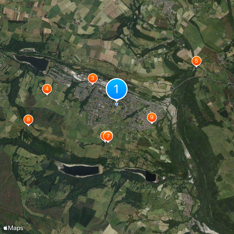
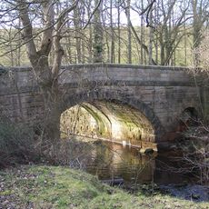
Stocksbridge is an industrial town in the Sheffield area that stretches along the Little Don River valley beneath Underbank Reservoir. The settlement sits surrounded by South Yorkshire hills and lies roughly 10 miles from Sheffield city center.

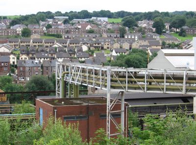
Samuel Fox established a steel manufacturing facility in 1842 on a former cotton mill site, which sparked the town's industrial development. This founding laid the groundwork for transformation into a major steel production center in the region.

The town maintains its link to steelmaking heritage through music groups and theater organizations that host regular performances. These groups shape community life and reflect the long tradition of craftsmanship rooted in the region.

The Stocksbridge Bypass connects the town directly to Sheffield and Manchester with faster travel options. Regular bus services also link to surrounding communities and help you explore the wider area.

The town's steel plant specializes in producing high-grade metal components for the aerospace industry. The facility uses advanced techniques to create materials with exceptional performance properties.

The community of curious travelers

AroundUs brings together thousands of curated places, local tips, and hidden gems, enriched daily by 60,000 contributors worldwide.

Start exploring
Location
GPS coordinates
53.47800,-1.58800
Latest update
December 20, 2025 13:11
Around this place
St Mary's Church, Bolsterstone
United Kingdom

St Mary's Church, Bolsterstone

1.2 km
Milepost Approximately 20 Metres East Of Junction With Park Drive
United Kingdom

Milepost Approximately 20 Metres East Of Junction With Park Drive

996 m
Guide Pillar At Junction With Peg Folly On South Side Of Junction
United Kingdom

Guide Pillar At Junction With Peg Folly On South Side Of Junction

2.2 km
United Kingdom

Ivy Cottage

2.8 km
United Kingdom

Castle Cottage

1.2 km
United Kingdom

Bolsterstone Castle

1.2 km
United Kingdom

Salt Springs Farmhouse

2.9 km
United Kingdom

Lower Townend Farmhouse, Cottage And Attached Barn

1.3 km
Stocksbridge Clock Tower
United Kingdom

Stocksbridge Clock Tower

330 m
Bolsterstone War Memorial
United Kingdom

Bolsterstone War Memorial

1.2 km
Unsliven Bridge, Stocksbridge
United Kingdom

Unsliven Bridge, Stocksbridge

2.4 km
United Kingdom

Barn At Peas Bloom Approximately 10 Metres To South East Of House

2 km
United Kingdom

Pot House Farm Cottages

816 m
United Kingdom

Cottage And Attached Mounting Block Immediately East Of Underbank Hall

2.5 km
United Kingdom

Dwarriden Cruck Barn, Approximately 200 Metres South East Of Junction With Rushy Lane And Mill Lane

2.9 km
Milestone Approximately 400 Metres West Of Junction With Underbank Lane
United Kingdom

Milestone Approximately 400 Metres West Of Junction With Underbank Lane

2.6 km
United Kingdom

Wharncliffe Lodge

3.9 km
United Kingdom

Romano-British settlements at Finkle Street

2.7 km
United Kingdom

Glass furnace, Bolsterstone

837 m
United Kingdom

Barn And Cowhouse At Edge End Farm Approximately 25 Metres To South East Of Farmhouse

1.6 km
United Kingdom

Farm Building At Pot House Farm Adjoining Farmhouse To North

834 m
United Kingdom

Iron Age and Roman quern workings on Wharncliffe Rocks

2.2 km
United Kingdom

Cruck-Framed House Approximately 10 Metres To South Of Windhill Farmhouse

2.9 km
Guide Pillar At Road Junction South Of Langley Brook On North West Side Of Junction
United Kingdom

Guide Pillar At Road Junction South Of Langley Brook On North West Side Of Junction

2.6 km
United Kingdom

Unslivenbridge Farmhouse And Attached Barn And Cowhouse

2.3 km
United Kingdom

Porters Lodge, Bolsterstone Castle

1.2 km
United Kingdom

Barn At Fair Hurst Farm Approximately 30 Metres To East Of House

2.4 km
United Kingdom

Stable Block To Broomhead Hall, Incorporating Farmbuildings

3.6 km
Show the full map
Reviews
Share your experience

No review yet

Discussions
Start a discussion...

No discussion yet

« Stocksbridge - Industrial town in Sheffield, England » is provided by Around Us (aroundus.com). Images and texts are derived from Wikimedia project under a Creative Commons license. You are allowed to copy, distribute, and modify copies of this page, under the conditions set by the license, as long as this note is clearly visible.

Discover hidden gems everywhere you go!

From secret cafés to breathtaking viewpoints, skip the crowded tourist spots and find places that match your style. Our app makes it easy with voice search, smart filtering, route optimization, and insider tips from travelers worldwide. Download now for the complete mobile experience.

Around Us App Screenshot

A unique approach to discovering new places

Le Figaro

All the places worth exploring

France Info

A tailor-made excursion in just a few clicks

20 Minutes

Around Us
Travel Guide & Maps
Download

Send to your phone

QR Code
1

Open the camera app on your mobile.

2

Point at the QR code with your camera. A notification will appear.

3

Tap the notification to open the link.