Enable Location

We need your location to show you interesting places around you

Discover nearby places

Find interesting locations and hidden gems around you

Precise directions

Get accurate directions and distances to places

Your location is never shared with other users. It's only used when you tap the location button.

Helliar Holm

Log in to your account

Start exploring — it's free

Trusted by 62,831 travelers worldwide

Continue with Google
Continue with Apple
or

We will send you a code to connect

By continuing, you accept our Terms and Conditions and our Privacy Policy

Check your inbox

We've sent a pincode in your inbox. Please enter the code below.

Helliar Holm

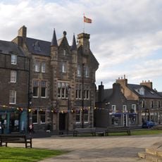
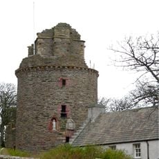
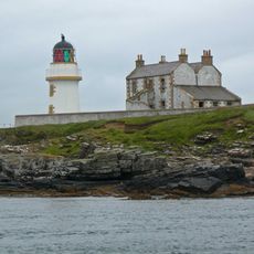
Helliar Holm, Tidal island with lighthouse in Orkney Islands, United Kingdom

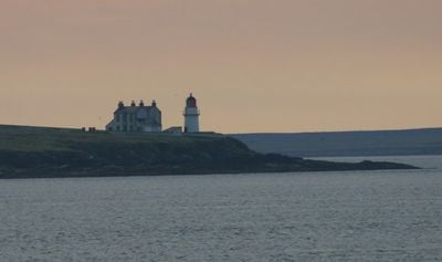
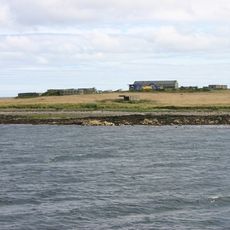
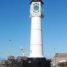
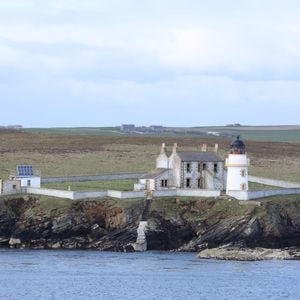
Helliar Holm is a tidal island off Shapinsay with a distinctive white cylindrical lighthouse built in the 1890s. The tower features black and ochre details and rises around 18 meters above the water.

The Northern Lighthouse Board built this navigation beacon in 1893 to guide ships through the challenging waters around the Orkney Islands. Automation came in 1967, allowing it to operate without resident keepers.

The name comes from Old Norse and refers to a cave island, reflecting the Viking heritage of the Orkney Islands. This linguistic link shows how medieval seafarers named landmarks they encountered.

You can only reach the island at low tide, when a natural causeway connects it to Shapinsay. Plan your visit using tide tables and check the weather, as conditions can change quickly in these waters.

The beacon runs entirely on solar power, making it a striking blend of Victorian architecture and modern self-sufficiency. This addition allowed the structure to survive without any staff, preserving its historic character while meeting contemporary needs.

The community of curious travelers

AroundUs brings together thousands of curated places, local tips, and hidden gems, enriched daily by 60,000 contributors worldwide.

Start exploring
Location
Inception
1893
Part of
Orkney Islands
GPS coordinates
59.02389,-2.89500
Latest update
December 13, 2025 11:41
« Helliar Holm - Tidal island with lighthouse in Orkney Islands, United Kingdom » is provided by Around Us (aroundus.com). Images and texts are derived from Wikimedia project under a Creative Commons license. You are allowed to copy, distribute, and modify copies of this page, under the conditions set by the license, as long as this note is clearly visible.

Discover hidden gems everywhere you go!

From secret cafés to breathtaking viewpoints, skip the crowded tourist spots and find places that match your style. Our app makes it easy with voice search, smart filtering, route optimization, and insider tips from travelers worldwide. Download now for the complete mobile experience.

Around Us App Screenshot

A unique approach to discovering new places

Le Figaro

All the places worth exploring

France Info

A tailor-made excursion in just a few clicks

20 Minutes

Around Us
Travel Guide & Maps
Download

Send to your phone

QR Code
1

Open the camera app on your mobile.

2

Point at the QR code with your camera. A notification will appear.

3

Tap the notification to open the link.