Enable Location

We need your location to show you interesting places around you

Discover nearby places

Find interesting locations and hidden gems around you

Precise directions

Get accurate directions and distances to places

Your location is never shared with other users. It's only used when you tap the location button.

Barnoldswick

Log in to your account

Start exploring — it's free

Trusted by 62,927 travelers worldwide

Continue with Google
Continue with Apple
or

We will send you a code to connect

By continuing, you accept our Terms and Conditions and our Privacy Policy

Check your inbox

We've sent a pincode in your inbox. Please enter the code below.

Discussion Reviews 1 Photos
26.5k Popularity

Barnoldswick, Market town in Lancashire, England

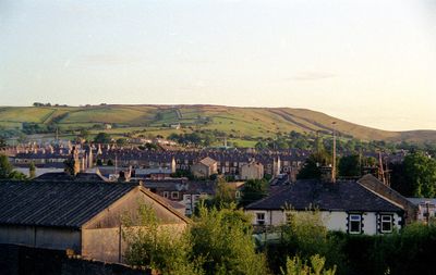
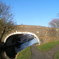
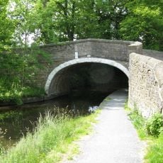
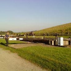
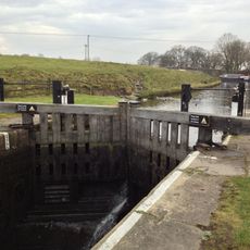
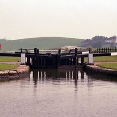
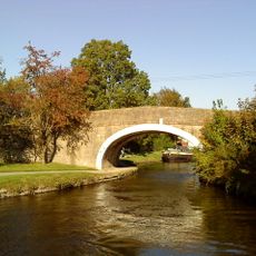
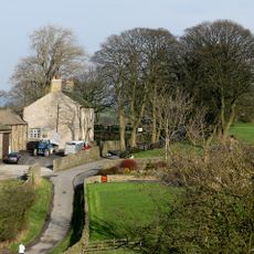
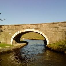
Barnoldswick is a town in Lancashire positioned on the slopes of Weets Hill, and it sits higher than any other settlement on the Leeds and Liverpool Canal. From its location, the surrounding Yorkshire Dales landscape comes into view, and the waterway runs through the area below.

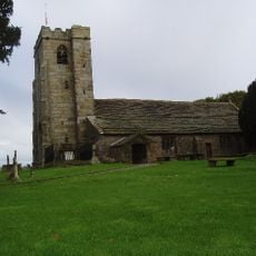
The settlement appears in medieval records as Bernulfesuuic and hosted a Cistercian monastery from 1147 onward. The monks eventually left because farming conditions in the area proved too difficult.

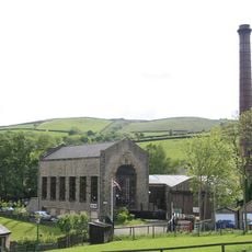
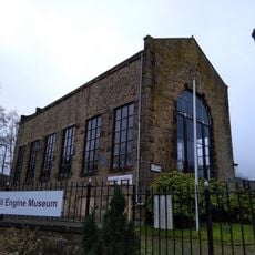
Preserved weaving sheds from the 1920s line the streets and speak to cotton production that once defined daily life here. These buildings remain part of how people experience and understand the town's industrial past today.

Regular bus services connect the town to surrounding settlements, and Manchester and Leeds Bradford airports are within reasonable travel distance. Visitors arriving by air from either airport will find transport options available to reach the area.

The town houses the headquarters of Silentnight, Britain's largest bed manufacturer, and once produced Esse stoves, a brand known across the country. Many people use these products without knowing where they came from.

The community of curious travelers

AroundUs brings together thousands of curated places, local tips, and hidden gems, enriched daily by 60,000 contributors worldwide.

Start exploring
Location
GPS coordinates
53.91470,-2.18950
Latest update
December 20, 2025 15:07
Around this place
Bancroft Shed
United Kingdom

Bancroft Shed

431 m
Church of St Mary le Ghyll, Barnoldswick
United Kingdom

Church of St Mary le Ghyll, Barnoldswick

2.2 km
Leeds And Liverpool Canal Cockshott Bridge
United Kingdom

Leeds And Liverpool Canal Cockshott Bridge

1 km
Anchor Inn
United Kingdom

Anchor Inn

1.7 km
Bancroft Mill Engine Museum
United Kingdom

Bancroft Mill Engine Museum

427 m
Independent Methodist Church Including Steps And Railings To Street
United Kingdom

Independent Methodist Church Including Steps And Railings To Street

59 m
Leeds And Liverpool Canal Salterforth Bridge Number 151
United Kingdom

Leeds And Liverpool Canal Salterforth Bridge Number 151

1.7 km
Coates Hall
United Kingdom

Coates Hall

1.2 km
Fosters Arms Public House
United Kingdom

Fosters Arms Public House

1.1 km
Leeds And Liverpool Canal Lock Number 42
United Kingdom

Leeds And Liverpool Canal Lock Number 42

2.3 km
Gill Hall
United Kingdom

Gill Hall

2.4 km
United Kingdom

Bridge Holme Laithe

1.3 km
Leeds And Liverpool Canal Lock Number 44
United Kingdom

Leeds And Liverpool Canal Lock Number 44

2 km
Leeds And Liverpool Canal Lock Number 43
United Kingdom

Leeds And Liverpool Canal Lock Number 43

2.2 km
Leeds And Liverpool Canal Coates Lane Or Greenfield Bridge Number 156
United Kingdom

Leeds And Liverpool Canal Coates Lane Or Greenfield Bridge Number 156

1.9 km
Milestone In South East Corner Of Garden At 245 (Lane End Farmhouse)
United Kingdom

Milestone In South East Corner Of Garden At 245 (Lane End Farmhouse)

1.2 km
United Kingdom

Stock medieval settlement and part of its associated medieval open field system

2.5 km
Greenberfield Farmhouse
United Kingdom

Greenberfield Farmhouse

1.8 km
United Kingdom

Higher Green Hall Farmhouse

1.8 km
Leeds And Liverpool Canal Canal Bridge Number 157
United Kingdom

Leeds And Liverpool Canal Canal Bridge Number 157

2.1 km
United Kingdom

Mounting Steps To South Of Mill Cottages

1.7 km
Milestone, ExYW Salterforth Lane on ancient lane
United Kingdom

Milestone, ExYW Salterforth Lane on ancient lane

1.7 km
United Kingdom

Lower Calf Hall Farmhouse

656 m
United Kingdom

Haystacks Bridge

2 km
United Kingdom

West Close Farmhouse

1.1 km
United Kingdom

Old Chapel House

87 m
United Kingdom

Barn Adjoining Mill Close Farmhouse

966 m
United Kingdom

Bawmier

1.7 km
Show the full map
Reviews
Share your experience

No review yet

Discussions
Start a discussion...

No discussion yet

« Barnoldswick - Market town in Lancashire, England » is provided by Around Us (aroundus.com). Images and texts are derived from Wikimedia project under a Creative Commons license. You are allowed to copy, distribute, and modify copies of this page, under the conditions set by the license, as long as this note is clearly visible.

Discover hidden gems everywhere you go!

From secret cafés to breathtaking viewpoints, skip the crowded tourist spots and find places that match your style. Our app makes it easy with voice search, smart filtering, route optimization, and insider tips from travelers worldwide. Download now for the complete mobile experience.

Around Us App Screenshot

A unique approach to discovering new places

Le Figaro

All the places worth exploring

France Info

A tailor-made excursion in just a few clicks

20 Minutes

Around Us
Travel Guide & Maps
Download

Send to your phone

QR Code
1

Open the camera app on your mobile.

2

Point at the QR code with your camera. A notification will appear.

3

Tap the notification to open the link.