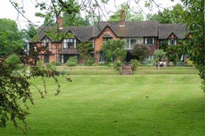
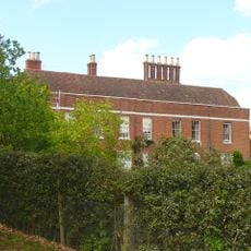
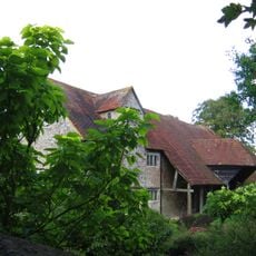
Pax Hill, English country house in Bentley, Hampshire, England
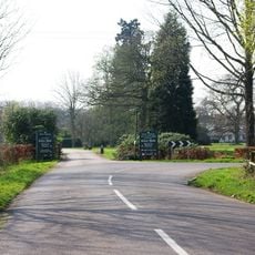
Pax Hill is an English country house in Bentley, Hampshire, located at the end of a half-mile drive off the A31, with extensive gardens that include two summer houses and a tennis court. The residence combines domestic spaces with landscaped grounds spread across the entire property.
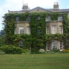
The Baden-Powell family purchased the property in 1918 when it was called Blackacre and made it their home for over twenty years until 1939. The house underwent significant changes during their ownership that shaped its character as a private residence.
The estate served as a gathering place for Scout and Guide groups during the Baden-Powell years, with young people camping along the main driveway. The grounds still carry the marks of these organized youth activities from that era.
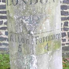
The property is located about five miles southwest of Farnham and reached via a private drive off the A31. It has operated as a residential nursing home since 1988, so casual visits are not possible and any access requires advance arrangements.
Robert Baden-Powell personally designed the west wing and created a bathroom frieze depicting fish species found in the nearby River Wey. This rare example of his architectural and artistic involvement remains an intimate detail of the house.
GPS coordinates: 51.19220,-0.89139
Latest update: December 10, 2025 20:01
Alice Holt Research Station
3.1 km
Northbrook
3.3 km
Church of St Mary of the Assumption
2.4 km
Church of St Mary
951 m
Binsted War Memorial
3.3 km
Coldrey
718 m
Table Tomb 6 Metres South Of St Mary's Church (Nave)
942 m
Barn 30 Metres South Of Mill Court
3.1 km
Table Tomb 10 Metres South Of St Mary's Church (Nave)
937 m
Fern Cottage
2.2 km
Jenkyn Place
723 m
Milestone
1.1 km
Table Tomb 15 Metres South Of St Mary's Church (Chancel)
959 m
Table Tomb 15 Metres South Of St Mary's Church (Nave)
942 m
Boundary Wall East Of Jenkyn Place
751 m
Table Tomb 21 Metres South Of St Mary's Church (Chancel)
962 m
Long Barlands
2 km
Table Tomb 9 Metres South Of St Mary's Church (Chancel)
963 m
Milestone 120 Metres East Of Junction With Isington Lane
937 m
Milestone
2.6 km
Table Tomb 5 Metres South Of St Mary's Church (Chancel)
959 m
Table Tomb 14 Metres South Of St Mary's Church (Chancel)
963 m
Table Tomb 15 Metres South Of St Mary's Church (Chancel)
955 m
Table Tomb 17 Metres South Of St Mary's Church (Chancel)
959 m
Table Tomb 12 Metres South Of St Mary's Church (Chancel)
959 m
Table Tomb 19 Metres South Of St Mary's Church (Chancel)
962 m
Table Tomb 7 Metres South Of St Mary's Church (Nave)
943 m
Table Tomb 12 Metres South Of St Mary's Church (Nave)
938 mVisited this place? Tap the stars to rate it and share your experience / photos with the community! Try now! You can cancel it anytime.
Discover hidden gems everywhere you go!
From secret cafés to breathtaking viewpoints, skip the crowded tourist spots and find places that match your style. Our app makes it easy with voice search, smart filtering, route optimization, and insider tips from travelers worldwide. Download now for the complete mobile experience.
A unique approach to discovering new places❞
— Le Figaro
All the places worth exploring❞
— France Info
A tailor-made excursion in just a few clicks❞
— 20 Minutes