The Storr

Log in to your account

AroundUs is a community-driven map of interesting places, built by curious explorers like you. It grows with every review, story, and photo you share.
Connect to save your favorite spots, contribute locations, and create personalized routes.
Continue with Google
Continue with Apple
Continue with X
Continue with Facebook
Continue with email
By continuing, you accept our Terms and Conditions and our Privacy Policy
Create an account
Add to collection
Map
Suggest a change
Share

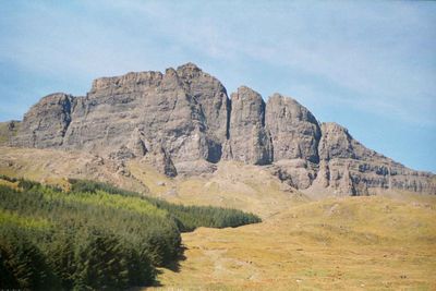
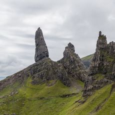
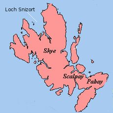
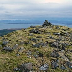
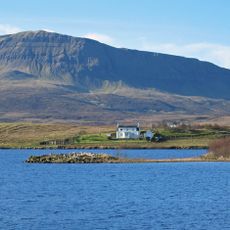
The Storr, Summit and mountain in Isle of Skye, Scotland.

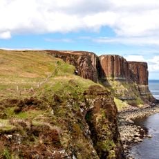
The Storr is a mountain summit on the Isle of Skye characterized by steep cliffs and a landscape of jagged rock formations rising from the surrounding terrain. The site features dramatic rocky pinnacles that create a distinctive silhouette when viewed from below.

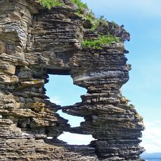
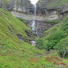
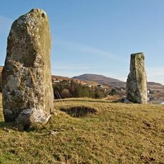
The landscape formed millions of years ago during the Paleogene period when massive landslips reshaped the geological structure of the ridge. These ancient movements created the dramatic rocky formations that define the area today.

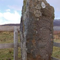
Local stories speak of giants who once shaped these mountains, and this folklore remains woven into how people describe the dramatic landscape today. Visitors often hear these tales from residents who connect them to the rocky formations surrounding the summit.

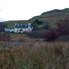
The trail begins at a car park on the A855 road and follows a marked route through former woodland to reach the summit. Sturdy footwear and waterproof clothing are essential, as the paths can be steep and slippery in wet conditions.

The north-facing slope presents several challenging climbing routes for experienced mountaineers seeking technical ascents beyond the standard walking path. Most visitors overlook this alternate aspect of the location.

Location: Highland

Elevation above the sea: 719 m

GPS coordinates: 57.50729,-6.18332

Latest update: December 17, 2025 09:56

Photos
Scottish Highlands: Hidden places, isolated mountains and remote villages

The Scottish Highlands span thousands of square miles in northern Scotland, offering striking landscapes of mountains, jagged coastlines, and remote lakes. This region retains villages that only recently gained road access, such as Rhenigidale on Harris Island, connected to the rest of the island in...

Around this place
Old Man of Storr
United Kingdom

Old Man of Storr

520 m
Loch Snizort
United Kingdom

Loch Snizort

16.8 km
Snizort Cathedral
United Kingdom

Snizort Cathedral

9.5 km
Sgùrr a' Mhadaidh Ruaidh
United Kingdom

Sgùrr a' Mhadaidh Ruaidh

4.9 km
Bearreraig Sandstone Formation
United Kingdom

Bearreraig Sandstone Formation

5 km
Clach Ard,symbol stone,Tote,Carbost
United Kingdom

Clach Ard,symbol stone,Tote,Carbost

8.9 km
Bearreraig Waterfall
United Kingdom

Bearreraig Waterfall

2.6 km
Kilt Rock
United Kingdom

Kilt Rock

11.5 km
Snizort Free Church
United Kingdom

Snizort Free Church

10.1 km
Dun Grianan,broch on N shore of Loch Mealt
United Kingdom

Dun Grianan,broch on N shore of Loch Mealt

11.3 km
Sornaichean Coir Fhinn standing stones
United Kingdom

Sornaichean Coir Fhinn standing stones

8.2 km
Skeabost House Hotel, Skye
United Kingdom

Skeabost House Hotel, Skye

9.8 km
St Columba's Episcopal Church, Park Road, Portree, Skye
United Kingdom

St Columba's Episcopal Church, Park Road, Portree, Skye

10.4 km
Kensaleyre Church
United Kingdom

Kensaleyre Church

7.7 km
Skye, Portree, Somerled Square, Sheriff Court House
United Kingdom

Skye, Portree, Somerled Square, Sheriff Court House

10.5 km
King's Haven Hotel, 11 Bosville Terrace, Portree, Skye
United Kingdom

King's Haven Hotel, 11 Bosville Terrace, Portree, Skye

10.5 km
Aros Centre
United Kingdom

Aros Centre

10.9 km
Old Parish Church, Bank Street, Portree, Skye
United Kingdom

Old Parish Church, Bank Street, Portree, Skye

10.6 km
Skye, Portree, Somerled Square, War Memorial
United Kingdom

Skye, Portree, Somerled Square, War Memorial

10.5 km
Skye, Skirinish House
United Kingdom

Skye, Skirinish House

8.7 km
Viewfield House
United Kingdom

Viewfield House

11.2 km
Skeabost Island,St Columba's Church & other ecclesiastical remains
United Kingdom

Skeabost Island,St Columba's Church & other ecclesiastical remains

9.5 km
Skye, Portree, Somerled Square, Bank Of Scotland
United Kingdom

Skye, Portree, Somerled Square, Bank Of Scotland

10.5 km
Romesdal Bridge,cairn 460m SW of
United Kingdom

Romesdal Bridge,cairn 460m SW of

8.8 km
Skye, Portree, Stormy Hill Road, Hill House
United Kingdom

Skye, Portree, Stormy Hill Road, Hill House

10.5 km
Free Church School, Skeabost, Skye
United Kingdom

Free Church School, Skeabost, Skye

10.1 km
Skeabost Bridge
United Kingdom

Skeabost Bridge

9.4 km
Stormy Hill Cottage, 3 Stormy Hill Road, Portree, Skye
United Kingdom

Stormy Hill Cottage, 3 Stormy Hill Road, Portree, Skye

10.4 km
Show the full map
Reviews

Visited this place? Tap the stars to rate it and share your experience / photos with the community! Try now! You can cancel it anytime.

« The Storr - Summit and mountain in Isle of Skye, Scotland » is provided by Around Us (aroundus.com). Images and texts are derived from Wikimedia project under a Creative Commons license. You are allowed to copy, distribute, and modify copies of this page, under the conditions set by the license, as long as this note is clearly visible.

Discover hidden gems everywhere you go!

From secret cafés to breathtaking viewpoints, skip the crowded tourist spots and find places that match your style. Our app makes it easy with voice search, smart filtering, route optimization, and insider tips from travelers worldwide. Download now for the complete mobile experience.

Around Us App Screenshot

A unique approach to discovering new places

Le Figaro

All the places worth exploring

France Info

A tailor-made excursion in just a few clicks

20 Minutes