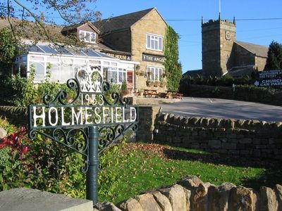
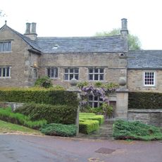
Holmesfield, village and civil parish in North East Derbyshire, England
Location: North East Derbyshire
Shares border with: Dronfield, Barlow, Baslow and Bubnell, Grindleford, Brampton
GPS coordinates: 53.29500,-1.51800
Latest update: March 21, 2025 08:41
Barlow Woodseats Hall
2.7 km
Barbrook One
4.8 km
St Swithin’s Church, Holmesfield
165 m
Church of All Saints
2.5 km
The Main Well
3.8 km
Church of St. Lawrence, Barlow
3.7 km
Fanshawe Gate Hall
1.4 km
Lee Bridge
3.1 km
Woodthorpe Hall
1.3 km
Milestone 550 Metres East South East Of The Peacock Inn, Owler Bar
2.3 km
Thickwood Lodge
2.8 km
Milepost 100 metres east of Thickwood Lodge
2.7 km
Clapper Bridge
5.6 km
Group of guidestones at OS 27 75
5.4 km
Lees Hall Farmhouse
2 km
Cartledge Grange
409 m
Milestone, Rod Moor Road & Barnes Lane jct
2 km
Milestone 650 Metres East Of The Robin Hood Inn
772 m
Shillito Cross
3.9 km
Wilkin Hill Pinfold
3.8 km
Prehistoric landscape on Big Moor and Ramsley Moor
5.4 km
Waymarker and clapper bridge 130m south of Barbrook Bridge
4.7 km
Lead smelting site on Ramsley Moor, 600m south west of Foxlane Farm
3.5 km
Milestone, N of Wooden Pole, S of jct with A6187
5.7 km
Milestone, W of Saltersitch Bridge; between Owler Bar & A625
3.8 km
Boundary Stone Os 279741
5.5 km
Highashes Farmhouse
3.4 km
Farm outbuilding comprising former barn, cowhouse and stables to the south west of Barlow Woodseats Hall
2.3 kmVisited this place? Tap the stars to rate it and share your experience / photos with the community! Try now! You can cancel it anytime.
Discover hidden gems everywhere you go!
From secret cafés to breathtaking viewpoints, skip the crowded tourist spots and find places that match your style. Our app makes it easy with voice search, smart filtering, route optimization, and insider tips from travelers worldwide. Download now for the complete mobile experience.
A unique approach to discovering new places❞
— Le Figaro
All the places worth exploring❞
— France Info
A tailor-made excursion in just a few clicks❞
— 20 Minutes