Barbrook One

Log in to your account

AroundUs is a community-driven map of interesting places, built by curious explorers like you. It grows with every review, story, and photo you share.
Connect to save your favorite spots, contribute locations, and create personalized routes.
By continuing, you accept our Terms and Conditions and our Privacy Policy
Add to collection
Map
Suggest a change
Share

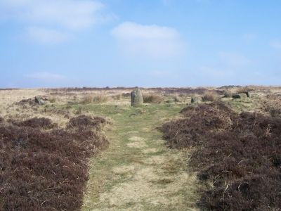
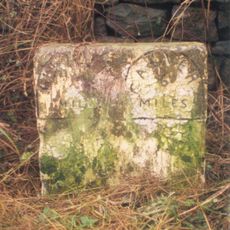
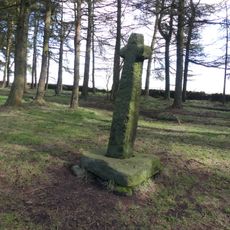
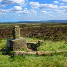
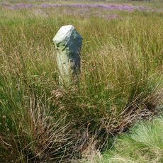
Barbrook One, Stone circle in Holmesfield, England.

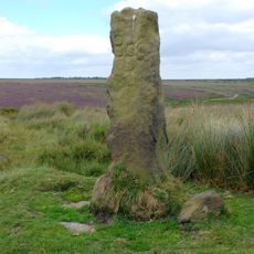
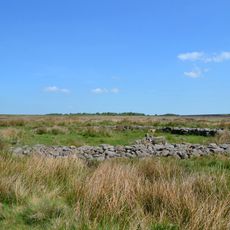
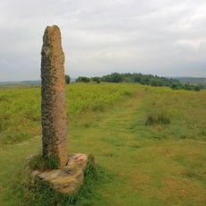
Barbrook One is a stone circle in Holmesfield consisting of one prominent upright stone surrounded by smaller stones arranged in a circular pattern. The ring spans roughly 13 meters across and is enclosed by a bank of loose rubble.

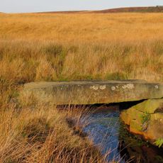
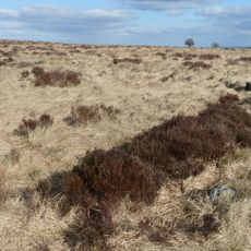
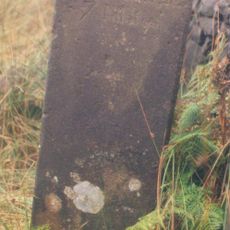
This stone circle was built in prehistoric times and later became associated with burial activities in the area. It forms part of a larger network of archaeological features scattered across Big Moor.

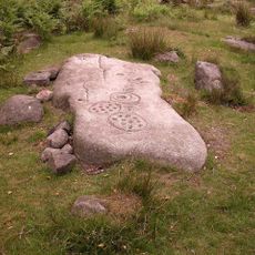
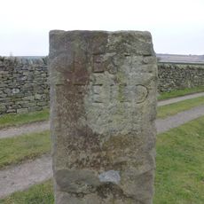
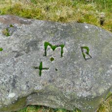
Archaeological excavations near the site revealed cremation burials within collared urns, flint scrapers, and knives, indicating ceremonial practices of prehistoric communities.

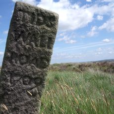
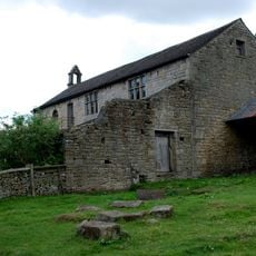
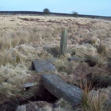
The site sits in open countryside and is visible from the surrounding landscape, though reaching it requires sturdy footwear for walking on moorland ground. Access is on foot, and visitors should be prepared for changing weather conditions.

Objects buried beneath a cairn at the site have been radiocarbon dated to show human activity going back roughly 3450 years. This evidence reveals that the location held importance for people across many centuries.

Location: Holmesfield

Part of: Prehistoric landscape on Big Moor and Ramsley Moor, Barbrook ring cairns

GPS coordinates: 53.27650,-1.58370

Latest update: December 12, 2025 14:25

Photos
Around this place
Gardom's Edge
United Kingdom

Gardom's Edge

2.5 km
Birchen Edge
United Kingdom

Birchen Edge

2.7 km
Calver Mill
United Kingdom

Calver Mill

3.3 km
Nelson Monument
United Kingdom

Nelson Monument

2.6 km
Masonry Weir To The East Of New Bridge
United Kingdom

Masonry Weir To The East Of New Bridge

3.3 km
Milestone 550 Metres East South East Of The Peacock Inn, Owler Bar
United Kingdom

Milestone 550 Metres East South East Of The Peacock Inn, Owler Bar

3.1 km
Clapper Bridge
United Kingdom

Clapper Bridge

1.4 km
Group of guidestones at OS 27 75
United Kingdom

Group of guidestones at OS 27 75

554 m
Guide post at OS 265776
United Kingdom

Guide post at OS 265776

2.4 km
Shillito Cross
United Kingdom

Shillito Cross

1.8 km
Prehistoric landscape on Big Moor and Ramsley Moor
United Kingdom

Prehistoric landscape on Big Moor and Ramsley Moor

581 m
Stoke Flat West prehistoric field system and stone circle
United Kingdom

Stoke Flat West prehistoric field system and stone circle

3 km
Guidestone, Bar Cross Road, track from Big Moor to Baslow, along Baslow Bar
United Kingdom

Guidestone, Bar Cross Road, track from Big Moor to Baslow, along Baslow Bar

1.6 km
Boundary Stone Os 279741
United Kingdom

Boundary Stone Os 279741

1.5 km
Former Schoolroom At Stocking Farm
United Kingdom

Former Schoolroom At Stocking Farm

3.3 km
Cairnfield and embanked stone circle 550m east of Barbrook Reservoir
United Kingdom

Cairnfield and embanked stone circle 550m east of Barbrook Reservoir

1.8 km
Wayside and boundary cross known as Lady's Cross
United Kingdom

Wayside and boundary cross known as Lady's Cross

2.8 km
Fox Lane Cross
United Kingdom

Fox Lane Cross

1.7 km
Wayside cross known as Whibbersley Cross
United Kingdom

Wayside cross known as Whibbersley Cross

3.3 km
Milestone At Os 279738
United Kingdom

Milestone At Os 279738

1.7 km
Milestone, W of Saltersitch Bridge; between Owler Bar & A625
United Kingdom

Milestone, W of Saltersitch Bridge; between Owler Bar & A625

2.3 km
Lead smelting site on Ramsley Moor, 600m south west of Foxlane Farm
United Kingdom

Lead smelting site on Ramsley Moor, 600m south west of Foxlane Farm

1.5 km
Waymarker and clapper bridge 130m south of Barbrook Bridge
United Kingdom

Waymarker and clapper bridge 130m south of Barbrook Bridge

2.6 km
Milestone, N of Froggatt village sign
United Kingdom

Milestone, N of Froggatt village sign

3.2 km
Milestone, NE of Wooden Pole jct
United Kingdom

Milestone, NE of Wooden Pole jct

3.2 km
Milestone, Ramsley Moor
United Kingdom

Milestone, Ramsley Moor

628 m
Milestone, just S of Owler Bar
United Kingdom

Milestone, just S of Owler Bar

2 km
Milestone, Clodhall Lane, near Whibbersley Cross
United Kingdom

Milestone, Clodhall Lane, near Whibbersley Cross

3.1 km
Show the full map
Reviews

Visited this place? Tap the stars to rate it and share your experience / photos with the community! Try now! You can cancel it anytime.

« Barbrook One - Stone circle in Holmesfield, England » is provided by Around Us (aroundus.com). Images and texts are derived from Wikimedia project under a Creative Commons license. You are allowed to copy, distribute, and modify copies of this page, under the conditions set by the license, as long as this note is clearly visible.

Discover hidden gems everywhere you go!

From secret cafés to breathtaking viewpoints, skip the crowded tourist spots and find places that match your style. Our app makes it easy with voice search, smart filtering, route optimization, and insider tips from travelers worldwide. Download now for the complete mobile experience.

Around Us App Screenshot

A unique approach to discovering new places

Le Figaro

All the places worth exploring

France Info

A tailor-made excursion in just a few clicks

20 Minutes