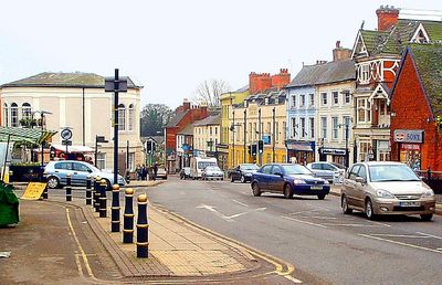
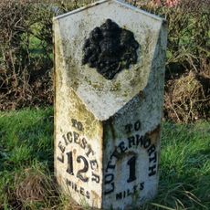
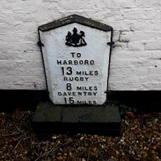
Lutterworth, Market town in Harborough, England
Lutterworth is a market town in Harborough positioned at a crossroads of major transport routes, with the M1 motorway to the east and the A426 road linking Leicester to Rugby. The town center retains its traditional market layout with shops and buildings surrounding the historic church.
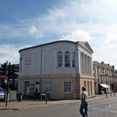
The town received its market charter from King John in 1214, which established it as a commercial hub for surrounding agricultural communities. This royal grant shaped its role as an economic center for centuries to come.
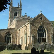
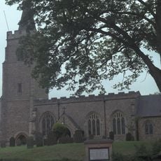
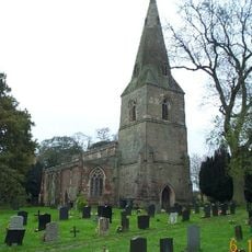
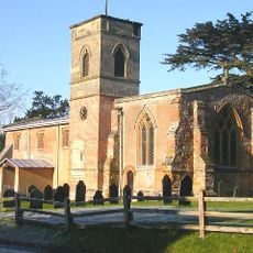
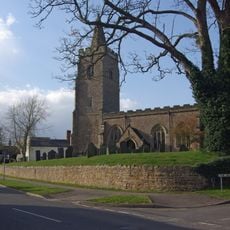
Saint Mary's Church holds 15th-century wall paintings and was the parish where John Wycliffe worked on translating the Bible into English. The church reflects the town's role as a center for religious learning and scholarship.
The weekly market operates every Thursday in the town center, selling fresh produce, household goods, and local merchandise. Parking is available near the center, and the streets are flat and easy to walk through.
A replica of the Gloster E.28/39, the first British jet aircraft designed by Frank Whittle, stands on a roundabout as a tribute to engineering achievement. The aircraft represents the technological innovations that advanced British aviation.
Location: Harborough
Website: http://lutterworth.org.uk
GPS coordinates: 52.45850,-1.20290
Latest update: December 20, 2025 01:22
Magna Park, Lutterworth
2.9 km
Church of St Mary
357 m
Town Hall
419 m
St Mary's Church, Bitteswell
1.2 km
Church of St Leonard
1.7 km
Church of St Mary
2.4 km
Wycliffe Memorial
198 m
Church of St Mary
1.2 km2, Church Street
374 mCandlemas Cottage
291 mThe Cottage
2.5 km
Lutterworth War Memorial Cross, Walls and Shelter
330 mThe Shambles Public House
387 m
Cotesbach Hall
2.5 km6, Bitteswell Road
213 mThe Manor House
2.5 kmOrchard Farmhouse And Attached Cottage
2.6 kmGarden Boundary Wall Immediately North And North East Of Cotesbach Hall
2.4 km
Milepost, opp. Milestone Cottage & Normanton House Farm, E of Ullesthorpe
3.9 kmThe Manor House
345 mKitchen Garden Wall East North East Of Cotesbach
2.4 km
Milepost, Riddlesdon Farm, Leicester Road
1.8 km
Milepost, wall of "The Springs"
694 mK6 Telephone Kiosk
1.2 kmTurnpike Lodge
1.3 km5 And 6, Powell Row
1.3 kmFormer School Room Immediately West South West Of Cotesbach Hall
2.5 km66, Woodmarket
529 mVisited this place? Tap the stars to rate it and share your experience / photos with the community! Try now! You can cancel it anytime.
Discover hidden gems everywhere you go!
From secret cafés to breathtaking viewpoints, skip the crowded tourist spots and find places that match your style. Our app makes it easy with voice search, smart filtering, route optimization, and insider tips from travelers worldwide. Download now for the complete mobile experience.
A unique approach to discovering new places❞
— Le Figaro
All the places worth exploring❞
— France Info
A tailor-made excursion in just a few clicks❞
— 20 Minutes