Chest opened
+${chestReward.xp} XP
Explorer
NOUVEAU ×${chestReward.collectible.quantity}
tapez pour fermer
Chest locked

Open chests in the app

Around Us is built for your phone — chests unlock when you walk, explore and capture nearby places.

Enable Location

We need your location to show you interesting places around you

Discover nearby places

Find interesting locations and hidden gems around you

Precise directions

Get accurate directions and distances to places

Your location is never shared with other users. It's only used when you tap the location button.

Wooler

Log in to your account

Start exploring — it's free

Trusted by 72,890 travelers worldwide

Continue with Google
Continue with Apple
or

We will send you a code to connect

By continuing, you accept our Terms and Conditions and our Privacy Policy

Check your inbox

We've sent a pincode in your inbox. Please enter the code below.

Discussion Reviews 1 Photos
15.7k Popularity

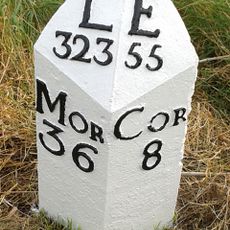
Wooler, town in Northumberland, England

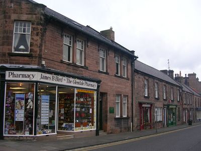
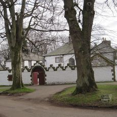
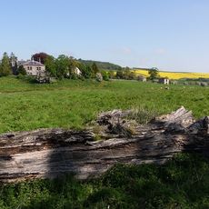
Wooler is a small town at the edge of the Cheviot Hills in Northumberland. Built along the Wooler Water river, it features stone buildings with historical architecture spanning from the 17th to 19th centuries.

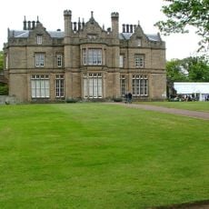
After the Norman Conquest, Wooler became part of a large holding by the Muschamp family. In medieval times, the town was known for exporting wool to Flanders and suffered from border raids, including a notable incident in 1595.

The name Wooler comes from old words meaning well or spring, reflecting the streams that run through the area. The main street defines daily life, where locals and visitors gather in shops, pubs, and traditional buildings that span several centuries.

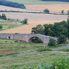
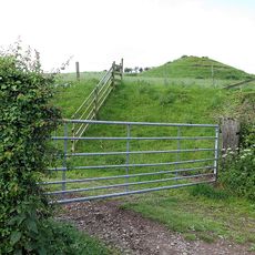
The town is easily reached by car via the A697 or by local bus and serves as a good base for exploring the Cheviot Hills and nearby attractions. Visitors will find hotels, bed-and-breakfasts, cottages, and campgrounds, along with a tourist information center providing maps and advice about walks and local events.

The Tankerville Arms, a historic inn built in the 18th century by the Earl of Tankerville, hosted the famous writer Virginia Woolf during her 1914 visit. This makes the site connected to literary history.

The community of curious travelers

AroundUs brings together thousands of curated places, local tips, and hidden gems, enriched daily by 60,000 contributors worldwide.

Start exploring
Location
GPS coordinates
55.54610,-2.01660
Latest update
February 19, 2026 23:40
Around this place
Lilburn Tower
United Kingdom

Lilburn Tower

5.1 km
Coupland Castle
United Kingdom

Coupland Castle

6.3 km
Fowberry Tower
United Kingdom

Fowberry Tower

5 km
St Ninian's Church, Wooler
United Kingdom

St Ninian's Church, Wooler

215 m
Prehistoric enclosed settlement, Iron Age hillfort and medieval shielings on Humbleton Hill
United Kingdom

Prehistoric enclosed settlement, Iron Age hillfort and medieval shielings on Humbleton Hill

2.4 km
Church of St Mary
United Kingdom

Church of St Mary

193 m
Church of St Mary and St Michael, Doddington
United Kingdom

Church of St Mary and St Michael, Doddington

4.2 km
Fowberry Bridge
United Kingdom

Fowberry Bridge

5.1 km
Kirknewton War Memorial
United Kingdom

Kirknewton War Memorial

7.8 km
Milepost Circa 200 Yards North Of Ewart Park West Lodge
United Kingdom

Milepost Circa 200 Yards North Of Ewart Park West Lodge

5.5 km
Milepost Circa 3/4 Mile South Of Millfield
United Kingdom

Milepost Circa 3/4 Mile South Of Millfield

7 km
Wooler War Memorial
United Kingdom

Wooler War Memorial

241 m
Weetwood Bridge
United Kingdom

Weetwood Bridge

3.1 km
Middleton Hall
United Kingdom

Middleton Hall

2.6 km
Milepost Circa 1/4 Mile North Of Haugh Head
United Kingdom

Milepost Circa 1/4 Mile North Of Haugh Head

1.7 km
Green Castle
United Kingdom

Green Castle

891 m
Milepost By Millvale
United Kingdom

Milepost By Millvale

352 m
Hetton House
United Kingdom

Hetton House

5.4 km
Weetwood Hall
United Kingdom

Weetwood Hall

3.1 km
Medieval chapel, 220m south east of White Gables
United Kingdom

Medieval chapel, 220m south east of White Gables

1.3 km
Milepost 1 1/2 Miles North Of Doddington Village
United Kingdom

Milepost 1 1/2 Miles North Of Doddington Village

6.4 km
Milepost Circa Half A Mile East Of Humbleton Buildings
United Kingdom

Milepost Circa Half A Mile East Of Humbleton Buildings

1.2 km
Boundary Stone Circa 20 Yards South Of North Yearle Farm Buildings
United Kingdom

Boundary Stone Circa 20 Yards South Of North Yearle Farm Buildings

1.9 km
Doddington South Farm
United Kingdom

Doddington South Farm

4.5 km
Akeld Bastle And Attached Walling To South
United Kingdom

Akeld Bastle And Attached Walling To South

3.5 km
Milepost, roadside at NT999327
United Kingdom

Milepost, roadside at NT999327

4.7 km
Milepost, Turvelaws Farm
United Kingdom

Milepost, Turvelaws Farm

1.7 km
Milepost, Lilburn Tower, in cutting
United Kingdom

Milepost, Lilburn Tower, in cutting

4.8 km
Show the full map
Reviews
Share your experience

No review yet

Discussions
Start a discussion...

No discussion yet

« Wooler - town in Northumberland, England » is provided by Around Us (aroundus.com). Images and texts are derived from Wikimedia project under a Creative Commons license. You are allowed to copy, distribute, and modify copies of this page, under the conditions set by the license, as long as this note is clearly visible.

Discover hidden gems everywhere you go!

From secret cafés to breathtaking viewpoints, skip the crowded tourist spots and find places that match your style. Our app makes it easy with voice search, smart filtering, route optimization, and insider tips from travelers worldwide. Download now for the complete mobile experience.

Around Us App Screenshot

A unique approach to discovering new places

Le Figaro

All the places worth exploring

France Info

A tailor-made excursion in just a few clicks

20 Minutes

Around Us
Travel Guide & Maps
Download

Send to your phone

QR Code
1

Open the camera app on your mobile.

2

Point at the QR code with your camera. A notification will appear.

3

Tap the notification to open the link.