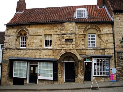
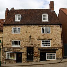
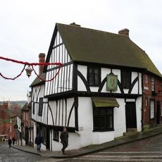
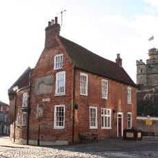
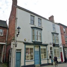
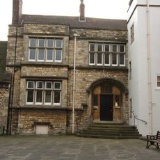
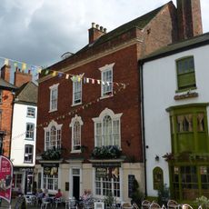
Jew's House, Norman stone house in Lincoln, England
Jew's House is a limestone dwelling featuring intricate stone carvings, rectangular windows, and decorative columns along its front on Steep Hill street. The structure combines typical Norman architectural elements with functional living spaces and retains its original external form despite centuries of use.
The building dates to 1170 and ranks among England's oldest surviving townhouse structures. It marks a period when Jewish families lived as established residents in England before expulsion policies reshaped the kingdom's religious composition.
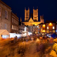
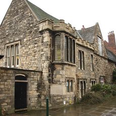
The building testifies to the Jewish community that lived in medieval Lincoln before being forced to leave the country. Today, walking through this street, you encounter a physical reminder of people whose presence shaped the town's history.
The house sits on a steep, cobbled street in Lincoln's historic center and is easy to find. A restaurant operates on the ground floor while the exterior remains unchanged, allowing visitors to see the original Norman features from the street.
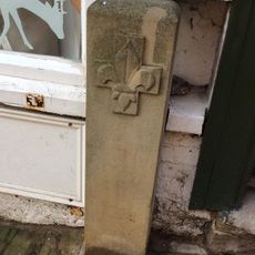
The stone chimney here stands as one of the earliest examples of this feature in English homes. This architectural innovation reflects how comfort and practicality gradually improved in medieval domestic buildings.
Location: Lincoln
Architectural style: Norman architecture
GPS coordinates: 53.23220,-0.53880
Latest update: December 8, 2025 19:51
Lincoln Christmas Market
234 m
The Collection
109 m
Lincoln Medieval Bishop's Palace
201 m
Norman House
167 m
Jew's Court
12 m
Theatre Royal, Lincoln
162 m
St Martin's Church, Lincoln
123 m
Church of St Michael On The Mount
132 m
Wig And Mitre Public House (Number 29)
198 m
20, 21 and 22 Steep Hill
129 m
Former Bluecoat School
173 m
Garmston House
114 m
Exchequergate
239 m
Usher Art Gallery
150 m
Castle Hill Club
232 m
3, Castle Hill
227 m
40, Michaelgate
129 m
Close Wall To South And West Of The Deanery
188 m
2, Exchequergate
236 m
The Deanery And Paley Flats And Adjoining Outbuildings And Stables
204 m
Close Wall between Number 16a Minster Yard and the Deanery
237 m
Edward King House and diocesan offices and attached chapel
173 m
The Subdeanery And East Midlands Tourist Board Offices
217 m
42, Michaelgate
135 m
268, High Street
95 m
Boundary Stone To Left Of Door Of Number 24
174 m
1, Castle Hill
223 m
Boundary Stone 1 Metre To Right Of Door Of Number 45
175 mVisited this place? Tap the stars to rate it and share your experience / photos with the community! Try now! You can cancel it anytime.
Discover hidden gems everywhere you go!
From secret cafés to breathtaking viewpoints, skip the crowded tourist spots and find places that match your style. Our app makes it easy with voice search, smart filtering, route optimization, and insider tips from travelers worldwide. Download now for the complete mobile experience.
A unique approach to discovering new places❞
— Le Figaro
All the places worth exploring❞
— France Info
A tailor-made excursion in just a few clicks❞
— 20 Minutes