Enable Location

We need your location to show you interesting places around you

Discover nearby places

Find interesting locations and hidden gems around you

Precise directions

Get accurate directions and distances to places

Your location is never shared with other users. It's only used when you tap the location button.

Lanhydrock

Log in to your account

Start exploring — it's free

Trusted by 63,538 travelers worldwide

Continue with Google
Continue with Apple
or

We will send you a code to connect

By continuing, you accept our Terms and Conditions and our Privacy Policy

Check your inbox

We've sent a pincode in your inbox. Please enter the code below.

Discussion Reviews 1 Photos
22.9k Popularity

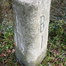
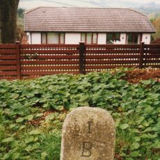
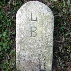
Lanhydrock, Civil parish in Cornwall, England

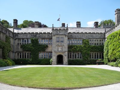
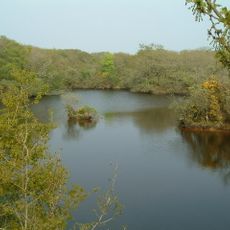
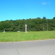
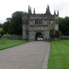
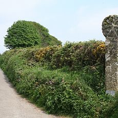
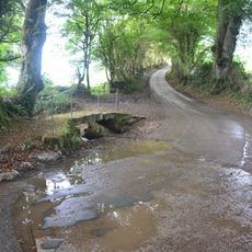
Lanhydrock is a civil parish located south of Bodmin that encompasses roughly 890 acres of countryside with scattered historical buildings and open green space. The parish church of St. Hydroc, with its nine bells, forms the focal point of the community and is surrounded by typical English rural landscape.

The parish originally formed part of Bodmin Priory until the dissolution of monasteries in 1539 led to its independent establishment. This ecclesiastical change reshaped local governance and the community's relationship with its land in the centuries that followed.

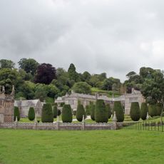
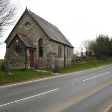
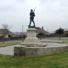
The parish church of St. Hydroc serves as the spiritual center and gathers people for worship and community events throughout the year. The churchyard with its gravestones and monuments reflects the lives of those who have called this place home over many generations.

The area is best explored on foot or by car, with the churchyard serving as a natural starting point for visitors. Wear sturdy footwear as the country lanes and paths can vary in condition depending on the weather.

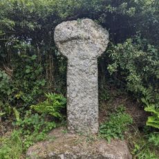
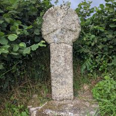
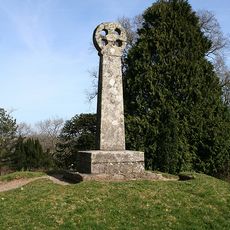
The granite cross standing in the churchyard bears marks of its medieval past, with a missing ring and holes that reveal centuries of change. This worn and altered form offers visitors a tangible connection to the site's long history.

The community of curious travelers

AroundUs brings together thousands of curated places, local tips, and hidden gems, enriched daily by 60,000 contributors worldwide.

Start exploring
Location
GPS coordinates
50.44100,-4.69800
Latest update
December 20, 2025 15:18
Around this place
Bodmin and Wenford Railway
United Kingdom

Bodmin and Wenford Railway

3.1 km
Lanhydrock House
United Kingdom

Lanhydrock House

14 m
Red Moor nature reserve
United Kingdom

Red Moor nature reserve

2.7 km
St Hydroc's Church, Lanhydrock
United Kingdom

St Hydroc's Church, Lanhydrock

24 m
Carminow Cross
United Kingdom

Carminow Cross

2.1 km
Respryn Bridge
United Kingdom

Respryn Bridge

1.4 km
Bodmin Keep - Cornwall's Army Museum
United Kingdom

Bodmin Keep - Cornwall's Army Museum

3 km
Bodmin Parkway Signal Box
United Kingdom

Bodmin Parkway Signal Box

2.6 km
Ebenezer Chapel
United Kingdom

Ebenezer Chapel

1.5 km
Fenton Pits Cross, 210m WSW of Penburthen Farm
United Kingdom

Fenton Pits Cross, 210m WSW of Penburthen Farm

2.5 km
Duke of Cornwall's Light Infantry War Memorial
United Kingdom

Duke of Cornwall's Light Infantry War Memorial

3 km
Gatehouse About 40 Metres East Of Lanhydrock House
United Kingdom

Gatehouse About 40 Metres East Of Lanhydrock House

116 m
Milestone At Sx 080640
United Kingdom

Milestone At Sx 080640

570 m
Guidepost At Sx 086617
United Kingdom

Guidepost At Sx 086617

1.8 km
Lodge With Front Wall And Railings At The South West Entrance To Glynn House
United Kingdom

Lodge With Front Wall And Railings At The South West Entrance To Glynn House

2.5 km
Lesquite Cross, 160m NNW of Lesquite Farm
United Kingdom

Lesquite Cross, 160m NNW of Lesquite Farm

2.1 km
St Ingunger Cross
United Kingdom

St Ingunger Cross

2.6 km
Guidepost At Sx 088647
United Kingdom

Guidepost At Sx 088647

1.2 km
Churchyard cross in Lanhydrock churchyard
United Kingdom

Churchyard cross in Lanhydrock churchyard

6 m
Milestone At Sx 082 624
United Kingdom

Milestone At Sx 082 624

1.2 km
Milestone South Of Chy-Praze (Ngr Sx0862966282)
United Kingdom

Milestone South Of Chy-Praze (Ngr Sx0862966282)

2.7 km
Milestone South Of Bodmin School (Ngr Sx0778165458)
United Kingdom

Milestone South Of Bodmin School (Ngr Sx0778165458)

2 km
Milestone (Ngr Sx0989765564)
United Kingdom

Milestone (Ngr Sx0989765564)

2.4 km
Footbridge At Sx 060 651
United Kingdom

Footbridge At Sx 060 651

2.9 km
Milestone At Sx 089611
United Kingdom

Milestone At Sx 089611

2.5 km
Treffry Cross
United Kingdom

Treffry Cross

174 m
Gateway And Flanking Walls At The East Entrance To Lanhydrock Park
United Kingdom

Gateway And Flanking Walls At The East Entrance To Lanhydrock Park

1 km
Milestone, Glynmill Lodge
United Kingdom

Milestone, Glynmill Lodge

2.5 km
Show the full map
Reviews
Share your experience

No review yet

Discussions
Start a discussion...

No discussion yet

« Lanhydrock - Civil parish in Cornwall, England » is provided by Around Us (aroundus.com). Images and texts are derived from Wikimedia project under a Creative Commons license. You are allowed to copy, distribute, and modify copies of this page, under the conditions set by the license, as long as this note is clearly visible.

Discover hidden gems everywhere you go!

From secret cafés to breathtaking viewpoints, skip the crowded tourist spots and find places that match your style. Our app makes it easy with voice search, smart filtering, route optimization, and insider tips from travelers worldwide. Download now for the complete mobile experience.

Around Us App Screenshot

A unique approach to discovering new places

Le Figaro

All the places worth exploring

France Info

A tailor-made excursion in just a few clicks

20 Minutes

Around Us
Travel Guide & Maps
Download

Send to your phone

QR Code
1

Open the camera app on your mobile.

2

Point at the QR code with your camera. A notification will appear.

3

Tap the notification to open the link.