Chest opened
+${chestReward.xp} XP
Explorer
NOUVEAU ×${chestReward.collectible.quantity}
tapez pour fermer
Chest locked

Open chests in the app

Around Us is built for your phone — chests unlock when you walk, explore and capture nearby places.

Enable Location

We need your location to show you interesting places around you

Discover nearby places

Find interesting locations and hidden gems around you

Precise directions

Get accurate directions and distances to places

Your location is never shared with other users. It's only used when you tap the location button.

Log in to your account

Start exploring — it's free

Trusted by 72,889 travelers worldwide

Continue with Google
Continue with Apple
or

We will send you a code to connect

By continuing, you accept our Terms and Conditions and our Privacy Policy

Check your inbox

We've sent a pincode in your inbox. Please enter the code below.

Discussion Reviews Photo
16.6k Popularity

Gedling, Parliamentary constituency in the United Kingdom, 1983 onwards

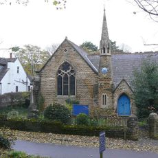
Gedling is a House of Commons constituency in Nottinghamshire in eastern England. The area consists mainly of suburbs and small villages with tree-lined streets and mostly brick family homes with gardens.

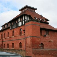
The constituency was created in 1983, replacing the older Carlton area. The region has a history as an industrial area with textile manufacturing and coal mining that shaped residents' lives for generations.

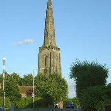
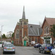
Gedling takes its name from the local village and became a voting area in 1983. The community is shaped by local traditions where residents gather in shops and parks, and neighborhood events and markets bring people together throughout the year.

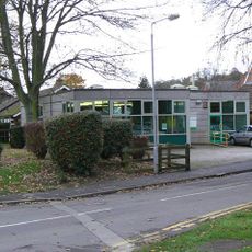
The area is divided into several neighborhoods, with Arnold being a notable one. Visitors should take time to explore the quiet streets, local shops, and parks scattered throughout the different districts.

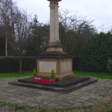
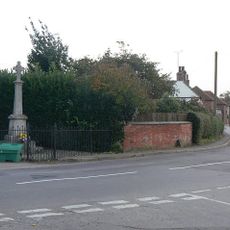
Arnold, a key part of the constituency, is connected to the Luddite movement, a 19th-century worker protest against mechanization. This history is visible in monuments and old mill buildings that remind visitors of this significant chapter today.

The community of curious travelers

AroundUs brings together thousands of curated places, local tips, and hidden gems, enriched daily by 60,000 contributors worldwide.

Start exploring
Location
Inception
June 9, 1983
GPS coordinates
52.97000,-1.05000
Latest update
February 17, 2026 02:01
Around this place
Rectory Junction Viaduct
United Kingdom

Rectory Junction Viaduct

2.1 km
St Helen's Church, Burton Joyce
United Kingdom

St Helen's Church, Burton Joyce

2.1 km
St. Peter and St. Paul's Church, Shelford
United Kingdom

St. Peter and St. Paul's Church, Shelford

2.3 km
St Luke's Church, Stoke Bardolph
United Kingdom

St Luke's Church, Stoke Bardolph

771 m
United Reformed Church, Burton Joyce
United Kingdom

United Reformed Church, Burton Joyce

2.2 km
Church of All Hallows
United Kingdom

Church of All Hallows

2.2 km
Regal Cinema
United Kingdom

Regal Cinema

2.2 km
Carlton Library
United Kingdom

Carlton Library

2.1 km
Burton Joyce War Memorial
United Kingdom

Burton Joyce War Memorial

2 km
Burton Joyce Library
United Kingdom

Burton Joyce Library

2.3 km
Shelford War Memorial
United Kingdom

Shelford War Memorial

2.3 km
Spire Top One And A Half Metres West Of South Aisle At Church Of St Helen
United Kingdom

Spire Top One And A Half Metres West Of South Aisle At Church Of St Helen

2.1 km
Font 2 Metres South Of West End At Church Of All Hallows
United Kingdom

Font 2 Metres South Of West End At Church Of All Hallows

2.2 km
Carlton Laundry
United Kingdom

Carlton Laundry

2.3 km
United Kingdom

Number 24 And Adjoining Stable

1.7 km
United Kingdom

86 And 88, Main Road

2 km
United Kingdom

Manor Farmhouse

2.5 km
Footbridge Over Stream Approximately 100 Metres South East Of 28 St Helens Road
United Kingdom

Footbridge Over Stream Approximately 100 Metres South East Of 28 St Helens Road

1.9 km
Burton Joyce Methodist Church And Adjoining School Room And Boundary Wall
United Kingdom

Burton Joyce Methodist Church And Adjoining School Room And Boundary Wall

2.3 km
United Kingdom

Lowe's Farmhouse And Adjoining Boundary Wall

842 m
United Kingdom

11 And 15, Wood Lane

1.7 km
United Kingdom

Gedling House

1.3 km
United Kingdom

Barn At Number 36

2.1 km
United Kingdom

Shelford

2.3 km
United Kingdom

Knitters' Workshops Opposite Numbers 58 To 64

2.3 km
United Kingdom

Beech Farmhouse

2.3 km
United Kingdom

The Manor House

2.3 km
United Kingdom

Civil War gun battery 50m south west of St Peters and St Paul's Church

2.3 km
Show the full map
Reviews
Share your experience

No review yet

Discussions
Start a discussion...

No discussion yet

« Gedling - Parliamentary constituency in the United Kingdom, 1983 onwards » is provided by Around Us (aroundus.com). Images and texts are derived from Wikimedia project under a Creative Commons license. You are allowed to copy, distribute, and modify copies of this page, under the conditions set by the license, as long as this note is clearly visible.

Discover hidden gems everywhere you go!

From secret cafés to breathtaking viewpoints, skip the crowded tourist spots and find places that match your style. Our app makes it easy with voice search, smart filtering, route optimization, and insider tips from travelers worldwide. Download now for the complete mobile experience.

Around Us App Screenshot

A unique approach to discovering new places

Le Figaro

All the places worth exploring

France Info

A tailor-made excursion in just a few clicks

20 Minutes

Around Us
Travel Guide & Maps
Download

Send to your phone

QR Code
1

Open the camera app on your mobile.

2

Point at the QR code with your camera. A notification will appear.

3

Tap the notification to open the link.