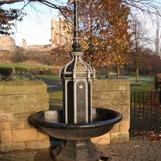
Conisbrough Castle, Medieval castle in Conisbrough, England.
Conisbrough Castle is a medieval fortress positioned on a hilltop overlooking the Don Valley with a prominent cylindrical keep at its core. The tower features thick limestone walls reinforced with six buttresses, surrounded by a defensive wall with additional structures that form the residential and military complex.
The fortress was established following the Norman Conquest of 1066, though the distinctive cylindrical keep was constructed between 1159 and 1202 under Hamelin Plantagenet. This later construction represented a significant advancement in English military engineering practices.
The fortress reflects how Norman nobles controlled the surrounding land after their arrival in England. It served as a symbol of power and authority that shaped the social order of the medieval Yorkshire region.
The site is situated on a slope, so comfortable footwear is recommended for navigating the grounds and climbing to the keep's entrance. Inside, visitors will encounter narrow stone stairs and different floor levels that require some physical exertion but are generally accessible to most people.
The keep's hexagonal design was an experimental approach that combined defensive strength with living space more efficiently than traditional round towers. Few fortifications of that era attempted such an unconventional geometric shape.
Location: Conisbrough
Location: Doncaster
Inception: 11 century
Founders: William de Warenne, 1st Earl of Surrey
Operator: English Heritage
Website: https://english-heritage.org.uk/visit/places/conisbrough-castle
GPS coordinates: 53.48430,-1.22606
Latest update: December 20, 2025 13:27
Conisbrough Viaduct
1.1 km
Church of St Peter
277 m
St John the Evangelist's Church, Cadeby
1.6 kmAshfield Brick Pits
802 m
Conisbrough Wesleyan Methodist Chapel
438 m
War Memorial in Coronation Park
132 mChurch of St Alban with Attached Presbytery
1.4 kmThe Red Lion Public House
616 m
Set Of Stocks Resited In Coronation Park
113 m
Fountain and Lamp Standard at the southern entrance to Coronation Park
158 mThe Old Priory Nursing Home And And Attached Outbuilding
152 m
Milepost In Pavement To Front Of Number 10
797 m
Denaby War Memorial
1.7 km
Milestone, on Carr Lane boundary of Crookhill Park Golf Course
1.9 kmThe Priory (Offices Of Local Authority Department)
218 mWildthorpe medieval settlement 680m south of Leylands Farm
2.3 km
Milepost Approximately 70 Metres To West Of Junction With Denaby Lane
2.3 kmConisbrough Tunnel East Portal
1 kmBarn Approximately 40 Metres To Rear Of Cadeby Inn
1.5 km
Milestone, Sheffield Road, W end of Conisbrough
1.5 km
Milestone, Doncaster Road, Conisbrough
279 mWell Cover Approximately 50 Metres North West Of Junction With Church Street
293 mWest Portal
813 mWhite House Farmhouse
1.8 kmDerelict Farmhouse At Butterbusk Farm
1.9 kmDenaby Ings
2 kmCrookhill Park Golf Course
1.8 kmScenic viewpoint
1.5 kmVisited this place? Tap the stars to rate it and share your experience / photos with the community! Try now! You can cancel it anytime.
Discover hidden gems everywhere you go!
From secret cafés to breathtaking viewpoints, skip the crowded tourist spots and find places that match your style. Our app makes it easy with voice search, smart filtering, route optimization, and insider tips from travelers worldwide. Download now for the complete mobile experience.
A unique approach to discovering new places❞
— Le Figaro
All the places worth exploring❞
— France Info
A tailor-made excursion in just a few clicks❞
— 20 Minutes