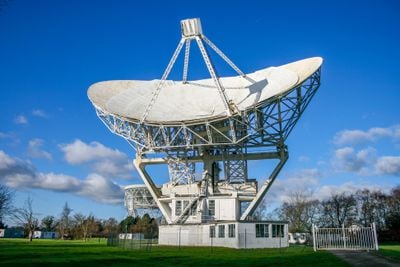
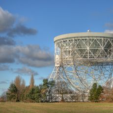
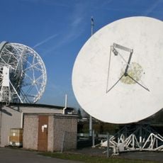
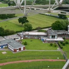
Mark II, Radio telescope at Jodrell Bank Observatory, Lower Withington, United Kingdom
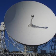
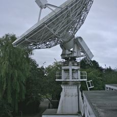
Mark II is a radio telescope featuring an elliptical dish positioned at Jodrell Bank Observatory in Lower Withington. This large moving structure stands over 80 meters tall and collects radio waves from space to study distant objects.
The telescope was built between 1962 and 1964 through a collaboration between Sir Bernard Lovell and structural engineer Charles Husband. This period coincided with major advances in radio astronomy and the space race competition.
The Grade I listed telescope participates in the European VLBI Network, connecting astronomers across continents for advanced astronomical observations.
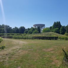
The site is located in a rural area and is generally visible from outside, as the observatory welcomes visitors. It is helpful to contact the facility beforehand to plan your visit and learn about viewing opportunities.
The telescope can move and track objects across the sky as it rotates. This tracking ability allows scientists to make detailed observations of the same sources over extended periods.
Location: Lower Withington
Elevation above the sea: 81.7 m
Diameter: 38.1 m
Part of: Jodrell Bank Observatory, e-MERLIN, European VLBI Network
GPS coordinates: 53.23397,-2.30390
Latest update: December 12, 2025 12:05
Jodrell Bank Observatory
333 m
Lovell Telescope
334 m
Jodrell Bank
926 m
St Luke's Church, Goostrey
2 km
St.Oswald's Church, Padgate
2.2 km
Blackden Hall
1.2 km
Blackden Manor
1.7 km
Peover Hall Stable Block
3.6 km
7m radio telescope of Jodrell Bank Observatory
168 m
42ft radio telescope of Jodrell Bank Observatory
279 m
Searchlight Telescope
62 m
Table tomb by east wall of St Luke's Church
2 km
Jodrell Bank Observatory: Control Building
301 m
Swanwick Hall
3.1 km
The Old Schoolhouse
2.1 km
Winterbottom Farmhouse
2.9 km
Manor Farmhouse
3.5 km
Bate Mill (Disused Water Mill)
1.6 km
The Coach House, Peover Hall
3.6 km
Brookside Farmhouse
1.9 km
Peover Viaduct
1.5 km
Barnshaw Hall
2.1 km
Gatepiers and gates circa 20 yards north east of The Old Stable Block, Peover Hall
3.6 km
Milepost, S of Chelford, by lake
2.6 km
Sundial 3 metres from south east end of St Luke's Church
2 km
Crook Hall
1.7 km
Milepost, SW of Twemlow Green
3.2 km
Milepost, Blackden Manor Farm, SW of New Farm
1.9 kmVisited this place? Tap the stars to rate it and share your experience / photos with the community! Try now! You can cancel it anytime.
Discover hidden gems everywhere you go!
From secret cafés to breathtaking viewpoints, skip the crowded tourist spots and find places that match your style. Our app makes it easy with voice search, smart filtering, route optimization, and insider tips from travelers worldwide. Download now for the complete mobile experience.
A unique approach to discovering new places❞
— Le Figaro
All the places worth exploring❞
— France Info
A tailor-made excursion in just a few clicks❞
— 20 Minutes