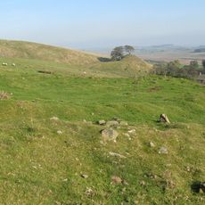
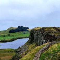
Magna Roman Fort, Roman military fort and museum in Greenhead, England
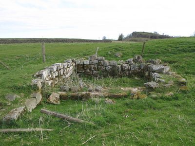
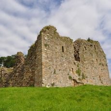
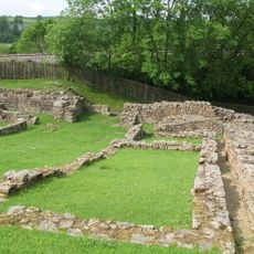
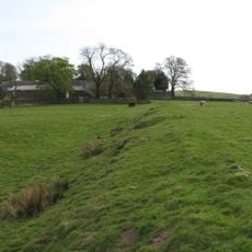
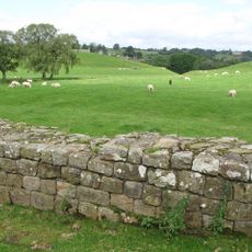
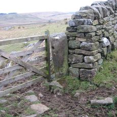
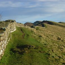
Magna Roman Fort is a stone fortification located at a strategic position where the Maiden Way crosses the Stanegate road. The site once monitored movement along both routes in this region.
The fort was founded around 86 AD by the Twentieth Legion and was rebuilt around 120 AD during the construction of Hadrian's Wall. This phase marked an important shift in Roman defensive strategy in this region.
The nearby museum displays military equipment and everyday items from soldiers stationed at this northern frontier post. The objects reveal how the Roman garrison organized their daily routines and work.
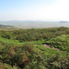
Visitors should wear sturdy shoes as the ground is uneven and paths cross open countryside. There are limited facilities on site, so it is best to find refreshments and services in Greenhead or nearby villages.
Excavations uncovered a grain-measuring bucket buried near the fort, providing insight into how Roman soldiers managed their daily food supplies. Such finds are uncommon and help archaeologists understand the practical aspects of running a military garrison.
Location: Greenhead
Part of: Stanegate, Hadrian's Wall, Carvoran Roman fort and Hadrian's Wall and vallum between the unclassified road to Old Shield and the field boundary west of the fort in wall miles 45 and 46
Address: Roman Army Museum, Greenhead, Brampton CA8 7JB
GPS coordinates: 54.98490,-2.52440
Latest update: December 11, 2025 18:11
Blenkinsopp Castle
1.2 km
Thirlwall Castle
666 m
Milecastle 48
3.2 km
Milecastle 45
1.5 km
Roman Army Museum
253 m
Milecastle 47
1.7 km
Milecastle 44
2.6 km
Milecastle 46
309 m
St. Mary Magdalene's Church, Gilsland
3.6 km
Church of St Cuthbert
645 m
Greenhead water fountain
619 m
Roman Army Museum
1.6 km
Poltross Burn Viaduct
3.1 km
Greenhead Memorial Cross
625 m
Dinmont House
3.3 km
2 Storey Farmbuilding And Flanking Ranges To Rear Of Glenwhelt
509 m
Barn And Workshop Adjoining Glenwhelt Cottage
489 m
Hadrian's Wall between Walltown Quarry East and Walltown Quarry West in wall mile 45
950 m
Hadrians Wall Milecastle And Turrets Hadrians Wall, Milecastle And Turrets
2.8 km
Road Bridge 25 Metres South-West Of Glenwhelt
546 m
Orchard House
3.5 km
1-4, Hall Terrace
3.3 km
Accomodation Bridge 60 Metres South Of East Lodge To Blenkinsopp Hall
3.2 km
Station House
650 m
Spa Villa
3.6 km
Hadrian's Wall between the track to Cockmount Hill and Walltown Quarry East in wall miles 43, 44 and 45
2.4 km
Hadrians Wall, Milecastles And Turrets
2 km
Milestone, Gap Shields
2.6 kmVisited this place? Tap the stars to rate it and share your experience / photos with the community! Try now! You can cancel it anytime.
Discover hidden gems everywhere you go!
From secret cafés to breathtaking viewpoints, skip the crowded tourist spots and find places that match your style. Our app makes it easy with voice search, smart filtering, route optimization, and insider tips from travelers worldwide. Download now for the complete mobile experience.
A unique approach to discovering new places❞
— Le Figaro
All the places worth exploring❞
— France Info
A tailor-made excursion in just a few clicks❞
— 20 Minutes