Enable Location

We need your location to show you interesting places around you

Discover nearby places

Find interesting locations and hidden gems around you

Precise directions

Get accurate directions and distances to places

Your location is never shared with other users. It's only used when you tap the location button.

Stargroves

Log in to your account

Start exploring — it's free

Trusted by 63,003 travelers worldwide

Continue with Google
Continue with Apple
or

We will send you a code to connect

By continuing, you accept our Terms and Conditions and our Privacy Policy

Check your inbox

We've sent a pincode in your inbox. Please enter the code below.

Discussion Reviews 1 Photos
25.2k Popularity

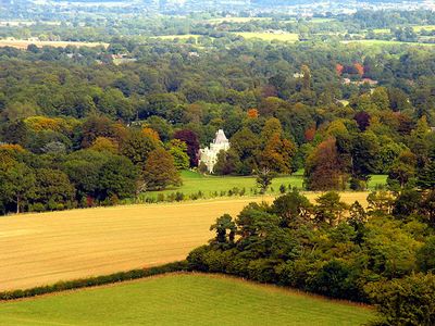
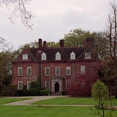
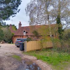
Stargroves, Manor house in East Woodhay, England.

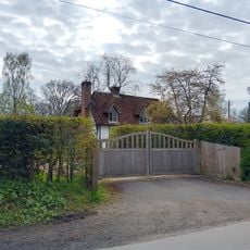
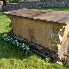
Stargroves is a Grade II listed manor house in East Woodhay, England, built in the style of a French chateau. Corner turrets rise at each corner of the structure, while castellations and Tudor revival windows give the facade a mix of Gothic and neo-Gothic elements.

The Goddard family owned the estate from 1565 to 1830 and hosted Oliver Cromwell there after the Second Battle of Newbury in 1644. The current building was constructed in the 19th century in the style of French chateau architecture, replacing the earlier manor.

Mick Jagger owned the property between 1970 and 1979 and set up a mobile recording facility on the grounds. The rooms echoed with guitar riffs from Keith Richards and drumbeats from John Bonham as some of the best-known rock albums of that decade took shape.

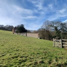
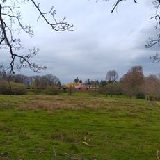
The property remains in private hands and is not open to the public. Visitors should inquire in advance whether special events or tours might allow a glimpse of the exterior.

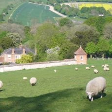
The grounds served as a filming location for two Doctor Who episodes in the 1970s: Pyramids of Mars and Image of the Fendahl. The Gothic turrets and parkland provided a fitting backdrop for science fiction plots set in English country estates.

The community of curious travelers

AroundUs brings together thousands of curated places, local tips, and hidden gems, enriched daily by 60,000 contributors worldwide.

Start exploring
Location
GPS coordinates
51.34700,-1.41100
Latest update
December 20, 2025 11:35
Around this place
Walbury Hill
United Kingdom

Walbury Hill

3.8 km
West Woodhay House
United Kingdom

West Woodhay House

3.4 km
Hog's Hole
United Kingdom

Hog's Hole

3.6 km
Church of St Michael Archangel
United Kingdom

Church of St Michael Archangel

3 km
Church of St Thomas
United Kingdom

Church of St Thomas

1.9 km
Church of St Barnabas
United Kingdom

Church of St Barnabas

3.6 km
Church of St Swithin
United Kingdom

Church of St Swithin

4.3 km
Church of St Martin
United Kingdom

Church of St Martin

719 m
Merville Battery Memorial
United Kingdom

Merville Battery Memorial

4.1 km
Walbury Camp
United Kingdom

Walbury Camp

3.8 km
Woolton Hill War Memorial
United Kingdom

Woolton Hill War Memorial

1.9 km
Whistler Tomb, 5 Metres South Of South Door To Chancel
United Kingdom

Whistler Tomb, 5 Metres South Of South Door To Chancel

4.3 km
Townsend Tomb, 1 Metre North West Of Rawlinson Tomb
United Kingdom

Townsend Tomb, 1 Metre North West Of Rawlinson Tomb

4.3 km
Whistler Tomb, 3 Metres South Of South Door To Chancel
United Kingdom

Whistler Tomb, 3 Metres South Of South Door To Chancel

4.3 km
Hitchens
United Kingdom

Hitchens

2 km
Milestone On A343 At Ngr 439 611
United Kingdom

Milestone On A343 At Ngr 439 611

2.8 km
Whistler Tomb, 20 Metres South Of South Door Of Chancel
United Kingdom

Whistler Tomb, 20 Metres South Of South Door Of Chancel

4.3 km
Whistler Tomb, 20 Metres South Of South Door To Chancel
United Kingdom

Whistler Tomb, 20 Metres South Of South Door To Chancel

4.3 km
Garden House At Manor Farm In South West Corner Of Garden Wall
United Kingdom

Garden House At Manor Farm In South West Corner Of Garden Wall

4.4 km
Walls Around Garden At West Of Manor Farm House
United Kingdom

Walls Around Garden At West Of Manor Farm House

4.4 km
Woolton House
United Kingdom

Woolton House

1.8 km
Nether Oakhurst
United Kingdom

Nether Oakhurst

1.7 km
Milestone On A343 At Ngr 431 581
United Kingdom

Milestone On A343 At Ngr 431 581

3.6 km
Milestone On A343 At Ngr 434 596
United Kingdom

Milestone On A343 At Ngr 434 596

2.7 km
Whistler Tomb, 1 Metre South Of South Door To Chancel
United Kingdom

Whistler Tomb, 1 Metre South Of South Door To Chancel

4.3 km
Rawlinson Tomb, 9 Metres South Of South Porch
United Kingdom

Rawlinson Tomb, 9 Metres South Of South Porch

4.3 km
Milestone, near Highclere Farm, S of village
United Kingdom

Milestone, near Highclere Farm, S of village

2.7 km
Milestone, half way up hill to Three Legs House
United Kingdom

Milestone, half way up hill to Three Legs House

3.6 km
Show the full map
Reviews
Share your experience

No review yet

Discussions
Start a discussion...

No discussion yet

« Stargroves - Manor house in East Woodhay, England » is provided by Around Us (aroundus.com). Images and texts are derived from Wikimedia project under a Creative Commons license. You are allowed to copy, distribute, and modify copies of this page, under the conditions set by the license, as long as this note is clearly visible.

Discover hidden gems everywhere you go!

From secret cafés to breathtaking viewpoints, skip the crowded tourist spots and find places that match your style. Our app makes it easy with voice search, smart filtering, route optimization, and insider tips from travelers worldwide. Download now for the complete mobile experience.

Around Us App Screenshot

A unique approach to discovering new places

Le Figaro

All the places worth exploring

France Info

A tailor-made excursion in just a few clicks

20 Minutes

Around Us
Travel Guide & Maps
Download

Send to your phone

QR Code
1

Open the camera app on your mobile.

2

Point at the QR code with your camera. A notification will appear.

3

Tap the notification to open the link.