Enable Location

We need your location to show you interesting places around you

Discover nearby places

Find interesting locations and hidden gems around you

Precise directions

Get accurate directions and distances to places

Your location is never shared with other users. It's only used when you tap the location button.

HM Fort Roughs

Log in to your account

Start exploring — it's free

Trusted by 63,704 travelers worldwide

Continue with Google
Continue with Apple
or

We will send you a code to connect

By continuing, you accept our Terms and Conditions and our Privacy Policy

Check your inbox

We've sent a pincode in your inbox. Please enter the code below.

HM Fort Roughs
Discussion Reviews 1 Photos
57.1k Popularity

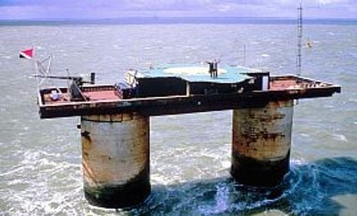
HM Fort Roughs, Sea fort in North Sea, United Kingdom.

HM Fort Roughs is a naval fortress built on a sandbar in the North Sea off the coast of Suffolk. The structure consists of two hollow reinforced concrete towers standing on a rectangular pontoon base with multiple levels containing crew quarters and equipment rooms.

The British military built the fortress in 1942 as part of a defensive line against German aircraft attacking ships in the Thames Estuary during World War II. After the war ended, the military abandoned the installation in 1956 and it remained unoccupied for years before being claimed by civilians in 1967.

Fort Roughs transformed into an independent territory when Paddy Roy Bates occupied it in 1967 and established the Principality of Sealand.

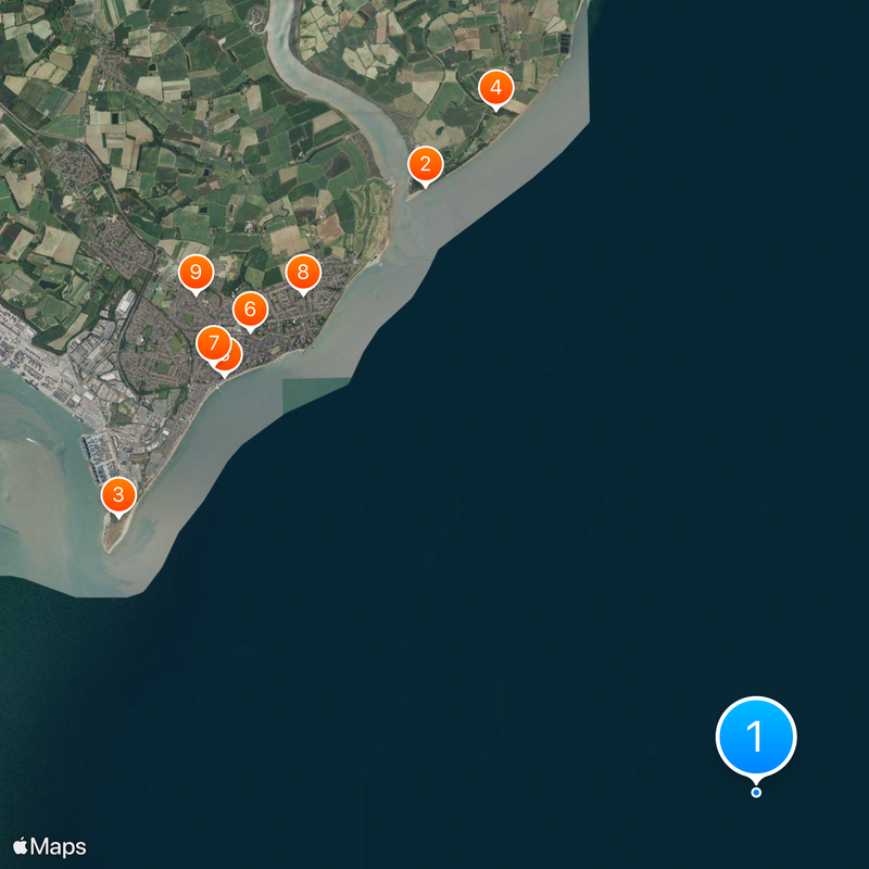
The fortress sits roughly 11 kilometers off the Suffolk coast and appears on navigational charts as a reference point for vessels heading toward Felixstowe or Harwich. Access is only possible by boat and depends on tidal conditions and weather in the North Sea.

The entire installation was built on land, then towed on pontoons into open water and deliberately sunk onto a sandbar so that the towers remained above sea level. The weight of the construction reached roughly 4,500 tons, requiring four tugboats to move it to its final position.

The community of curious travelers

AroundUs brings together thousands of curated places, local tips, and hidden gems, enriched daily by 60,000 contributors worldwide.

Start exploring
Inception
February 10, 1942
GPS coordinates
51.89517,1.48050
Latest update
December 13, 2025 19:50
Reviews
Share your experience

No review yet

Discussions
Start a discussion...

No discussion yet

« HM Fort Roughs - Sea fort in North Sea, United Kingdom » is provided by Around Us (aroundus.com). Images and texts are derived from Wikimedia project under a Creative Commons license. You are allowed to copy, distribute, and modify copies of this page, under the conditions set by the license, as long as this note is clearly visible.

Discover hidden gems everywhere you go!

From secret cafés to breathtaking viewpoints, skip the crowded tourist spots and find places that match your style. Our app makes it easy with voice search, smart filtering, route optimization, and insider tips from travelers worldwide. Download now for the complete mobile experience.

Around Us App Screenshot

A unique approach to discovering new places

Le Figaro

All the places worth exploring

France Info

A tailor-made excursion in just a few clicks

20 Minutes

Around Us
Travel Guide & Maps
Download

Send to your phone

QR Code
1

Open the camera app on your mobile.

2

Point at the QR code with your camera. A notification will appear.

3

Tap the notification to open the link.