Thor's Cave, Natural cave in Manifold Valley, Staffordshire, England
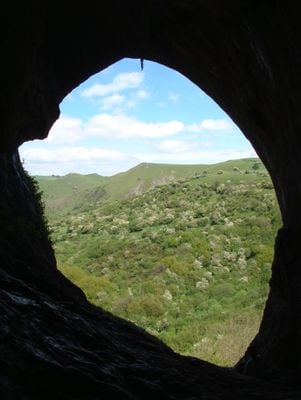
Thor's Cave is a limestone cavern in the Manifold Valley, Staffordshire, England, with a wide entrance arch that opens roughly 80 meters (260 feet) above the valley floor. The opening measures around 7.5 meters (25 feet) across and 10 meters (33 feet) tall, forming a natural frame for the landscape beyond.
Excavations between 1864 and 1935 revealed human remains, stone tools, pottery, and bronze items spanning from the Paleolithic through Roman periods. The finds show that people used the cave as a shelter across thousands of years.
The name connects the cave to old Germanic words, though the exact source remains uncertain. Local walkers often pause at the entrance to photograph the valley spread below.
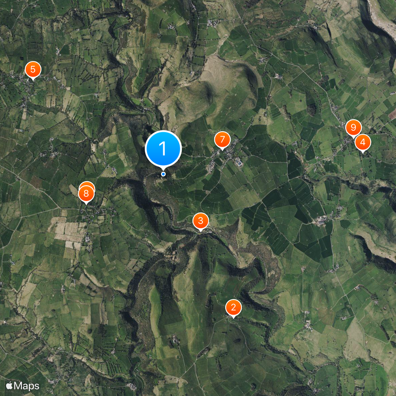
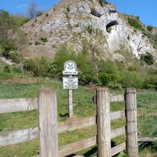
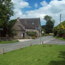
A stepped path leads up from the Manifold Way to the cave, with the climb taking around ten minutes. Parking is available in the nearby village of Wetton, from where visitors can reach the trail.
The walls inside hold eleven climbing routes of different difficulty levels, including a sport climbing line called Thormen's Moth. Climbers regularly come here to test the limestone rock.
Location: Staffordshire
GPS coordinates: 53.09176,-1.85422
Latest update: December 20, 2025 01:22
Throwley Old Hall
2.7 km
Beeston Tor
1.2 km
Church of St Peter
3.4 km
St Bartholomew's Church, Butterton
2.8 km
Church of All Saints
1.4 km
Church of St Margaret
1.1 km
Obelisk and memorial approximately 50 yards south of Church of All Saints
1.4 km
Former Coach House, Stables And Accommodation For Grooms Approximately 30 Yards North West Of The George
3.3 km
Weags Bridge
814 m
Pepper Inn
1.8 km
Darfar Bridge
833 m
Cawbrook Farmhouse
1.1 km
Wetton Bridge
1.2 km
Dalefields and attached outbuildings
1.2 km
Stable Block And Granary East Of Wetton Mill House
1.2 km
Milepost Approximately 100 Yards North West Of The Hollows
3.1 km
Lower Damgate Farmhouse and attached stable and loft
3.4 km
Grindley Croft
1.2 km
Wetton Mill Cafe
1.2 km
Stable block and granary approximately 20 yards south east of Wetton Mill House
1.2 km
Upper Damgate Farmhouse
3.3 km
Manor House
1.2 km
Chapel Farm House
3.4 km
The George Inn
3.3 km
Castern Farmhouse
3.4 km
Wetton Mill House
1.2 km
Dale Farmhouse
1.4 km
Green Farmhouse
3.2 kmVisited this place? Tap the stars to rate it and share your experience / photos with the community! Try now! You can cancel it anytime.
Discover hidden gems everywhere you go!
From secret cafés to breathtaking viewpoints, skip the crowded tourist spots and find places that match your style. Our app makes it easy with voice search, smart filtering, route optimization, and insider tips from travelers worldwide. Download now for the complete mobile experience.
A unique approach to discovering new places❞
— Le Figaro
All the places worth exploring❞
— France Info
A tailor-made excursion in just a few clicks❞
— 20 Minutes