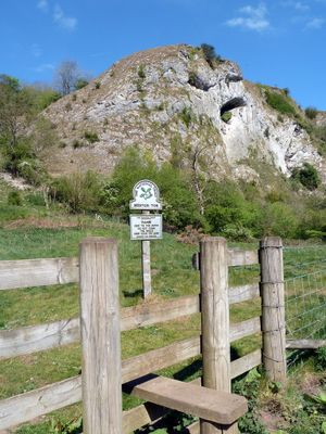
Beeston Tor, Limestone cliff in Wetton, England
Beeston Tor is a limestone cliff in Wetton that rises where the River Hamps and River Manifold meet. The rock face rises prominently with varying heights and formations that create a distinctive landmark within the surrounding valley.
The area was shaped by a narrow gauge railway that operated a station nearby from 1904 to 1934, transporting passengers through the valley. This line was part of the broader railway network that once served the region.
The limestone walls contain routes named The Beest, Black Grub, and Majolica, reflecting traditional climbing terminology developed by local mountaineers.
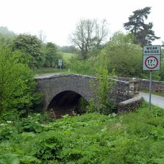
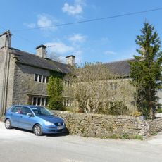
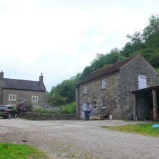
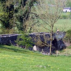
Parking at Weag's Bridge provides a good starting point for a riverside walk to the cliff. Alternative parking is available at a farm location, offering another approach option for visitors.
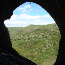
The cliff faces contain numerous pocketed surfaces and natural formations, providing climbers with routes of varying difficulty levels throughout the structure.
Location: Wetton
GPS coordinates: 53.08310,-1.84470
Latest update: December 14, 2025 12:20
Thor's Cave
1.2 km
Castern Hall
2.4 km
Throwley Old Hall
1.6 km
Church of All Saints
2 km
Church of St Margaret
1.4 km
Obelisk and memorial approximately 50 yards south of Church of All Saints
2 km
Former Coach House, Stables And Accommodation For Grooms Approximately 30 Yards North West Of The George
3.1 km
Weags Bridge
519 m
Pepper Inn
2.7 km
Darfar Bridge
2 km
Wetton Bridge
2.3 km
Cawbrook Farmhouse
1.6 km
Lower Damgate Farmhouse and attached stable and loft
2.4 km
Grindley Croft
1.7 km
Milepost Approximately 100 Yards North West Of The Hollows
3 km
Dalefields and attached outbuildings
1.7 km
Stable Block And Granary East Of Wetton Mill House
2.3 km
Stable block and granary approximately 20 yards south east of Wetton Mill House
2.3 km
Upper Damgate Farmhouse
2.3 km
Manor House
1.5 km
Castern Farmhouse
2.3 km
Wetton Mill House
2.3 km
Coach house, stables and hayloft to north of Castern Hall
2.4 km
Dale Farmhouse
2.5 km
Gate piers, forecourt walls and steps to Castern Hall
2.4 km
Rushley Bridge
3.1 km
Green Farmhouse
3.1 km
Alstonefield Geohut
3.1 kmVisited this place? Tap the stars to rate it and share your experience / photos with the community! Try now! You can cancel it anytime.
Discover hidden gems everywhere you go!
From secret cafés to breathtaking viewpoints, skip the crowded tourist spots and find places that match your style. Our app makes it easy with voice search, smart filtering, route optimization, and insider tips from travelers worldwide. Download now for the complete mobile experience.
A unique approach to discovering new places❞
— Le Figaro
All the places worth exploring❞
— France Info
A tailor-made excursion in just a few clicks❞
— 20 Minutes