Chest opened
+${chestReward.xp} XP
Explorer
NOUVEAU ×${chestReward.collectible.quantity}
tapez pour fermer
Chest locked

Open chests in the app

Around Us is built for your phone — chests unlock when you walk, explore and capture nearby places.

Enable Location

We need your location to show you interesting places around you

Discover nearby places

Find interesting locations and hidden gems around you

Precise directions

Get accurate directions and distances to places

Your location is never shared with other users. It's only used when you tap the location button.

Highams Park

Log in to your account

Start exploring — it's free

Trusted by 72,899 travelers worldwide

Continue with Google
Continue with Apple
or

We will send you a code to connect

By continuing, you accept our Terms and Conditions and our Privacy Policy

Check your inbox

We've sent a pincode in your inbox. Please enter the code below.

Highams Park
Discussion Reviews 2 Photos
24.3k Popularity

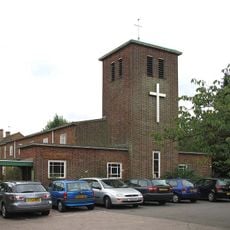
Highams Park, Residential district in Waltham Forest, England

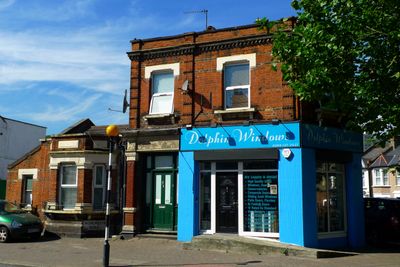
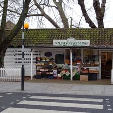
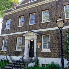
Highams Park is a residential area in northeast London containing both Victorian houses and terraced properties from the 1930s. The district features independent shops and a quiet, green streetscape throughout its neighborhoods.

The area was originally farmland called Hale End before the railway sparked its development. The shift from rural settlement to suburb took place in the late 1800s.

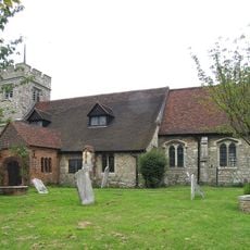
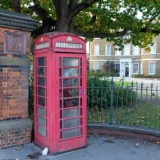
The name comes from the Higham family, who lived here during medieval times. Today, neighbors gather regularly in local shops and along the streets, where daily life follows a calm, community-oriented pace.

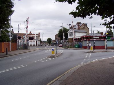
The area is well-connected to central London via the London Overground network, making visits straightforward. Walking around the neighborhood is pleasant, with plenty of sidewalks and quiet residential streets to explore.

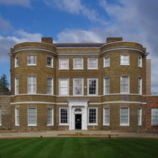
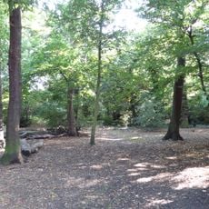
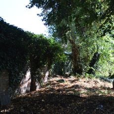
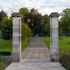
A lake here was designed by renowned landscape architect Humphry Repton and offers a tranquil sight. The water feature still reflects the classical garden design methods from the 18th century.

The community of curious travelers

AroundUs brings together thousands of curated places, local tips, and hidden gems, enriched daily by 60,000 contributors worldwide.

Start exploring
Shares border with
Chingford Hatch
GPS coordinates
51.60590,-0.01510
Latest update
December 20, 2025 12:47
Around this place
William Morris Gallery
United Kingdom

William Morris Gallery

1.7 km
Waltham Forest Town Hall
United Kingdom

Waltham Forest Town Hall

1.6 km
St. Mary's Church, Walthamstow
United Kingdom

St. Mary's Church, Walthamstow

2.3 km
Mirth, Marvel and Maud
United Kingdom

Mirth, Marvel and Maud

2.2 km
Banbury Reservoir
United Kingdom

Banbury Reservoir

1.4 km
All Saints' Church
United Kingdom

All Saints' Church

1.9 km
Ainslie Wood
United Kingdom

Ainslie Wood

604 m
Eley Industrial Estate
United Kingdom

Eley Industrial Estate

2.2 km
St Edmund's Church
United Kingdom

St Edmund's Church

1 km
Central Parade, Walthamstow
United Kingdom

Central Parade, Walthamstow

2.3 km
St Anne's Church
United Kingdom

St Anne's Church

1.7 km
Saint Gabriel's
United Kingdom

Saint Gabriel's

2 km
Walthamstow War Memorial
United Kingdom

Walthamstow War Memorial

1.7 km
Regal Cinema
United Kingdom

Regal Cinema

1.1 km
Entrance Range Including Tote Board At Walthamstow Stadium
United Kingdom

Entrance Range Including Tote Board At Walthamstow Stadium

361 m
Thorpe Coombe Hospital (Original House Only)
United Kingdom

Thorpe Coombe Hospital (Original House Only)

1.8 km
St John's
United Kingdom

St John's

983 m
Chingford Mount War Memorial
United Kingdom

Chingford Mount War Memorial

1.3 km
Gates, Gatepiers And Railings At Walthamstow Civic Centre
United Kingdom

Gates, Gatepiers And Railings At Walthamstow Civic Centre

1.8 km
Assembly Hall To South East Of Town Hall
United Kingdom

Assembly Hall To South East Of Town Hall

1.7 km
Wood Street Library
United Kingdom

Wood Street Library

1.8 km
Old Butchers Shop Adjacent To Number 76
United Kingdom

Old Butchers Shop Adjacent To Number 76

2 km
Wall To South East Side Of Graveyard To St Mary's Church
United Kingdom

Wall To South East Side Of Graveyard To St Mary's Church

2.3 km
Brookscroft
United Kingdom

Brookscroft

1.8 km
K6 Telephone Kiosk Outside William Morris Gallery, Forest Road
United Kingdom

K6 Telephone Kiosk Outside William Morris Gallery, Forest Road

1.7 km
Monoux Almshouses
United Kingdom

Monoux Almshouses

2.3 km
Walthamstow Civic Centre Eight Pairs Of Gatepiers In Forecourt To South Of Centre
United Kingdom

Walthamstow Civic Centre Eight Pairs Of Gatepiers In Forecourt To South Of Centre

1.7 km
Walthamstow Civic Centre Pair Of Flagpoles In Forecourt To South Of Centre
United Kingdom

Walthamstow Civic Centre Pair Of Flagpoles In Forecourt To South Of Centre

1.7 km
Show the full map
Reviews
Share your experience

No review yet

Discussions
Start a discussion...

No discussion yet

« Highams Park - Residential district in Waltham Forest, England » is provided by Around Us (aroundus.com). Images and texts are derived from Wikimedia project under a Creative Commons license. You are allowed to copy, distribute, and modify copies of this page, under the conditions set by the license, as long as this note is clearly visible.

Discover hidden gems everywhere you go!

From secret cafés to breathtaking viewpoints, skip the crowded tourist spots and find places that match your style. Our app makes it easy with voice search, smart filtering, route optimization, and insider tips from travelers worldwide. Download now for the complete mobile experience.

Around Us App Screenshot

A unique approach to discovering new places

Le Figaro

All the places worth exploring

France Info

A tailor-made excursion in just a few clicks

20 Minutes

Around Us
Travel Guide & Maps
Download

Send to your phone

QR Code
1

Open the camera app on your mobile.

2

Point at the QR code with your camera. A notification will appear.

3

Tap the notification to open the link.