Chest opened
+${chestReward.xp} XP
Explorer
NOUVEAU ×${chestReward.collectible.quantity}
tapez pour fermer
Chest locked

Open chests in the app

Around Us is built for your phone — chests unlock when you walk, explore and capture nearby places.

Enable Location

We need your location to show you interesting places around you

Discover nearby places

Find interesting locations and hidden gems around you

Precise directions

Get accurate directions and distances to places

Your location is never shared with other users. It's only used when you tap the location button.

Alice Holt Forest

Log in to your account

Start exploring — it's free

Trusted by 72,880 travelers worldwide

Continue with Google
Continue with Apple
or

We will send you a code to connect

By continuing, you accept our Terms and Conditions and our Privacy Policy

Check your inbox

We've sent a pincode in your inbox. Please enter the code below.

Alice Holt Forest
Discussion Reviews 1 Photos
9.1k Popularity

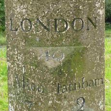
Alice Holt Forest, Royal and commercial forest in Waverley, United Kingdom

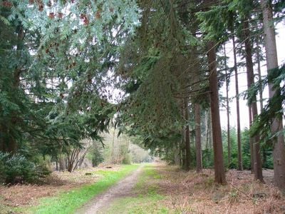
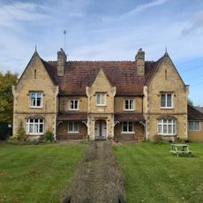
Alice Holt Forest is a woodland composed of Corsican pine plantations and oak woodlands situated near the Hampshire and Surrey border. The 850-hectare site combines different forest types and managed areas that support both recreational and commercial activities.

The forest supplied timber for Royal Navy vessels in the 18th century before becoming a research station under Forestry England management in 1924. This transformation shifted the site from naval procurement to scientific forest management and study.

The forest serves as a gathering place for running clubs and fitness enthusiasts who meet regularly on its paths and clearings. This active use reflects how the woodland has become woven into the daily routines of nearby communities.

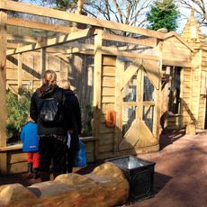
The site offers designated cycling paths, walking trails, and parking facilities for visitors. Mobility access is available on selected routes, and a cafe plus other basic facilities are located on the grounds.

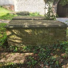
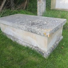
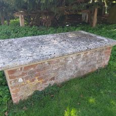
The forest contains Roman pottery production sites that supplied ceramics to ancient settlements in London and Staines during the Roman occupation. These archaeological remains show that the land was used for craft activities in antiquity.

The community of curious travelers

AroundUs brings together thousands of curated places, local tips, and hidden gems, enriched daily by 60,000 contributors worldwide.

Start exploring
Location
GPS coordinates
51.16800,-0.84300
Latest update
December 10, 2025 15:59
Around this place
Birdworld
United Kingdom

Birdworld

1.7 km
Farnham Pottery
United Kingdom

Farnham Pottery

3.4 km
Alice Holt Research Station
United Kingdom

Alice Holt Research Station

1.3 km
Northbrook
United Kingdom

Northbrook

3.2 km
Church of St Mary
United Kingdom

Church of St Mary

4 km
Binsted War Memorial
United Kingdom

Binsted War Memorial

3.9 km
The Royal Oak Public House
United Kingdom

The Royal Oak Public House

3.5 km
Table Tomb 6 Metres South Of St Mary's Church (Nave)
United Kingdom

Table Tomb 6 Metres South Of St Mary's Church (Nave)

4 km
Table Tomb 10 Metres South Of St Mary's Church (Nave)
United Kingdom

Table Tomb 10 Metres South Of St Mary's Church (Nave)

4 km
Jenkyn Place
United Kingdom

Jenkyn Place

4 km
Table Tomb 15 Metres South Of St Mary's Church (Chancel)
United Kingdom

Table Tomb 15 Metres South Of St Mary's Church (Chancel)

4 km
Milestone
United Kingdom

Milestone

3.4 km
Table Tomb 15 Metres South Of St Mary's Church (Nave)
United Kingdom

Table Tomb 15 Metres South Of St Mary's Church (Nave)

4 km
Boundary Wall East Of Jenkyn Place
United Kingdom

Boundary Wall East Of Jenkyn Place

3.9 km
Table Tomb 9 Metres South Of St Mary's Church (Chancel)
United Kingdom

Table Tomb 9 Metres South Of St Mary's Church (Chancel)

4 km
Table Tomb 7 Metres South Of St Mary's Church (Nave)
United Kingdom

Table Tomb 7 Metres South Of St Mary's Church (Nave)

4 km
Table Tomb 21 Metres South Of St Mary's Church (Chancel)
United Kingdom

Table Tomb 21 Metres South Of St Mary's Church (Chancel)

4 km
Table Tomb 19 Metres South Of St Mary's Church (Chancel)
United Kingdom

Table Tomb 19 Metres South Of St Mary's Church (Chancel)

4 km
Milestone 120 Metres East Of Junction With Isington Lane
United Kingdom

Milestone 120 Metres East Of Junction With Isington Lane

4.2 km
Table Tomb 14 Metres South Of St Mary's Church (Chancel)
United Kingdom

Table Tomb 14 Metres South Of St Mary's Church (Chancel)

4 km
Table Tomb 15 Metres South Of St Mary's Church (Chancel)
United Kingdom

Table Tomb 15 Metres South Of St Mary's Church (Chancel)

4 km
Knights Almshouses
United Kingdom

Knights Almshouses

3.7 km
Table Tomb 12 Metres South Of St Mary's Church (Nave)
United Kingdom

Table Tomb 12 Metres South Of St Mary's Church (Nave)

4 km
Table Tomb 17 Metres South Of St Mary's Church (Chancel)
United Kingdom

Table Tomb 17 Metres South Of St Mary's Church (Chancel)

4 km
Table Tomb 12 Metres South Of St Mary's Church (Chancel)
United Kingdom

Table Tomb 12 Metres South Of St Mary's Church (Chancel)

4 km
Milestone On Island Before Junction Of Alton Road With Chamber Lane
United Kingdom

Milestone On Island Before Junction Of Alton Road With Chamber Lane

3.5 km
Milestone
United Kingdom

Milestone

2.9 km
Table Tomb 5 Metres South Of St Mary's Church (Chancel)
United Kingdom

Table Tomb 5 Metres South Of St Mary's Church (Chancel)

4 km
Show the full map
Reviews
Share your experience

No review yet

Discussions
Start a discussion...

No discussion yet

« Alice Holt Forest - Royal and commercial forest in Waverley, United Kingdom » is provided by Around Us (aroundus.com). Images and texts are derived from Wikimedia project under a Creative Commons license. You are allowed to copy, distribute, and modify copies of this page, under the conditions set by the license, as long as this note is clearly visible.

Discover hidden gems everywhere you go!

From secret cafés to breathtaking viewpoints, skip the crowded tourist spots and find places that match your style. Our app makes it easy with voice search, smart filtering, route optimization, and insider tips from travelers worldwide. Download now for the complete mobile experience.

Around Us App Screenshot

A unique approach to discovering new places

Le Figaro

All the places worth exploring

France Info

A tailor-made excursion in just a few clicks

20 Minutes

Around Us
Travel Guide & Maps
Download

Send to your phone

QR Code
1

Open the camera app on your mobile.

2

Point at the QR code with your camera. A notification will appear.

3

Tap the notification to open the link.