Chest opened
+${chestReward.xp} XP
Explorer
NOUVEAU ×${chestReward.collectible.quantity}
tapez pour fermer
Chest locked

Open chests in the app

Around Us is built for your phone — chests unlock when you walk, explore and capture nearby places.

Enable Location

We need your location to show you interesting places around you

Discover nearby places

Find interesting locations and hidden gems around you

Precise directions

Get accurate directions and distances to places

Your location is never shared with other users. It's only used when you tap the location button.

Log in to your account

Start exploring — it's free

Trusted by 72,874 travelers worldwide

Continue with Google
Continue with Apple
or

We will send you a code to connect

By continuing, you accept our Terms and Conditions and our Privacy Policy

Check your inbox

We've sent a pincode in your inbox. Please enter the code below.

Discussion Reviews Photo
2.2k Popularity

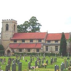
Askham Bog, Protected peat bog in York, England

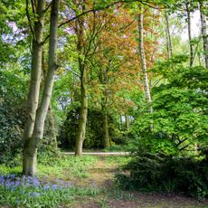
Askham Bog is a protected peat bog near York made up of separate wetland zones including marshy meadows, wooded areas, and open bog sections. Water channels wind through the site and connect these different habitats together.

The bog formed thousands of years ago when glacial meltwater became trapped between ridges of glacial deposits. Soil layers here contain traces of hemp farming from the medieval period.

The site maintains research facilities where scientists study rare invertebrates, water beetles, and plant species found within the protected wetland environment.

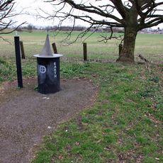
The site is accessible via marked walking paths that take you through the different wetland zones. Signs along the trails help explain what you are seeing and why these habitats matter.

The location contains specific soil layers that preserve evidence of hemp cultivation from the Tudor period beneath distinct horizons of fen and Sphagnum peat.

The community of curious travelers

AroundUs brings together thousands of curated places, local tips, and hidden gems, enriched daily by 60,000 contributors worldwide.

Start exploring
Location
GPS coordinates
53.92500,-1.13250
Latest update
December 13, 2025 17:09
Around this place
Bishopthorpe Palace
United Kingdom

Bishopthorpe Palace

2.7 km
Goddards
United Kingdom

Goddards

2.5 km
Middlethorpe Hall
United Kingdom

Middlethorpe Hall

2.9 km
Ruined Church of St Andrew
United Kingdom

Ruined Church of St Andrew

2.7 km
Bishopthorpe Garth
United Kingdom

Bishopthorpe Garth

2.1 km
Holy Trinity Church, Acaster Malbis
United Kingdom

Holy Trinity Church, Acaster Malbis

3.2 km
Church of St Nicholas
United Kingdom

Church of St Nicholas

1.7 km
Askham Bryan Wildlife and Conservation Park
United Kingdom

Askham Bryan Wildlife and Conservation Park

1.7 km
Church of St Giles
United Kingdom

Church of St Giles

1.2 km
Church of St Andrew, Bishopthorpe
United Kingdom

Church of St Andrew, Bishopthorpe

2.4 km
The Ship Inn
United Kingdom

The Ship Inn

3.2 km
Church of St Edward the Confessor
United Kingdom

Church of St Edward the Confessor

2.4 km
Cross Keys Hotel
United Kingdom

Cross Keys Hotel

2.4 km
Dringhouses Library
United Kingdom

Dringhouses Library

2.3 km
York planet trail
United Kingdom

York planet trail

1.3 km
Pinfold Approximately 30 Metres South of Fox Hotel (Hotel Not Included)
United Kingdom

Pinfold Approximately 30 Metres South of Fox Hotel (Hotel Not Included)

2.2 km
War Memorial at the Church of St Edward the Confessor
United Kingdom

War Memorial at the Church of St Edward the Confessor

2.4 km
Boundary Stone At Ngr Se 5906 5037
United Kingdom

Boundary Stone At Ngr Se 5906 5037

3.1 km
Hob Moor Milestone At Ngr Se 589 502
United Kingdom

Hob Moor Milestone At Ngr Se 589 502

2.9 km
Bishopthorpe War Memorial
United Kingdom

Bishopthorpe War Memorial

2.5 km
103, Front Street
United Kingdom

103, Front Street

3.2 km
Askham Bryan War Memorial
United Kingdom

Askham Bryan War Memorial

1.8 km
Number 25 Including Carriage Entrance, 25, Tadcaster Road
United Kingdom

Number 25 Including Carriage Entrance, 25, Tadcaster Road

2.5 km
Naburn Railway Bridge
United Kingdom

Naburn Railway Bridge

3.1 km
The Fisher of Dreams
United Kingdom

The Fisher of Dreams

3.1 km
Milestone Approximately 10 Metres West Of Number 211 (Number 211 Not Included)
United Kingdom

Milestone Approximately 10 Metres West Of Number 211 (Number 211 Not Included)

1.4 km
Milestone Approximately 80 Metres West Of Askham Fields Lane
United Kingdom

Milestone Approximately 80 Metres West Of Askham Fields Lane

1.9 km
Gatehouse And Walls Adjoining To Bishopthorpe Palace
United Kingdom

Gatehouse And Walls Adjoining To Bishopthorpe Palace

2.6 km
Show the full map
Reviews
Share your experience

No review yet

Discussions
Start a discussion...

No discussion yet

« Askham Bog - Protected peat bog in York, England » is provided by Around Us (aroundus.com). Images and texts are derived from Wikimedia project under a Creative Commons license. You are allowed to copy, distribute, and modify copies of this page, under the conditions set by the license, as long as this note is clearly visible.

Discover hidden gems everywhere you go!

From secret cafés to breathtaking viewpoints, skip the crowded tourist spots and find places that match your style. Our app makes it easy with voice search, smart filtering, route optimization, and insider tips from travelers worldwide. Download now for the complete mobile experience.

Around Us App Screenshot

A unique approach to discovering new places

Le Figaro

All the places worth exploring

France Info

A tailor-made excursion in just a few clicks

20 Minutes

Around Us
Travel Guide & Maps
Download

Send to your phone

QR Code
1

Open the camera app on your mobile.

2

Point at the QR code with your camera. A notification will appear.

3

Tap the notification to open the link.