Baulk Head to Mullion, Protected coastal area in Cornwall, England
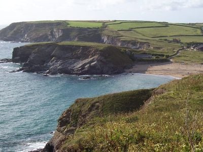
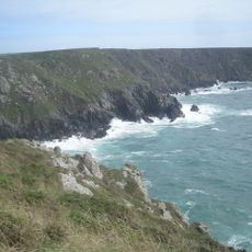
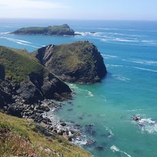
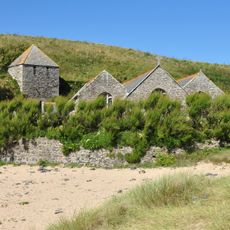
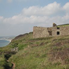
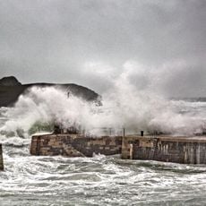
Baulk Head to Mullion is a coastal protected area on the Lizard Peninsula with steep cliffs, rocky coves, and varied habitats along the shoreline. The site stretches across several kilometres connecting two notable coastal points with diverse geology and landscape features.
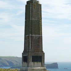
The site was designated as protected to preserve its distinctive geological formations and ecological systems. This official recognition ensures that the natural processes at this important coastal section are monitored and safeguarded.
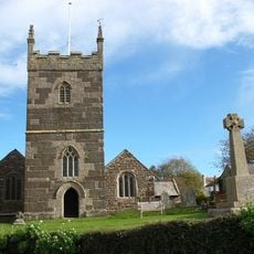
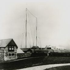
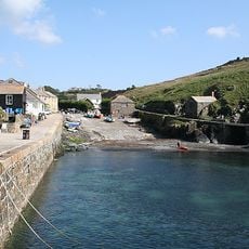
The site reflects the deep connection between the Cornish coast and fishing communities who have depended on these waters for generations. Walking here, you sense how the landscape shapes the identity and daily rhythm of nearby villages.
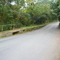
The South West Coast Path runs through the site offering straightforward walking routes with sea views. Most trails are exposed and windswept, so visitors should be prepared for changeable coastal weather at any time of year.
The area shelters rare plant species that grow on rocky coastal slopes and occur in few other places in England. These special plants thrive only in the challenging conditions created by this wild and windswept shoreline.
GPS coordinates: 50.03480,-5.26410
Latest update: December 14, 2025 17:04
Church of Saint Winwaloe, Gunwalloe
585 m
Bonython Manor
3.4 km
St Corentine’s Church, Cury
1.9 km
Ogo-dour Cove
4.2 km
Polurrian Beach
1.4 km
Church of St Melaines
1.8 km
Marconi Memorial
657 m
The Old Inn
1.7 km
Tower At South West Of Church Of Saint Winwaloe
578 m
Bochym Manor House
2.8 km
Former Pilchard Net Fishing Cellars And Winches At Approx 50 And 70M To Southeast At Sw 654 225
2.7 km
The Marconi Centre
499 m
Harbour Walls
2.2 km
Bar Lodge And Forecourt Steps And Walls
4.8 km
RAF Predannack WWII Memorial
4.8 km
Bonython Manor House
3.5 km
Footbridge At Sw 682 225
3.1 km
Three bowl barrows 815m north west of Leech Pool forming part of a round barrow cemetery on Goonhilly Downs
5.4 km
Winch House
2.2 km
Clocktower, Coach Houses And Stabling At Approx 25M South-West Of Manor House
2.8 km
Wayside cross in Gunwalloe churchyard, 0.75m east of the church
576 m
Wayside cross 240m north west of Higher Predannack Farm
3.1 km
Milestone, Tregellas, N of Trewellah Cottage
3.2 km
Milestone, Culdrose, S of HMS Seahawk bridge
5.1 km
Milestone, Polwin, Mainlay, nr Garras
4.1 km
Milestone, Gwealeath Cottages
3.8 km
Milestone, Goonhilly Downs, on bend
3.4 km
Milestone, Penhale, just S of bend and T jct
4 kmVisited this place? Tap the stars to rate it and share your experience / photos with the community! Try now! You can cancel it anytime.
Discover hidden gems everywhere you go!
From secret cafés to breathtaking viewpoints, skip the crowded tourist spots and find places that match your style. Our app makes it easy with voice search, smart filtering, route optimization, and insider tips from travelers worldwide. Download now for the complete mobile experience.
A unique approach to discovering new places❞
— Le Figaro
All the places worth exploring❞
— France Info
A tailor-made excursion in just a few clicks❞
— 20 Minutes