Bathampton Down, Iron Age hillfort in Bathampton, England
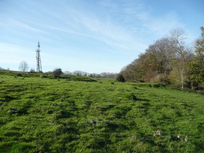
Bathampton Down is an Iron Age hillfort situated on a limestone plateau that rises roughly 200 meters above the river valley. The site is crossed today by walking paths and bordered by modern development including a university campus.
The site shows evidence of human settlement from the Mesolithic period through the Iron Age and beyond. Archaeological finds indicate the area remained in use during the Roman occupation of Britain.
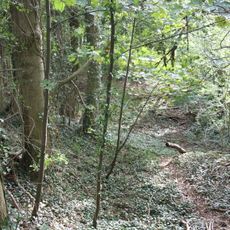
The name Bathampton refers to a settlement by the river in Anglo-Saxon times. Today the site is a quiet place where walkers can see open hillside and occasional archaeological markers.
The site is accessible via several walking routes and offers good orientation with views across the surrounding landscape. Sturdy footwear is recommended since paths can become muddy or slippery depending on weather conditions.
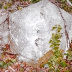
Two Romano-British stone coffins were discovered at this site, suggesting the hilltop served as a burial ground during Roman times. This reveals how the location held significance across different historical periods.
GPS coordinates: 51.38470,-2.32620
Latest update: December 11, 2025 11:03
American Museum and Gardens
1.4 km
Church of St Nicholas, Bathampton
1.5 km
Sham Castle
822 m
American Museum & Gardens
1.5 km
North Road Quarry, Bath
868 m
Bath Skyline
1.5 km
Kennet And Avon Canal Tunnel (under Cleveland House And Sydney Road)
1.5 km
Bath Spa Hotel
1.3 km
The George Inn Public House
1.4 km
Anglican Cemetery Chapel, St Mary's Churchyard
1.5 km
Bathwick Hill House
1.1 km
Candy's Bridge
1.2 km
Cleveland House
1.5 km
Grosvenor Bridge
1.5 km
Nethersole House
1.1 km
Loggia
1.5 km
Temple In Grounds Of Bath Spa Hotel Approx 30M To The West
1.3 km
Fiesole (youth Hostel)
1.1 km
White Lodge
1.3 km
Sydney House, Sydney Road
1.5 km
Kennet House
1.5 km
1-15, Dunsford Place
1.5 km
Lodge, Walls And Piers To Bathwick Hill House
1.1 km
Bridge Over The Railway, To North Of Canal Bridge
1.2 km
Oakwood and Bathwick Tower
1 km
The Round House
956 m
1-6, Canal Terrace
1.4 km
Milestone, Claverton Down Road, just short of jct with Norwood Avenue
1.3 kmVisited this place? Tap the stars to rate it and share your experience / photos with the community! Try now! You can cancel it anytime.
Discover hidden gems everywhere you go!
From secret cafés to breathtaking viewpoints, skip the crowded tourist spots and find places that match your style. Our app makes it easy with voice search, smart filtering, route optimization, and insider tips from travelers worldwide. Download now for the complete mobile experience.
A unique approach to discovering new places❞
— Le Figaro
All the places worth exploring❞
— France Info
A tailor-made excursion in just a few clicks❞
— 20 Minutes