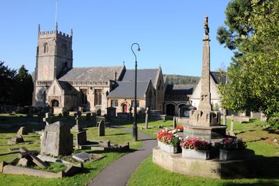
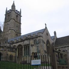
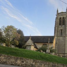
Church of St Nicholas, Bathampton, Grade II* listed Anglican church in Bathampton, England
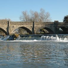
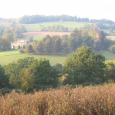
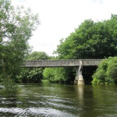
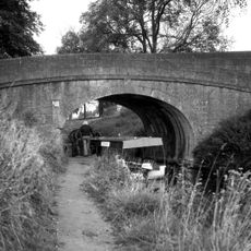
Church of St Nicholas stands between the River Avon and the Kennet and Avon Canal, occupying a riverside position that shapes the village landscape. The 15th-century tower with its six bells and the interior chapels and spaces define the building's structure and character.
The original church was established around 1200 and remained under Bath Abbey's administration until the Reformation fundamentally changed its governance. Major rebuilding work in the 15th century transformed its appearance and structure.
The Australia Chapel displays flooring made from Australian marble, wooden kneelers from Tasmania, and stained glass showing state emblems from across Australia. These details reflect how this parish church maintained connections to the British colonial world.
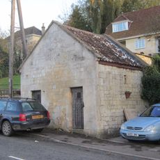
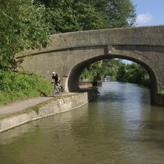
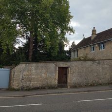
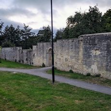
The location between the river and canal makes it a natural stop during a walk along either waterway and its surroundings. Access and viewing hours are limited, so it is worth checking ahead and allowing time to explore the grounds properly.
The churchyard holds the grave of Admiral Arthur Phillip, who led the first British colonial settlement in Australia starting in 1788. His burial here in 1814 reflects how important this parish was to figures connected to British expansion overseas.
Location: Bathampton
Inception: 13 century
Website: https://stnicholasbathampton.org.uk
GPS coordinates: 51.39750,-2.32167
Latest update: December 14, 2025 11:00
Little Solsbury Hill
1.7 km
Bathampton Toll Bridge
522 m
Bathampton Down
1.5 km
Browne's Folly
1.6 km
Shockerwick House
1.3 km
Church of St John The Baptist, Batheaston
1.4 km
Hampton Rocks Cutting
189 m
Lock Up, Between Nos 22 And 24 Bathford Hill
1.2 km
Former Bailbrook Mission Church
1.2 km
Parish Church of St Swithun's
1.1 km
The George Inn Public House
93 m
Grosvenor Bridge
1.5 km
Candy's Bridge
849 m
Boundary Marker On (Ngr St 7844 6721)
980 m
245 And 247, London Road East
920 m
292, High Street
934 m
Section Of Garden Wall 100 Yards To South East Of Batheaston House, Including Niche And Garden Seat
898 m
Bridge Over The Railway, To North Of Canal Bridge
849 m
Milestone At Ngr St 7851 6712
987 m
Parish Boundary Post In Wall By The Lam Bridge
1.4 km
Fiveways House
956 m
Toll House
567 m
Boundary Walls And Garden Shed At Warleigh Point
1.2 km
Garage, 15 Yards To East Of No 290, High Street
939 m
Milestone At Ngr St 7854 6759
1.3 km
Milestone At Ngr St 7898 6560
1.6 km
1-6, Canal Terrace
100 m
Milepost, London Road West, by Bathway House, No. 144
718 mVisited this place? Tap the stars to rate it and share your experience / photos with the community! Try now! You can cancel it anytime.
Discover hidden gems everywhere you go!
From secret cafés to breathtaking viewpoints, skip the crowded tourist spots and find places that match your style. Our app makes it easy with voice search, smart filtering, route optimization, and insider tips from travelers worldwide. Download now for the complete mobile experience.
A unique approach to discovering new places❞
— Le Figaro
All the places worth exploring❞
— France Info
A tailor-made excursion in just a few clicks❞
— 20 Minutes