Chest opened
+${chestReward.xp} XP
Explorer
NOUVEAU ×${chestReward.collectible.quantity}
tapez pour fermer
Chest locked

Open chests in the app

Around Us is built for your phone — chests unlock when you walk, explore and capture nearby places.

Enable Location

We need your location to show you interesting places around you

Discover nearby places

Find interesting locations and hidden gems around you

Precise directions

Get accurate directions and distances to places

Your location is never shared with other users. It's only used when you tap the location button.

Log in to your account

Start exploring — it's free

Trusted by 72,876 travelers worldwide

Continue with Google
Continue with Apple
or

We will send you a code to connect

By continuing, you accept our Terms and Conditions and our Privacy Policy

Check your inbox

We've sent a pincode in your inbox. Please enter the code below.

Backwell Hillfort
Discussion Reviews Photo
1.2k Popularity

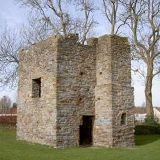
Backwell Hillfort, Iron Age hillfort in North Somerset, England

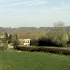
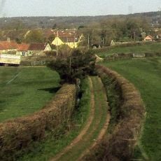
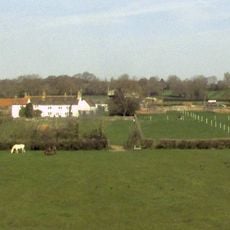
Backwell Hillfort is an Iron Age fortification on elevated terrain in North Somerset with surviving defensive banks and ditches on three sides. The site displays characteristic features of prehistoric defensive engineering built to command the surrounding landscape.

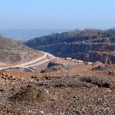
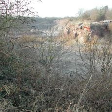
The fortification developed as an Iron Age settlement defense and was first documented in 1933 when its earthworks were recognized. Limestone quarrying operations from the 1950s onwards significantly damaged the site, destroying parts of its original structure.

The structure represents early British defensive engineering and settlement patterns, contributing to understanding Iron Age communities in Somerset.

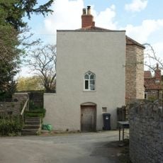
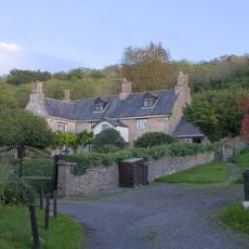
The site is freely accessible but situated on private land, so checking access permissions beforehand is wise. The surviving earthworks are partially overgrown and can be slippery in wet conditions.

Local limestone quarrying operations in the 1950s and 1970s modified the original layout, leaving only partial sections of the prehistoric fortification intact.

The community of curious travelers

AroundUs brings together thousands of curated places, local tips, and hidden gems, enriched daily by 60,000 contributors worldwide.

Start exploring
Location
GPS coordinates
51.40920,-2.72890
Latest update
December 14, 2025 18:20
Around this place
Barrow Court
United Kingdom

Barrow Court

2.1 km
Nailsea Glassworks
United Kingdom

Nailsea Glassworks

3.3 km
Strawberries and Cream Tree
United Kingdom

Strawberries and Cream Tree

1.3 km
Backwell House, Somerset
United Kingdom

Backwell House, Somerset

1.3 km
Church of St Mary and St Edward
United Kingdom

Church of St Mary and St Edward

2.1 km
St Nicholas' Church, Brockley
United Kingdom

St Nicholas' Church, Brockley

3 km
Church of St Andrew, Backwell
United Kingdom

Church of St Andrew, Backwell

293 m
Elms Colliery
United Kingdom

Elms Colliery

2.8 km
Stancombe Quarry
United Kingdom

Stancombe Quarry

1 km
Church of St Bridget, Chelvey
United Kingdom

Church of St Bridget, Chelvey

2.7 km
Lulsgate Quarry
United Kingdom

Lulsgate Quarry

3.1 km
Church of St Michael and All Angels
United Kingdom

Church of St Michael and All Angels

1.8 km
Milestone At National Grid Reference St 4778 6750
United Kingdom

Milestone At National Grid Reference St 4778 6750

1.7 km
The Grange
United Kingdom

The Grange

239 m
Tithe barn at Barrow Court
United Kingdom

Tithe barn at Barrow Court

2.2 km
Combe Cottage
United Kingdom

Combe Cottage

317 m
Court Farmhouse
United Kingdom

Court Farmhouse

299 m
Gatepiers, Gates And Series Of 12 Pillars Forming West Boundary Wall Of Garden At Barrow Court
United Kingdom

Gatepiers, Gates And Series Of 12 Pillars Forming West Boundary Wall Of Garden At Barrow Court

2 km
Churchyard cross in St Andrew's churchyard
United Kingdom

Churchyard cross in St Andrew's churchyard

282 m
Barn, 50 Yards North West Of Court Farmhouse, And Cartshed With Loft
United Kingdom

Barn, 50 Yards North West Of Court Farmhouse, And Cartshed With Loft

336 m
Walled Garden Including Glass Houses And Peach House
United Kingdom

Walled Garden Including Glass Houses And Peach House

3.3 km
Caroline Place
United Kingdom

Caroline Place

1.2 km
Cider Farmhouse
United Kingdom

Cider Farmhouse

1.7 km
Old Farmhouse
United Kingdom

Old Farmhouse

1.8 km
Youngwood House Farmhouse
United Kingdom

Youngwood House Farmhouse

2.5 km
Sores Court
United Kingdom

Sores Court

848 m
East And West Corner Gazebos And Linking North Boundary Wall Of Formal Garden At Barrow Court
United Kingdom

East And West Corner Gazebos And Linking North Boundary Wall Of Formal Garden At Barrow Court

2.2 km
The Lodge, Brockley Hall And Adjoining Gates And Gate Piers
United Kingdom

The Lodge, Brockley Hall And Adjoining Gates And Gate Piers

2.5 km
Show the full map
Reviews
Share your experience

No review yet

Discussions
Start a discussion...

No discussion yet

« Backwell Hillfort - Iron Age hillfort in North Somerset, England » is provided by Around Us (aroundus.com). Images and texts are derived from Wikimedia project under a Creative Commons license. You are allowed to copy, distribute, and modify copies of this page, under the conditions set by the license, as long as this note is clearly visible.

Discover hidden gems everywhere you go!

From secret cafés to breathtaking viewpoints, skip the crowded tourist spots and find places that match your style. Our app makes it easy with voice search, smart filtering, route optimization, and insider tips from travelers worldwide. Download now for the complete mobile experience.

Around Us App Screenshot

A unique approach to discovering new places

Le Figaro

All the places worth exploring

France Info

A tailor-made excursion in just a few clicks

20 Minutes

Around Us
Travel Guide & Maps
Download

Send to your phone

QR Code
1

Open the camera app on your mobile.

2

Point at the QR code with your camera. A notification will appear.

3

Tap the notification to open the link.