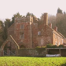
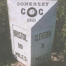
Nailsea Glassworks, Industrial heritage site in Nailsea, England.
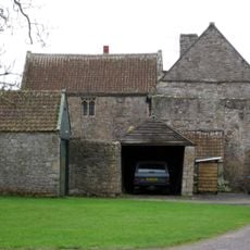
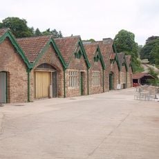
Nailsea Glassworks is an industrial heritage site with preserved structures and foundations dating from the late 18th century. The complex included various production areas designed for glass manufacturing with specialized equipment.
The factory began operations in 1788 under John Robert Lucas and became the fourth largest glassworks in the United Kingdom by 1835. This growth shows the expansion of British glass manufacturing during the industrial revolution.
The factory produced bottles, window glass, and decorative pieces with white combed lines that collectors still seek today. These items reflect the craftsmanship and production methods of that working place.
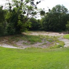
The archaeological remains lie beneath a supermarket car park and are conserved under protective sand layers. Visitors should explore the site's location and can learn more about excavation plans from local authorities.
The facility used local raw materials including coal from Elms colliery, sand from nearby quarries, and lime from Walton in Gordano. This access to resources was key to the operation's economic success.
Location: Nailsea
GPS coordinates: 51.43450,-2.75283
Latest update: December 12, 2025 14:23
Noah's Ark Zoo Farm
2.2 km
Cadbury Camp
2.8 km
Clapton Court
2.8 km
All Saints Church, Wraxall
1.7 km
Holy Trinity Church, Nailsea
1.5 km
Strawberries and Cream Tree
2.3 km
Church of SS Quiricus & Julietta, Tickenham
2.1 km
Elms Colliery
558 m
Church of St Bridget, Chelvey
2.7 km
Church of St Michael, Clapton in Gordano
2.8 km
Birdcombe Court And Birdcombe Court Farmhouse
1 km
Walled Garden Including Glass Houses And Peach House
2.8 km
Clevedon Lodge
2.8 km
Old Farmhouse
1.5 km
South Retaining Walls, Piers And Central Steps To The Rose Garden
2.8 km
Caroline Place
2.8 km
Cider Farmhouse
1.7 km
Remains Of Village Cross At National Grid Reference St 4910 7190 At Junction With Clevedon Road Remains Of Village Cross At National Grid Reference St 4910 7190 At Junction With Wraxall Hall
1.7 km
K6 Telephone Kiosk (Opposite Holy Trinity Church)
1.5 km
Milepost
2.2 km
Milepost
437 m
Youngwood House Farmhouse
2 km
Wraxall Church Of England Primary School
1.6 km
The Court
2.1 km
Home Farm Buildings
2.5 km
Tyntesfield boating lake
2.8 km
Milestone, Backwell village, short distance from crossroads
2.4 km
Milepost, Clevedon Road, between Jacklands Farm and road to Fire Station
984 mVisited this place? Tap the stars to rate it and share your experience / photos with the community! Try now! You can cancel it anytime.
Discover hidden gems everywhere you go!
From secret cafés to breathtaking viewpoints, skip the crowded tourist spots and find places that match your style. Our app makes it easy with voice search, smart filtering, route optimization, and insider tips from travelers worldwide. Download now for the complete mobile experience.
A unique approach to discovering new places❞
— Le Figaro
All the places worth exploring❞
— France Info
A tailor-made excursion in just a few clicks❞
— 20 Minutes