All Saints Church, Wraxall

Log in to your account

AroundUs is a community-driven map of interesting places, built by curious explorers like you. It grows with every review, story, and photo you share.
Connect to save your favorite spots, contribute locations, and create personalized routes.
By continuing, you accept our Terms and Conditions and our Privacy Policy

All Saints Church, Wraxall

Add to collection
Map
Suggest a change
Share

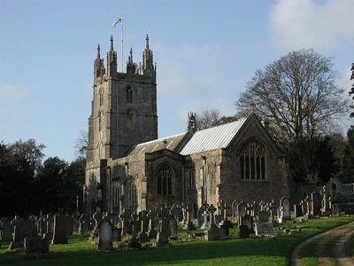
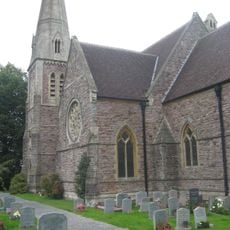
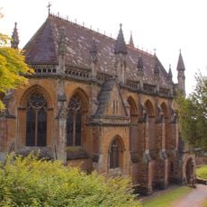
All Saints Church, Wraxall, Grade I listed parish church in Wraxall, England

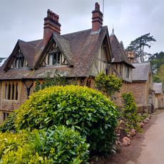
All Saints Church is a stone parish church in Wraxall with a tall west tower containing eight bells and a large surrounding cemetery. The interior features painted stone figures in the chancel and various monuments marking centuries of local burials.

The building originates from 1301, with the western tower, clock face, and three bells added during later centuries between 1705 and 1730. These additions show how the structure was enlarged and improved to serve the growing parish community.

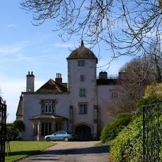
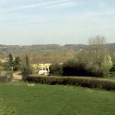
The cemetery holds monuments to families who shaped this area, particularly the Gibbs family who controlled much of the surrounding land. Walking through the graveyard shows how local life was intertwined with the estates and manor houses nearby.

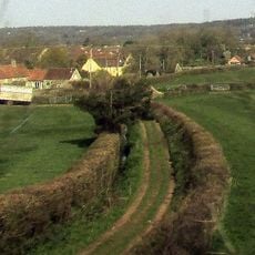
The church building is accessible during regular opening hours, and visitors can explore the cemetery at most times, with helpful information available from the parish office. Footpaths run through the grounds making it easy to walk among the monuments and gravestones.

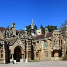
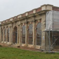
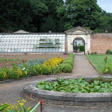
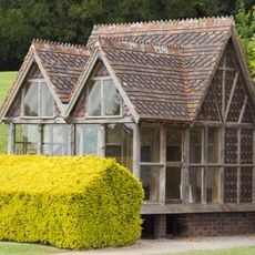
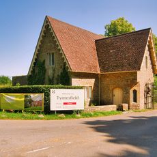
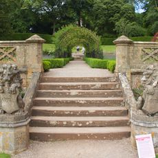
The cemetery contains monuments to the Gibbs family, who owned the nearby Tyntesfield Estate now managed by the National Trust. This connection reveals how the church was closely tied to the grand estates that shaped the surrounding landscape.

Location: Wraxall and Failand

Inception: 14 century

GPS coordinates: 51.44440,-2.73491

Latest update: December 14, 2025 11:42

Photos
Around this place
Tyntesfield
United Kingdom

Tyntesfield

1.7 km
Tyntesfield
United Kingdom

Tyntesfield

1.7 km
Noah's Ark Zoo Farm
United Kingdom

Noah's Ark Zoo Farm

882 m
Charlton House, Wraxall
United Kingdom

Charlton House, Wraxall

1.8 km
Nailsea Glassworks
United Kingdom

Nailsea Glassworks

1.7 km
Clapton Court
United Kingdom

Clapton Court

2.8 km
Elms Colliery
United Kingdom

Elms Colliery

1.6 km
Church of St Michael, Clapton in Gordano
United Kingdom

Church of St Michael, Clapton in Gordano

2.7 km
Church of St Bartholomew
United Kingdom

Church of St Bartholomew

2.9 km
Birdcombe Court And Birdcombe Court Farmhouse
United Kingdom

Birdcombe Court And Birdcombe Court Farmhouse

1.1 km
Orangery at Tyntesfield Park
United Kingdom

Orangery at Tyntesfield Park

1.8 km
The Black Horse
United Kingdom

The Black Horse

2.6 km
Walled Garden Including Glass Houses And Peach House
United Kingdom

Walled Garden Including Glass Houses And Peach House

1.8 km
Milepost
United Kingdom

Milepost

1.2 km
Aviary Immediately North West Of Tyntesfield House
United Kingdom

Aviary Immediately North West Of Tyntesfield House

1.6 km
Remains Of Village Cross At National Grid Reference St 4910 7190 At Junction With Clevedon Road  Remains Of Village Cross At National Grid Reference St 4910 7190 At Junction With Wraxall Hall
United Kingdom

Remains Of Village Cross At National Grid Reference St 4910 7190 At Junction With Clevedon Road Remains Of Village Cross At National Grid Reference St 4910 7190 At Junction With Wraxall Hall

103 m
North Retaining Walls, Steps And 2 Summer Houses, To The Rose Garden
United Kingdom

North Retaining Walls, Steps And 2 Summer Houses, To The Rose Garden

1.5 km
Chaplains House
United Kingdom

Chaplains House

1.5 km
Old Farmhouse
United Kingdom

Old Farmhouse

2.3 km
Cider Farmhouse
United Kingdom

Cider Farmhouse

2.3 km
Clevedon Lodge
United Kingdom

Clevedon Lodge

1.2 km
South Retaining Walls, Piers And Central Steps To The Rose Garden
United Kingdom

South Retaining Walls, Piers And Central Steps To The Rose Garden

1.5 km
Home Farm Buildings
United Kingdom

Home Farm Buildings

1.2 km
Wraxall Church Of England Primary School
United Kingdom

Wraxall Church Of England Primary School

107 m
Tyntesfield chapel
United Kingdom

Tyntesfield chapel

1.7 km
Tyntesfield boating lake
United Kingdom

Tyntesfield boating lake

1.5 km
Milepost, Clevedon Road, between Jacklands Farm and road to Fire Station
United Kingdom

Milepost, Clevedon Road, between Jacklands Farm and road to Fire Station

2.1 km
Milestone, nr Backwell Green; opp. Six Mile Cottage that stands by a wide entrance of a quarry road
United Kingdom

Milestone, nr Backwell Green; opp. Six Mile Cottage that stands by a wide entrance of a quarry road

2.9 km
Show the full map
Reviews

Visited this place? Tap the stars to rate it and share your experience / photos with the community! Try now! You can cancel it anytime.

« All Saints Church, Wraxall - Grade I listed parish church in Wraxall, England » is provided by Around Us (aroundus.com). Images and texts are derived from Wikimedia project under a Creative Commons license. You are allowed to copy, distribute, and modify copies of this page, under the conditions set by the license, as long as this note is clearly visible.

Discover hidden gems everywhere you go!

From secret cafés to breathtaking viewpoints, skip the crowded tourist spots and find places that match your style. Our app makes it easy with voice search, smart filtering, route optimization, and insider tips from travelers worldwide. Download now for the complete mobile experience.

Around Us App Screenshot

A unique approach to discovering new places

Le Figaro

All the places worth exploring

France Info

A tailor-made excursion in just a few clicks

20 Minutes