Black Patch Park, Municipal park in Smethwick, England.
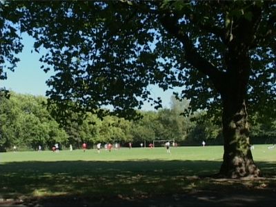
Black Patch Park is a municipal park in Smethwick covering about 20 acres of green space bordered by Foundry Lane, Woodburn Road, Perrott Street, and Kitchener Street. Two brooks, Boundary Brook and Hockley Brook, flow through the site and create natural divisions.
The land was originally heathland that later became farmland before opening as a municipal park in 1911. The opening was made possible through public donations and support from the local council.
The park held significance for Romany Gypsy communities during the 1800s, with families making their home and caring for the land over generations. This heritage remains woven into the place's story today.
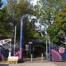
The park can be accessed from several street entrances and offers different areas to explore at your own pace. Be aware that the two brooks running through the site may carry more water after rainfall.
Research suggests that film pioneer Charlie Chaplin may have been born here, supported by a letter his daughter Victoria discovered. This connection remains debated among historians and researchers.
The community of curious travelers
AroundUs brings together thousands of curated places, local tips, and hidden gems, enriched daily by 60,000 contributors worldwide.