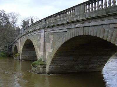
Bewdley Bridge, Stone arch bridge in Bewdley, England.
Bewdley Bridge is a stone arch bridge that crosses the River Severn using three arches to span the water. The structure carries both road traffic and pedestrians across the river, linking the two sides of the town via the B4190 route.
Engineer Thomas Telford designed this structure, which was finished in 1798 and replaced an earlier bridge that had occupied the same spot. That older structure dated from the 15th century, making it a significant earlier crossing point.
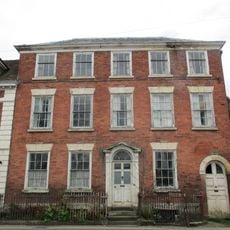
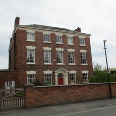
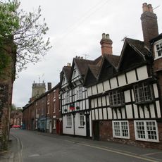
The bridge has become woven into the identity of this market town, and locals pass over it daily as part of their ordinary routines. Its presence shapes how people experience the town and move through the community.
The bridge provides straightforward access on foot or by car and is well-maintained for regular use. Visitors can walk across to enjoy different views of the structure and the surrounding river valley.
Excavations in the early 2000s uncovered remains of the medieval bridge buried beneath the current structure. These discoveries revealed layers of history at the site and showed how engineering solutions changed over centuries.
Location: Bewdley
GPS coordinates: 52.37650,-2.31390
Latest update: December 12, 2025 09:04
West Midland Safari Park
1.7 km
Knowles Mill
2.8 km
Ribbesford House
1.6 km
Bewdley Town Hall
131 m
Bewdley Museum
131 m
Church of St Leonard
1.4 km
Church of All Saints
618 m
Church of St Anne
193 m
Wribbenhall War Memorial, North West of Church of All Saints
596 m
Railway Viaduct And Adjoining Revetments Immediately North West Of Bewdley Railway Station
362 m
Number 62 (the Manor House) And Attached Railings
254 m
K4 Telephone Kiosk South Of Main Station Buildings
511 m
Bewdley War Memorial
1.4 km
Beales Corner
109 m
K6 Telephone Kiosk
94 m
13 And 14, Load Street
146 m
5, 7 And 9, Stourport Road
192 m
Churchyard Walls And Lychgate At Church Of All Saints
604 m
Numbers 15, 16, 17 And 18 And Attached Railings
157 m
Blair House
230 m
The Bewdley Institute
189 m
Number 63 And Attached Railings
247 m
Redthorne Road
213 m
9, High Street
215 m
Bailiff's House
224 m
Milestone, Withybed Wood ; 150m S of car park
3.2 km
Worcestershire County Council Milestone, Hawthorn Bush
1.7 km
Welch Gate turnpike trust Milestone, Hawthorn Bush
1.7 kmVisited this place? Tap the stars to rate it and share your experience / photos with the community! Try now! You can cancel it anytime.
Discover hidden gems everywhere you go!
From secret cafés to breathtaking viewpoints, skip the crowded tourist spots and find places that match your style. Our app makes it easy with voice search, smart filtering, route optimization, and insider tips from travelers worldwide. Download now for the complete mobile experience.
A unique approach to discovering new places❞
— Le Figaro
All the places worth exploring❞
— France Info
A tailor-made excursion in just a few clicks❞
— 20 Minutes