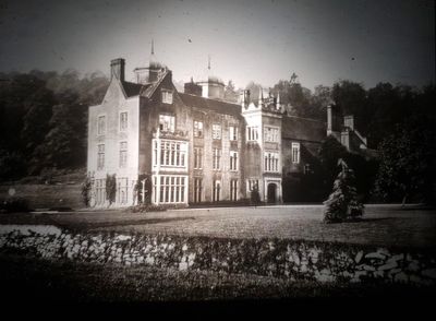
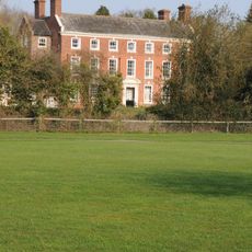
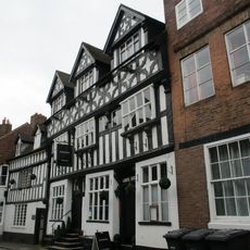
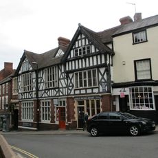
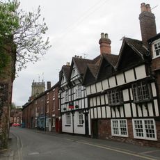
Ribbesford House, Grade II* listed manor house in Ribbesford, England.
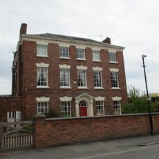
Ribbesford House is a Jacobean manor with two distinctive octagonal turrets rising across three stories. The interior contains multiple bedrooms and reception rooms arranged within its traditional architectural framework.
The estate's roots trace back to the 11th century when it was granted to the sister of Bishop Wulfstan. The property changed hands over time, eventually being awarded again following the Norman Conquest.
The house hosted Free French soldiers during World War II, who trained and prepared for military operations from within its rooms. This wartime chapter left its mark on the building's story and the local community.
The property sits near the River Severn and spreads across eight acres of gardens, woods, and grounds with various outbuildings. The grounds contain areas that require restoration, so visitors should wear appropriate footwear for exploring.
The building standing today represents only half of its original quadrangle layout, with the other wing demolished in 1787. This transformation occurred when Francis Ingram took ownership and decided to reshape the structure.
Location: Ribbesford
Architectural style: Jacobean architecture
GPS coordinates: 52.36220,-2.31506
Latest update: December 11, 2025 18:08
West Midland Safari Park
2.3 km
Bewdley Bridge
1.6 km
Bewdley Town Hall
1.5 km
Bewdley Museum
1.5 km
Church of St Leonard
178 m
Church of All Saints
1.9 km
Church of St Anne
1.5 km
Wribbenhall War Memorial, North West of Church of All Saints
1.9 km
Lickhill Manor
2.3 km
Number 62 (the Manor House) And Attached Railings
1.3 km
Bewdley War Memorial
192 m
K6 Telephone Kiosk
1.5 km
13 And 14, Load Street
1.5 km
K4 Telephone Kiosk South Of Main Station Buildings
1.6 km
Railway Viaduct And Adjoining Revetments Immediately North West Of Bewdley Railway Station
1.6 km
5, 7 And 9, Stourport Road
1.5 km
Beales Corner
1.6 km
Blair House
1.4 km
Churchyard Walls And Lychgate At Church Of All Saints
1.9 km
Numbers 15, 16, 17 And 18 And Attached Railings
1.5 km
Bailiff's House
1.4 km
The Bewdley Institute
1.5 km
Number 63 And Attached Railings
1.4 km
Redthorne Road
1.4 km
9, High Street
1.4 km
Milestone, 20yds W of St Johns Lane
2.9 km
Worcestershire County Council Milestone, Hawthorn Bush
1.7 km
Welch Gate turnpike trust Milestone, Hawthorn Bush
1.7 kmVisited this place? Tap the stars to rate it and share your experience / photos with the community! Try now! You can cancel it anytime.
Discover hidden gems everywhere you go!
From secret cafés to breathtaking viewpoints, skip the crowded tourist spots and find places that match your style. Our app makes it easy with voice search, smart filtering, route optimization, and insider tips from travelers worldwide. Download now for the complete mobile experience.
A unique approach to discovering new places❞
— Le Figaro
All the places worth exploring❞
— France Info
A tailor-made excursion in just a few clicks❞
— 20 Minutes