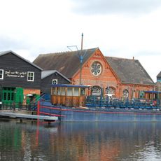
Blake's Lock, Navigation lock on River Kennet, Reading, England
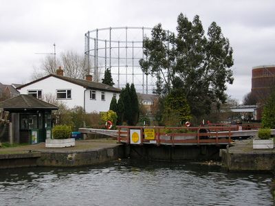
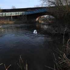
Blake's Lock is a manually operated lock on the River Kennet in Reading, featuring traditional wooden beams. The structure manages water flow and allows vessels to navigate the river.
The lock originated in the 13th century as Brokenburglok, when Reading Abbey's Abbot charged a toll for passing vessels. The structure has undergone repairs and modifications over the centuries.
The Riverside Museum next to the lock displays a medieval mill wheel and Romani heritage items. The collection reflects the area's craft traditions and the diverse communities that have lived here.
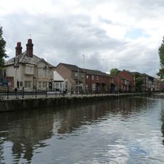
The lock sits near the Riverside Museum and is easily reached on foot from Reading's town center. Visitors can watch the lock's operation from the riverbank and explore the surrounding paths.
The lock stands as one of the few Environment Agency-controlled structures located outside the main river system, operating on the Kennet instead. This distinctive placement makes it an interesting example of water management in a tributary system.
Location: Reading
GPS coordinates: 51.45580,-0.95506
Latest update: December 14, 2025 09:47
University of Reading War Memorial
733 m
St James's Church, Reading
719 m
Reading Old Cemetery
702 m
Albion Terrace, Reading
713 m
Watlington House
559 m
Riverside Museum at Blake's Lock
242 m
Sacred Heart Church, Reading
516 m
Kings Road Baptist Church, Reading
500 m
Reading Abbey
698 m
St Luke's Church
712 m
King's Meadow
623 m
Wesley Methodist Church
545 m
Hugh de Boves and Hugh of Faringdon Memorials (Reading)
684 m
Robed Figure
720 m
Memorial to Henry I
775 m
Riverside Museum
194 m
Main block and flanking wings at Royal Berkshire Hospital
611 m
The Fisherman's Cottage
31 m
Shelter At North East Corner Of Forbury Gardens
755 m
173-183, Kings Road
274 m
Bel and the dragon
218 m
Sumer Is Icumen In (Relief, Reading Abbey)
699 m
Railway Bridge And Attached Accommodation Bridge Over River Kennet At SU 7306 7381
476 m
Rustic Fountain
783 m
Archway Connecting Forbury Gardens to Abbey Ruins. Including Retaining Walls Flanking Path to Abbey Ruins
734 m
10, Abbot's Walk
738 m
11 And 12, Abbot's Walk
729 m
14, St John's Road
496 mVisited this place? Tap the stars to rate it and share your experience / photos with the community! Try now! You can cancel it anytime.
Discover hidden gems everywhere you go!
From secret cafés to breathtaking viewpoints, skip the crowded tourist spots and find places that match your style. Our app makes it easy with voice search, smart filtering, route optimization, and insider tips from travelers worldwide. Download now for the complete mobile experience.
A unique approach to discovering new places❞
— Le Figaro
All the places worth exploring❞
— France Info
A tailor-made excursion in just a few clicks❞
— 20 Minutes