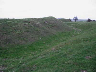
Bratton Castle, Iron Age contour fort in Bratton Down, Wiltshire, England.
Bratton Castle is an Iron Age contour fort located on Bratton Down in Wiltshire and displays two concentric circuits of ramparts with defensive ditches covering roughly 9 hectares. The site follows the natural hillside terrain and its earthworks were carved into the chalky slope to create elevated defensive barriers.
The fort was built during the Iron Age and shows evidence of continuous occupation from the Late Bronze Age through the Iron Age period. Coins found at the site from Roman and Saxon times suggest that the location remained important across different historical periods.
The site contains three distinct burial barrows where archaeologists discovered cremation urns, pottery fragments, and animal bones reflecting ancient burial practices.
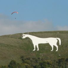
The site is accessible via public footpaths that lead to the hilltop, offering clear views of the fortified structures from multiple angles. Walking around the entire perimeter allows visitors to fully appreciate the scale and layout of the defensive works.
Within the ramparts lie three distinct burial mounds where archaeologists uncovered cremation urns, pottery sherds, and animal bones. These discoveries reveal that the site served not only as a fortress but also as a burial ground for the community.
The community of curious travelers
AroundUs brings together thousands of curated places, local tips, and hidden gems, enriched daily by 60,000 contributors worldwide.