Enable Location

We need your location to show you interesting places around you

Discover nearby places

Find interesting locations and hidden gems around you

Precise directions

Get accurate directions and distances to places

Your location is never shared with other users. It's only used when you tap the location button.

Bourne House, East Woodhay

Log in to your account

Start exploring — it's free

Trusted by 62,995 travelers worldwide

Continue with Google
Continue with Apple
or

We will send you a code to connect

By continuing, you accept our Terms and Conditions and our Privacy Policy

Check your inbox

We've sent a pincode in your inbox. Please enter the code below.

Bourne House, East Woodhay
Discussion Reviews 1 Photos
1.7k Popularity

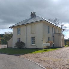
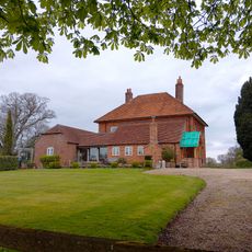
Bourne House, East Woodhay, English country house in East Woodhay, Hampshire, England.

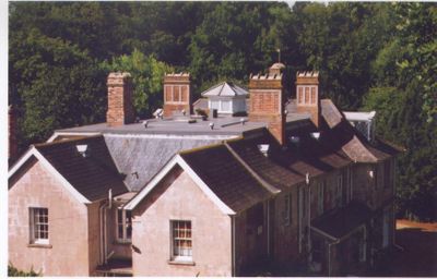
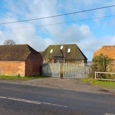
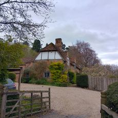
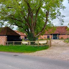
Bourne House is an English country house on a substantial estate in East Woodhay, featuring a lounge hall, three reception rooms, and ten bedrooms distributed throughout the property. The rooms are arranged around formal gardens and complemented by various outbuildings that served the working estate.

The house came under the ownership of Philip Antoine de Teissier in 1872, establishing the de Teissier family's tenure until 1910. This period shaped the property and its subsequent developments.

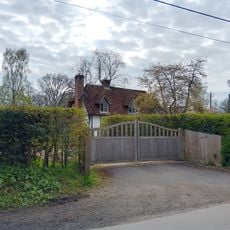
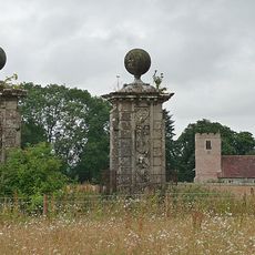
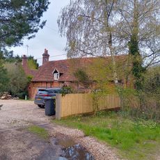
The house reflects architectural traditions typical of Hampshire estates, with its symmetrical design and formal gardens that visitors can still see today. The outbuildings such as stables and cowhouse show how these properties once functioned as working agricultural centers.

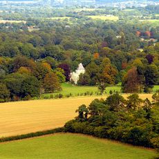
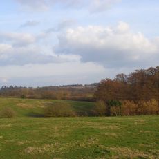
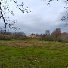
The estate sits near a stream in a quiet rural setting at the northwestern edge of Widehaye parish, offering a peaceful country location. Visitors should plan their journey carefully since the site is somewhat remote and requires advance arrangements for access.

During World War II, the dining room served as a control center for local Air Raid Precautions operations under Sir Arthur Southwell. This wartime transformation shows how private country houses were repurposed for civil defense during the conflict.

The community of curious travelers

AroundUs brings together thousands of curated places, local tips, and hidden gems, enriched daily by 60,000 contributors worldwide.

Start exploring
GPS coordinates
51.36750,-1.37470
Latest update
December 14, 2025 12:21
Around this place
Stargroves
United Kingdom

Stargroves

3.4 km
Avery's Pightle
United Kingdom

Avery's Pightle

1.8 km
Higg's Lock
United Kingdom

Higg's Lock

3.5 km
Parish Church of St Michael
United Kingdom

Parish Church of St Michael

2.4 km
Church of St Michael Archangel
United Kingdom

Church of St Michael Archangel

3.1 km
Church of St Thomas
United Kingdom

Church of St Thomas

1.8 km
Church of St Martin
United Kingdom

Church of St Martin

3.6 km
Benham Bridge On Kennet And Avon Canal
United Kingdom

Benham Bridge On Kennet And Avon Canal

3.2 km
Woolton Hill War Memorial
United Kingdom

Woolton Hill War Memorial

1.8 km
Pillbox Immediately West Of Benham Bridge, At Su 439666
United Kingdom

Pillbox Immediately West Of Benham Bridge, At Su 439666

3.3 km
Milestone On A343 At Approximately Ngr 445 626
United Kingdom

Milestone On A343 At Approximately Ngr 445 626

1.2 km
Barn Approximately 30 Metres To South Of Wash Common Farmhouse
United Kingdom

Barn Approximately 30 Metres To South Of Wash Common Farmhouse

2.3 km
Warren Lodge Presbytery
United Kingdom

Warren Lodge Presbytery

2.6 km
Hitchens
United Kingdom

Hitchens

1.5 km
Milestone On A343 At Ngr 439 611
United Kingdom

Milestone On A343 At Ngr 439 611

2.2 km
Woolton House
United Kingdom

Woolton House

1.6 km
Falkland Garth
United Kingdom

Falkland Garth

2.7 km
Pair Of Gate Piers 210 Metres Due South Of Church Tower
United Kingdom

Pair Of Gate Piers 210 Metres Due South Of Church Tower

3.6 km
Wheatlands Farmhouse
United Kingdom

Wheatlands Farmhouse

1.8 km
Nether Oakhurst
United Kingdom

Nether Oakhurst

2 km
Milestone On A34 At Ngr 470 632
United Kingdom

Milestone On A34 At Ngr 470 632

3.4 km
Barn To South East Of East Of Elm Farm House
United Kingdom

Barn To South East Of East Of Elm Farm House

3.1 km
Milestone, Sandpit Hill; N of Newbury Wash, beside Pine Lodge
United Kingdom

Milestone, Sandpit Hill; N of Newbury Wash, beside Pine Lodge

2 km
Boames Farmhouse
United Kingdom

Boames Farmhouse

970 m
Milestone, The Chase, S of A34 newbury by-pass, S of slip road
United Kingdom

Milestone, The Chase, S of A34 newbury by-pass, S of slip road

1.2 km
Milestone, by Belgret, just N of bridge, The Mount
United Kingdom

Milestone, by Belgret, just N of bridge, The Mount

2.2 km
Milestone, Newtown Common
United Kingdom

Milestone, Newtown Common

3.4 km
Milestone, Tot Hill; 300m S of jct with A34 by-pass
United Kingdom

Milestone, Tot Hill; 300m S of jct with A34 by-pass

3.3 km
Show the full map
Reviews
Share your experience

No review yet

Discussions
Start a discussion...

No discussion yet

« Bourne House, East Woodhay - English country house in East Woodhay, Hampshire, England » is provided by Around Us (aroundus.com). Images and texts are derived from Wikimedia project under a Creative Commons license. You are allowed to copy, distribute, and modify copies of this page, under the conditions set by the license, as long as this note is clearly visible.

Discover hidden gems everywhere you go!

From secret cafés to breathtaking viewpoints, skip the crowded tourist spots and find places that match your style. Our app makes it easy with voice search, smart filtering, route optimization, and insider tips from travelers worldwide. Download now for the complete mobile experience.

Around Us App Screenshot

A unique approach to discovering new places

Le Figaro

All the places worth exploring

France Info

A tailor-made excursion in just a few clicks

20 Minutes

Around Us
Travel Guide & Maps
Download

Send to your phone

QR Code
1

Open the camera app on your mobile.

2

Point at the QR code with your camera. A notification will appear.

3

Tap the notification to open the link.