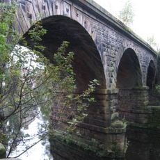
Bullbridge Aqueduct, Navigable aqueduct in Derbyshire, England.
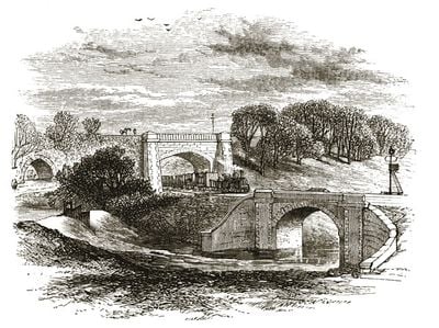
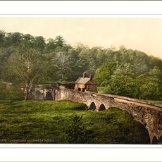
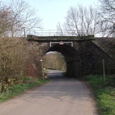
Bullbridge Aqueduct is a navigable aqueduct spanning the Amber Valley in Derbyshire with three distinct arches below. The cast-iron trough measures 150 feet long, 6 feet deep, and 9 feet wide, holding water that flows continuously while boats travel above.
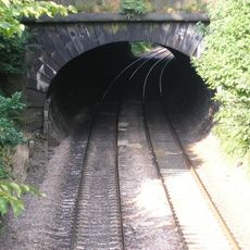
George Stephenson designed the crossing where the North Midland Railway met the canal at Bullbridge in 1839. This moment marked a shift as new transportation networks had to be integrated with existing waterway infrastructure.
The structure demonstrated British engineering capabilities during the canal construction period, connecting communities along the Cromford Canal network.
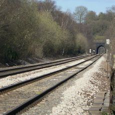
The site is easily visible from the towpath and requires no special gear to explore. Best views are found by walking the paths that run alongside and beneath the structure.
The cast-iron structure was installed in a night operation on March 2, 1839, without halting canal traffic. This was a remarkable feat showing how Victorian engineers managed to keep both transportation routes functioning.
Official opening: 1840
GPS coordinates: 53.06360,-1.47160
Latest update: December 14, 2025 17:02
National Tramway Museum
3 km
Cromford Canal
739 m
Oakhurst House
1.5 km
All Saints' Church, Alderwasley
3.2 km
Church of St Mary
2.8 km
Church of St Luke
2 km
Heage Windmill
1.7 km
Crich Baptist Chapel
2.3 km
Milepost At Entrance Gates To Park Lodge
648 m
Chapels At Belper Cemetery
3 km
Alderwasley War Memorial
3.1 km
Metropolitan Police Public Call Post At The National Tramway Museum
3.2 km
K1 Telephone Box At The National Tramway Museum
3.1 km
Half Penny Bridge Over The River Derwent
964 m
Crich Wesleyan Chapel And Attached Walls
1.8 km
Ripley Road Bridge (Spc8 45)
281 m
Milepost
3.1 km
Wingfield Tunnel North Portal
1.8 km
Penfold post box at the National Tramway Museum
3.1 km
Derwent Viaduct
1.1 km
North And South Portals Of Toadmoor Tunnel
693 m
Milepost 20 Metres South East Of The Former Rising Sun Public House
2.2 km
Lodge At Entrance To Belper Cemetery
2.9 km
Milepost At Sk 369 522
1.5 km
Railway Bridge To The West Of Weirmill Bridge
2.9 km
Milepost To The West Of The Junction Of Chesterfield Road And Wood Lane
2.2 km
Milepost, bottom of hill, NE of Crich village
2.7 km
Milestone, Chase Cliff
2.1 kmVisited this place? Tap the stars to rate it and share your experience / photos with the community! Try now! You can cancel it anytime.
Discover hidden gems everywhere you go!
From secret cafés to breathtaking viewpoints, skip the crowded tourist spots and find places that match your style. Our app makes it easy with voice search, smart filtering, route optimization, and insider tips from travelers worldwide. Download now for the complete mobile experience.
A unique approach to discovering new places❞
— Le Figaro
All the places worth exploring❞
— France Info
A tailor-made excursion in just a few clicks❞
— 20 Minutes