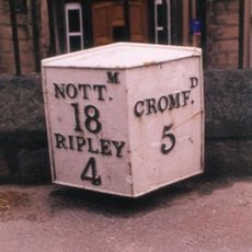
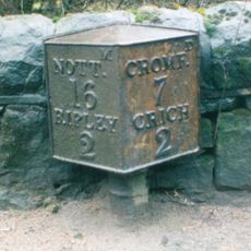
Cromford Canal, Historic canal in Derbyshire, England
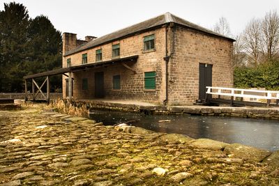
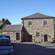
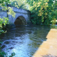
Cromford Canal is a waterway in Derbyshire that connects Cromford with Langley Mill and passes through multiple locks and tunnels along its route. The waterway retains historic buildings, towpaths, and a pump house that demonstrate industrial engineering from the 18th century.
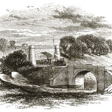
The canal was built in the 1790s during the Industrial Revolution to transport coal, lead, and iron ore from local mines and quarries. Engineers designed tunnels and locks to overcome the natural landscape and create an effective shipping route across the region.
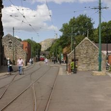
The canal represents how communities once relied on water transport to move goods and materials across the region. The preserved structures and working landscapes along the route show how people organized their lives around this industrial waterway.
The best way to explore the canal is on foot using the towpaths or by taking a boat trip from Cromford Wharf, where guides share information about the route. Most sections are easy to walk and the area has nearby shops, cafes, and small museums worth visiting.
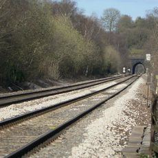
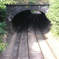
One of the tunnels along the route runs under a hillside and required miners to dig by hand through stone and earth for weeks. This underground section remains impressive to pass through today and shows the effort required to create such a passage with only basic tools.
Location: Derbyshire
Official opening: 1794
GPS coordinates: 53.06400,-1.48262
Latest update: December 10, 2025 15:55
National Tramway Museum
2.8 km
Oakhurst House
758 m
Bullbridge Aqueduct
739 m
All Saints' Church, Alderwasley
2.5 km
Church of St Mary
2.7 km
Church of St Luke
2.6 km
Heage Windmill
2.3 km
Crich Baptist Chapel
2.2 km
Alderwasley Chapel
2.8 km
Milepost At Entrance Gates To Park Lodge
1.1 km
Alderwasley War Memorial
2.4 km
Half Penny Bridge Over The River Derwent
524 m
Crich Wesleyan Chapel And Attached Walls
1.7 km
K1 Telephone Box At The National Tramway Museum
2.9 km
Ripley Road Bridge (Spc8 45)
547 m
Whatstandwell Bridge
2.9 km
Wingfield Tunnel North Portal
2.5 km
Penfold post box at the National Tramway Museum
2.9 km
Derwent Viaduct
790 m
North And South Portals Of Toadmoor Tunnel
511 m
Milepost 20 Metres South East Of The Former Rising Sun Public House
2.1 km
Lodge At Entrance To Belper Cemetery
2.9 km
Milepost At Sk 369 522
2.2 km
Milepost To The West Of The Junction Of Chesterfield Road And Wood Lane
3 km
Milestone, Wilderbrook Lane jct
2.8 km
Milepost, bottom of hill, NE of Crich village
2.7 km
Milestone, Chase Cliff
1.8 km
Milestone, Hilltop Farm
2.9 kmVisited this place? Tap the stars to rate it and share your experience / photos with the community! Try now! You can cancel it anytime.
Discover hidden gems everywhere you go!
From secret cafés to breathtaking viewpoints, skip the crowded tourist spots and find places that match your style. Our app makes it easy with voice search, smart filtering, route optimization, and insider tips from travelers worldwide. Download now for the complete mobile experience.
A unique approach to discovering new places❞
— Le Figaro
All the places worth exploring❞
— France Info
A tailor-made excursion in just a few clicks❞
— 20 Minutes