Chest opened
+${chestReward.xp} XP
Explorer
NOUVEAU ×${chestReward.collectible.quantity}
tapez pour fermer
Chest locked

Open chests in the app

Around Us is built for your phone — chests unlock when you walk, explore and capture nearby places.

Enable Location

We need your location to show you interesting places around you

Discover nearby places

Find interesting locations and hidden gems around you

Precise directions

Get accurate directions and distances to places

Your location is never shared with other users. It's only used when you tap the location button.

Log in to your account

Start exploring — it's free

Trusted by 72,890 travelers worldwide

Continue with Google
Continue with Apple
or

We will send you a code to connect

By continuing, you accept our Terms and Conditions and our Privacy Policy

Check your inbox

We've sent a pincode in your inbox. Please enter the code below.

Buttercrambe Castle
Discussion Reviews Photo
1.4k Popularity

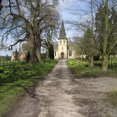
Buttercrambe Castle, Medieval castle ruins in North Yorkshire, England.

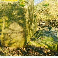
Buttercrambe Castle consists of earthwork remains from a medieval fortification situated near the River Derwent in North Yorkshire. The site preserves the characteristic mound-and-enclosure layout typical of Norman-era defensive structures in England.

In 1200, William de Stuteville received royal permission from King John to fortify his estate into a defensive stronghold. This Norman fortification served as part of the region's medieval control network in North Yorkshire.

The castle site represents the medieval period's architectural and defensive practices, displaying characteristics of Norman military construction methods.

The site is openly accessible and can be viewed from ground level without restrictions, though the earthworks are modest in scale. Sturdy footwear is recommended as the terrain can be uneven and muddy depending on recent weather.

The outer enclosure underwent significant landscaping changes over the centuries, making it challenging for archaeologists to interpret the original medieval design. These modifications have obscured some of the fortification's original form and function.

The community of curious travelers

AroundUs brings together thousands of curated places, local tips, and hidden gems, enriched daily by 60,000 contributors worldwide.

Start exploring
GPS coordinates
54.01654,-0.88198
Latest update
December 9, 2025 20:22
Around this place
United Kingdom

HM Prison Full Sutton

3.8 km
Stamford Bridge
United Kingdom

Stamford Bridge

3.6 km
Howsham Hall
United Kingdom

Howsham Hall

4.8 km
Aldby Park
United Kingdom

Aldby Park

363 m
Howsham Mill
United Kingdom

Howsham Mill

4.4 km
Church of St John the Evangelist
United Kingdom

Church of St John the Evangelist

306 m
Church of St Botolph
United Kingdom

Church of St Botolph

2.8 km
Church of Saint Mary
United Kingdom

Church of Saint Mary

2 km
Church of St Andrew
United Kingdom

Church of St Andrew

3.9 km
Church of St Mary
United Kingdom

Church of St Mary

3.9 km
Church of Saint John
United Kingdom

Church of Saint John

4.5 km
Church of Saint Peter and Saint Paul
United Kingdom

Church of Saint Peter and Saint Paul

2 km
Church of All Saints
United Kingdom

Church of All Saints

5.3 km
Church of St Mary
United Kingdom

Church of St Mary

3.3 km
Bay Horse Inn
United Kingdom

Bay Horse Inn

3.5 km
Wesleyan Methodist Chapel
United Kingdom

Wesleyan Methodist Chapel

3.6 km
Milestone, W of Gate Helmsley
United Kingdom

Milestone, W of Gate Helmsley

4.7 km
Stamford Bridge Railway Viaduct
United Kingdom

Stamford Bridge Railway Viaduct

3.9 km
Sand Hutton and Claxton War Memorial
United Kingdom

Sand Hutton and Claxton War Memorial

3.5 km
The Corn Mill
United Kingdom

The Corn Mill

3.4 km
Part of Leppington medieval village, a moated site and site of the former parish church of St Helen
United Kingdom

Part of Leppington medieval village, a moated site and site of the former parish church of St Helen

4.2 km
Milestone, Concrete Post, W of entrance to High Burtonfields Farm
United Kingdom

Milestone, Concrete Post, W of entrance to High Burtonfields Farm

2.2 km
Milepost Approximately 440M North Of Lobster House, Claxton
United Kingdom

Milepost Approximately 440M North Of Lobster House, Claxton

5.3 km
Milepost Approximately 300 Yards East Of Field House, Flaxton
United Kingdom

Milepost Approximately 300 Yards East Of Field House, Flaxton

5.3 km
Milestone At Se 758562
United Kingdom

Milestone At Se 758562

3.3 km
Milestone, just W of Full Sutton jct.
United Kingdom

Milestone, just W of Full Sutton jct.

2.2 km
Milestone, 550m W of Barf Lane (to Bugthorpe)
United Kingdom

Milestone, 550m W of Barf Lane (to Bugthorpe)

4.5 km
Milestone, Carved Stone Post, W of entrance to High Burtonfields Farm
United Kingdom

Milestone, Carved Stone Post, W of entrance to High Burtonfields Farm

2.2 km
Show the full map
Reviews
Share your experience

No review yet

Discussions
Start a discussion...

No discussion yet

« Buttercrambe Castle - Medieval castle ruins in North Yorkshire, England » is provided by Around Us (aroundus.com). Images and texts are derived from Wikimedia project under a Creative Commons license. You are allowed to copy, distribute, and modify copies of this page, under the conditions set by the license, as long as this note is clearly visible.

Discover hidden gems everywhere you go!

From secret cafés to breathtaking viewpoints, skip the crowded tourist spots and find places that match your style. Our app makes it easy with voice search, smart filtering, route optimization, and insider tips from travelers worldwide. Download now for the complete mobile experience.

Around Us App Screenshot

A unique approach to discovering new places

Le Figaro

All the places worth exploring

France Info

A tailor-made excursion in just a few clicks

20 Minutes

Around Us
Travel Guide & Maps
Download

Send to your phone

QR Code
1

Open the camera app on your mobile.

2

Point at the QR code with your camera. A notification will appear.

3

Tap the notification to open the link.