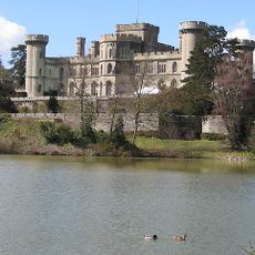
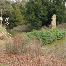
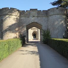
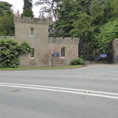
Bronsil Castle, Medieval castle ruins in Eastnor, England
Bronsil Castle is a medieval fortified structure with a water-filled moat and corner towers near Ledbury. The four-sided ruins display defensive walls and crenellated parapets that once protected the resident nobility.
Richard Beauchamp, Treasurer to Henry VI, received permission to fortify his residence at Bronsil in the middle of the 15th century. The site developed as a defensive stronghold for the local nobility during this period.
The castle stands as an example of medieval defensive architecture, reflecting the social and military requirements of Herefordshire's nobility.
The ruins are located about 2 miles east of Ledbury off the A438, with a late 19th-century bridge providing access across the moat. Plan to walk across uneven ground and be prepared for potentially damp conditions around the water-filled defensive ditches.
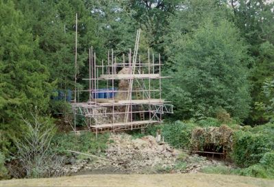
During consolidation work in 1991, the gatehouse tower unexpectedly collapsed into the moat as scaffolding was being installed. This dramatic incident revealed how unstable the remaining stone structures had become over the centuries.
Location: Eastnor
GPS coordinates: 52.03270,-2.36658
Latest update: December 9, 2025 20:26
Eastnor Castle
1.5 km
British Camp
3 km
Church of St Michael and All Angels, including the detached Bell Tower, Ledbury
3.7 km
Church of St Mary
3.6 km
Church of St John the Baptist
1.8 km
Church of All Saints, Hollybush
2 km
Sunnyside
771 m
Obelisk At National Grid Reference So 7523
683 m
The Haven
774 m
Bromsberrow War Memorial
3.6 km
Milestone At National Grid Reference So 7323 3963
3 km
Midsummer Hill Camp
1.2 km
Herefordshire Beacon Camp
2.9 km
Bronsil Castle Bridge And Moat
30 m
Bromsberrow Place
3 km
The Cloisters
3.7 km
Milestone At National Grid Reference So 7600 3689
1.1 km
Portcullis Lodge And Retaining Walls To Forecourt Of Eastnor Caslte
1.5 km
Castle Lodge And Gates
1.6 km
Home Farmhouse And Estate Office
1.9 km
Clenchers Mill
2.7 km
Netherton Farmhouse And Attached Dairy Building At Rear
2.1 km
Milestone At Ngr So 7213 3845
3.1 km
Milestone At National Grid Reference So 7317 3740
1.8 km
Clenchers Mill House
2.8 km
Lodge, Circa 430 Metres South West Of Bromsberrow Place
3.2 km
Milestone, Barton Farm; Chances Pitch, E of farm
3 km
Milestone, N of The Beacon
3.7 kmVisited this place? Tap the stars to rate it and share your experience / photos with the community! Try now! You can cancel it anytime.
Discover hidden gems everywhere you go!
From secret cafés to breathtaking viewpoints, skip the crowded tourist spots and find places that match your style. Our app makes it easy with voice search, smart filtering, route optimization, and insider tips from travelers worldwide. Download now for the complete mobile experience.
A unique approach to discovering new places❞
— Le Figaro
All the places worth exploring❞
— France Info
A tailor-made excursion in just a few clicks❞
— 20 Minutes