British Camp, Iron Age hillfort in Colwall, England
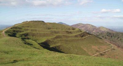
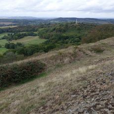
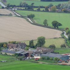
British Camp is an Iron Age hillfort above Colwall featuring multiple circular earthen ramparts and ditches distributed across three hilltops. The fortification covers approximately 44 acres and displays clear layers of defensive construction from different periods of occupation.
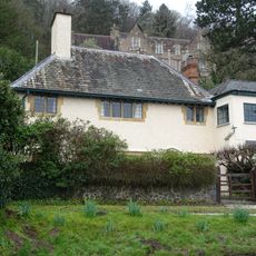
The site began as an Iron Age settlement in the 2nd century BC and later received a Norman castle structure during medieval times. The two periods of construction reflect how the hilltop remained strategically valuable across different eras.
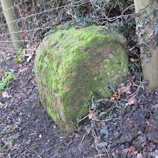
The site reveals traces of a substantial ancient settlement, with foundations of more than 100 round structures scattered across the hillsides. Walking through the ruins shows how a complex community once thrived in this elevated location.
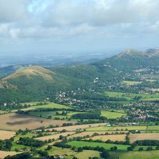
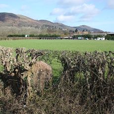
The site has established pathways leading through its defensive ramparts and can be accessed from the eastern, western, and northeastern sides. The terrain slopes considerably, so sturdy footwear suits the uneven ground and elevation changes.
Another major hillfort called Midsummer Hill sits directly to the south, roughly a mile away. The coexistence of two substantial fortifications so close together raises questions about how these communities related to each other.
Location: Colwall
GPS coordinates: 52.05800,-2.35176
Latest update: December 7, 2025 19:31
Malvern Hills
3.1 km
Holy Well, Malvern
2.5 km
Little Malvern Priory
1.1 km
St Wulstan's Roman Catholic Church
1.5 km
Bronsil Castle
3 km
Malvern Wells War Memorial
2.7 km
Church of St James
3.1 km
Little Malvern Court
1.1 km
Park Farmhouse
3.2 km
Peattys Cottage
3 km
Obelisk At National Grid Reference So 7523
2.3 km
Bronsil Castle Bridge And Moat
3 km
Colwall War Memorial
3 km
Milestone At National Grid Reference So 7323 3963
2.8 km
Midsummer Hill Camp
2.6 km
Herefordshire Beacon Camp
114 m
Milestone, north of The Abbey
2.1 km
Lower Lodge, Gate-Piers And Gates
3 km
Milestone
897 m
Elgar's Grave, Approximately 20 Metres South Of Church Of St Wulstan
1.4 km
Churchyard Cross
3.1 km
Netherton Farmhouse And Attached Dairy Building At Rear
1.4 km
Milestone At National Grid Reference So 7600 3689
3.1 km
Milestone, Mayalls Farm; 100 yds W of Yew Tree Farm
2 km
Cob Nash
3.3 km
Milestone, Barton Farm; Chances Pitch, E of farm
1.4 km
Milestone, N of The Beacon
883 m
Tollhouse Cottage
270 mReviews
Visited this place? Tap the stars to rate it and share your experience / photos with the community! Try now! You can cancel it anytime.
Discover hidden gems everywhere you go!
From secret cafés to breathtaking viewpoints, skip the crowded tourist spots and find places that match your style. Our app makes it easy with voice search, smart filtering, route optimization, and insider tips from travelers worldwide. Download now for the complete mobile experience.
A unique approach to discovering new places❞
— Le Figaro
All the places worth exploring❞
— France Info
A tailor-made excursion in just a few clicks❞
— 20 Minutes