Chest opened
+${chestReward.xp} XP
Explorer
NOUVEAU ×${chestReward.collectible.quantity}
tapez pour fermer
Chest locked

Open chests in the app

Around Us is built for your phone — chests unlock when you walk, explore and capture nearby places.

Enable Location

We need your location to show you interesting places around you

Discover nearby places

Find interesting locations and hidden gems around you

Precise directions

Get accurate directions and distances to places

Your location is never shared with other users. It's only used when you tap the location button.

Log in to your account

Start exploring — it's free

Trusted by 72,880 travelers worldwide

Continue with Google
Continue with Apple
or

We will send you a code to connect

By continuing, you accept our Terms and Conditions and our Privacy Policy

Check your inbox

We've sent a pincode in your inbox. Please enter the code below.

Brimsdown Industrial Estate
Discussion Reviews Photo
1.8k Popularity

Brimsdown Industrial Estate, Industrial complex in Brimsdown, England.

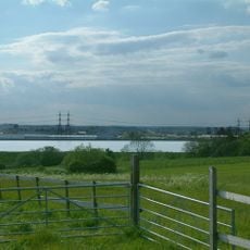
Brimsdown Industrial Estate is an industrial complex spread across the Lea Valley, situated between the West Anglia Main Line railway and the King George V Reservoir. The site contains several manufacturing facilities, including a major bakery operation, precious metals processing, and metal fabrication plants.

The North Metropolitan Electric Power Supply Company built a coal-fired power station here in 1907 to generate electricity for the surrounding region. This facility served as a major energy hub for decades before operations eventually ceased.

Multiple manufacturing facilities occupy the estate, including Warburtons bakery, Johnson Matthey precious metals, and specialized metal processing plants.

The estate is easily accessible via Brimsdown railway station, which provides direct rail connections for visitors and workers. The location near water and rail infrastructure makes transportation straightforward for anyone arriving by train.

Seven massive cooling towers from the original power station once dominated the local skyline until their demolition in the 1970s. These towering structures were instantly recognizable landmarks that shaped the area's visual identity for generations.

The community of curious travelers

AroundUs brings together thousands of curated places, local tips, and hidden gems, enriched daily by 60,000 contributors worldwide.

Start exploring
GPS coordinates
51.65570,-0.02453
Latest update
December 14, 2025 11:20
Around this place
Enfield Lock
United Kingdom

Enfield Lock

1.4 km
St James' Church, Enfield Highway
United Kingdom

St James' Church, Enfield Highway

1.6 km
Wright's Flour Mill
United Kingdom

Wright's Flour Mill

1.6 km
The White Horse Public House
United Kingdom

The White Horse Public House

1.2 km
Ponder's End Lock
United Kingdom

Ponder's End Lock

1.6 km
Enfield Island Village Library
United Kingdom

Enfield Island Village Library

1.5 km
United Kingdom

Forecourt Wall To Nos 346 To 356 (Even) (Wright's Almshouses)

1.6 km
Machine Shop and attached range to west at Royal Ordnance Factory
United Kingdom

Machine Shop and attached range to west at Royal Ordnance Factory

1.5 km
United Kingdom

Sewardstone Lodge

1.2 km
Water Tower House At King George Pumping Station
United Kingdom

Water Tower House At King George Pumping Station

971 m
18-28, Government Row
United Kingdom

18-28, Government Row

1.6 km
4-14, Government Row
United Kingdom

4-14, Government Row

1.5 km
United Kingdom

Barn To South Of Mill Owner's House, Wright's Flour Mills

1.6 km
United Kingdom

Wright's Almshouses

1.6 km
United Kingdom

Railings To East Of West Range Of Offices Attached To Machine Shop, Royal Ordnance Factory

1.5 km
United Kingdom

Mill Owner's House To West Of Old Mill Building, Wright's Flour Mills

1.6 km
United Kingdom

Luthers

1.3 km
Former Well Station Of Thames Water Authority
United Kingdom

Former Well Station Of Thames Water Authority

1.4 km
United Kingdom

Old Mill Building, Wright's Flour Mills

1.6 km
Pump House At King George Pumping Station
United Kingdom

Pump House At King George Pumping Station

990 m
United Kingdom

Retort House And King George Pumping Station

1 km
United Kingdom

98 And 100, Green Street

1.3 km
United Kingdom

House To East Of Old Mill Building Now Used As Offices, Wright's Flour Mills

1.6 km
United Kingdom

Weir With Inlet Pipes At King George Pumping Station And Adjacent To King George Reservoir

950 m
United Kingdom

Sluice Gates And Flanking Walls At Intake From The Lea Navigation To King George Pumping Station

1 km
King George V Reservoir
United Kingdom

King George V Reservoir

869 m
United Kingdom

Brimsdown Sports & Social Club Golf Course

883 m
United Kingdom

Howard Gilpin

1.5 km
Show the full map
Reviews
Share your experience

No review yet

Discussions
Start a discussion...

No discussion yet

« Brimsdown Industrial Estate - Industrial complex in Brimsdown, England » is provided by Around Us (aroundus.com). Images and texts are derived from Wikimedia project under a Creative Commons license. You are allowed to copy, distribute, and modify copies of this page, under the conditions set by the license, as long as this note is clearly visible.

Discover hidden gems everywhere you go!

From secret cafés to breathtaking viewpoints, skip the crowded tourist spots and find places that match your style. Our app makes it easy with voice search, smart filtering, route optimization, and insider tips from travelers worldwide. Download now for the complete mobile experience.

Around Us App Screenshot

A unique approach to discovering new places

Le Figaro

All the places worth exploring

France Info

A tailor-made excursion in just a few clicks

20 Minutes

Around Us
Travel Guide & Maps
Download

Send to your phone

QR Code
1

Open the camera app on your mobile.

2

Point at the QR code with your camera. A notification will appear.

3

Tap the notification to open the link.