Enable Location

We need your location to show you interesting places around you

Discover nearby places

Find interesting locations and hidden gems around you

Precise directions

Get accurate directions and distances to places

Your location is never shared with other users. It's only used when you tap the location button.

Bristol General Hospital

Log in to your account

Start exploring — it's free

Trusted by 62,107 travelers worldwide

Continue with Google
Continue with Apple
or

We will send you a code to connect

By continuing, you accept our Terms and Conditions and our Privacy Policy

Check your inbox

We've sent a pincode in your inbox. Please enter the code below.

Bristol General Hospital

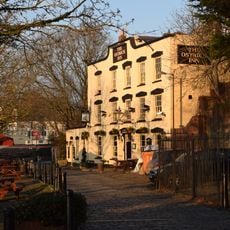
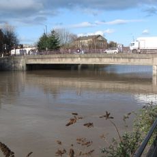
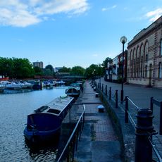
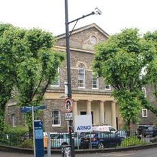
Bristol General Hospital, Grade II listed former hospital in Harbourside, Bristol, England

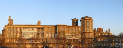
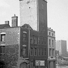
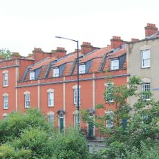
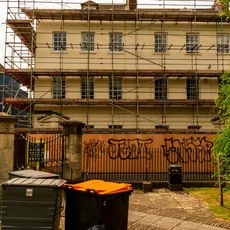
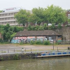
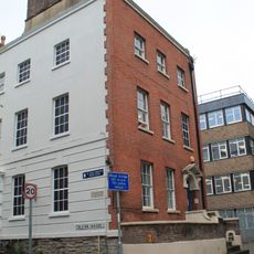
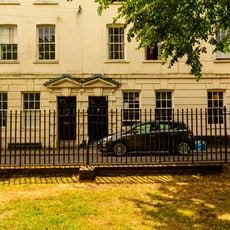
Bristol General Hospital is a substantial Victorian structure on Guinea Street featuring distinctive architectural elements and a prominent dome crowning the roof. The building comprises multiple sections that expanded during different periods of the 19th and 20th centuries.

The hospital was founded in 1832 with Quaker support and grew through multiple expansion phases over the following decades. It served the community as a medical facility until closure in 2012.

The building served as a filming location for the BBC Three drama Being Human, linking medical heritage with contemporary television. This modern use shows how historic structures find new roles in popular culture.

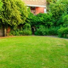
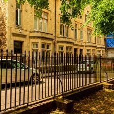
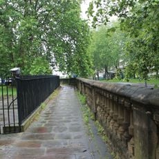
The former medical facility has been converted into residential apartments while maintaining its Grade II listed status and historical features. Visitors can appreciate the exterior and setting while exploring the surrounding Harbourside area.

During World War II the building sustained severe damage, with its characteristic dome completely destroyed in the bombing. The dome was later reconstructed, showing how this landmark recovered from wartime devastation.

The community of curious travelers

AroundUs brings together thousands of curated places, local tips, and hidden gems, enriched daily by 60,000 contributors worldwide.

Start exploring
Location
Inception
1832
Part of
National Health Service
GPS coordinates
51.44650,-2.59276
Latest update
December 11, 2025 11:08
Around this place
St Mary Redcliffe
United Kingdom

St Mary Redcliffe

274 m
Redcliffe Shot Tower
United Kingdom

Redcliffe Shot Tower

250 m
Bedminster Bridge
United Kingdom

Bedminster Bridge

145 m
Robinson's Warehouse, Bristol
United Kingdom

Robinson's Warehouse, Bristol

197 m
The Ostrich Inn
United Kingdom

The Ostrich Inn

174 m
War Memorial, St Mary Redcliffe
United Kingdom

War Memorial, St Mary Redcliffe

266 m
The Louisiana Public House
United Kingdom

The Louisiana Public House

256 m
Bedminster Old Bridge
United Kingdom

Bedminster Old Bridge

114 m
Fountain
United Kingdom

Fountain

269 m
Hermitage in Quaker burial ground near St Mary Redcliffe
United Kingdom

Hermitage in Quaker burial ground near St Mary Redcliffe

252 m
Numbers 42 To 58 (Even) And Attached Front Basement Area Railings
United Kingdom

Numbers 42 To 58 (Even) And Attached Front Basement Area Railings

247 m
Fry's House Of Mercy
United Kingdom

Fry's House Of Mercy

237 m
6-9, Colston Parade
United Kingdom

6-9, Colston Parade

234 m
Numbers 3-13 And Attached Front Area Railings And Gates
United Kingdom

Numbers 3-13 And Attached Front Area Railings And Gates

186 m
Balustrade, Wall And Well Head 5 Metres West Of Church Of St Mary Redcliffe
United Kingdom

Balustrade, Wall And Well Head 5 Metres West Of Church Of St Mary Redcliffe

267 m
Hand Crane On Redcliffe Wharf
United Kingdom

Hand Crane On Redcliffe Wharf

220 m
1 and 2, Colston Parade
United Kingdom

1 and 2, Colston Parade

269 m
Drinking Fountain Approximately 3 Metres North West Of Bedminster Bridge
United Kingdom

Drinking Fountain Approximately 3 Metres North West Of Bedminster Bridge

97 m
Redcliffe Wharf Quays And Bollards, Extending Approximately 250 Metres South Of Redcliffe Bridge
United Kingdom

Redcliffe Wharf Quays And Bollards, Extending Approximately 250 Metres South Of Redcliffe Bridge

243 m
Number 51 And Attached Basement Area Wall
United Kingdom

Number 51 And Attached Basement Area Wall

225 m
7, 8 And 9, Bathurst Parade
United Kingdom

7, 8 And 9, Bathurst Parade

229 m
Bedminster New Bridge
United Kingdom

Bedminster New Bridge

178 m
Numbers 2 To 12 And Attached Front Area Railings
United Kingdom

Numbers 2 To 12 And Attached Front Area Railings

203 m
1-4, Wapping Road
United Kingdom

1-4, Wapping Road

261 m
Walls, Quays And Bollards To Bathurst Basin
United Kingdom

Walls, Quays And Bollards To Bathurst Basin

186 m
Zion House And Attached Railings And Gateways
United Kingdom

Zion House And Attached Railings And Gateways

128 m
3, 4 And 5, Colston Parade
United Kingdom

3, 4 And 5, Colston Parade

255 m
Quay Wall Of Bathurst Wharf
United Kingdom

Quay Wall Of Bathurst Wharf

261 m
Show the full map
« Bristol General Hospital - Grade II listed former hospital in Harbourside, Bristol, England » is provided by Around Us (aroundus.com). Images and texts are derived from Wikimedia project under a Creative Commons license. You are allowed to copy, distribute, and modify copies of this page, under the conditions set by the license, as long as this note is clearly visible.

Discover hidden gems everywhere you go!

From secret cafés to breathtaking viewpoints, skip the crowded tourist spots and find places that match your style. Our app makes it easy with voice search, smart filtering, route optimization, and insider tips from travelers worldwide. Download now for the complete mobile experience.

Around Us App Screenshot

A unique approach to discovering new places

Le Figaro

All the places worth exploring

France Info

A tailor-made excursion in just a few clicks

20 Minutes

Around Us
Travel Guide & Maps
Download

Send to your phone

QR Code
1

Open the camera app on your mobile.

2

Point at the QR code with your camera. A notification will appear.

3

Tap the notification to open the link.