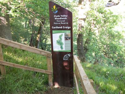
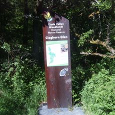
Cartland Craigs, Protected woodland area in South Lanarkshire, Scotland.
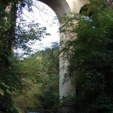
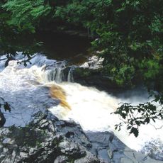
Cartland Craigs is a protected woodland site stretching along steep river cliffs in the Clyde Valley of South Lanarkshire. The landscape combines oak, ash, and birch trees growing across the slopes and rocky faces that form a varied ecosystem.
The rocky cliffs formed through river erosion over thousands of years, shaping the geology of the site today. This natural landscape development created the conditions for the woodland ecosystem that exists now.
The site draws birdwatchers and nature enthusiasts who come to observe peregrine falcons nesting on the rocky cliffs. Visitors experience how the woodland landscape supports both wildlife and human interest in conservation.
Walking trails wind through the area and lead to viewpoints along the cliffs overlooking the valley. Parking areas and information boards are located at entry points to help visitors get oriented.
The site hosts breeding peregrine falcons that nest on the steep rocky faces, offering a rare chance to watch these swift hunters in action. Additionally, it shelters rare beetle species found mainly in this type of woodland landscape.
Location: South Lanarkshire
Part of: Clyde Valley Woodlands National Nature Reserve
GPS coordinates: 55.68400,-3.79600
Latest update: December 14, 2025 18:03
Lee Castle
2.4 km
St Mary's Roman Catholic Church
1.9 km
St Kentigern's Church
2.3 km
Cartland Bridge
479 m
St Nicholas Parish Church, Lanark
1.5 km
Cleghorn Glen
1.8 km
Lanark, 22-26 Hope Street, County Buildings
1.4 km
Lanark, 4 High Street
1.6 km
Broomgate drill hall, Lanark
1.5 km
Stonebyres Falls
2 km
Lindsay Institute
1.4 km
New Lanark, 3 Rosedale Street, Robert Owen's House
2.4 km
New Lanark, Mill Number One
2.4 km
Clydesholm Bridge
987 m
Water Houses
2.4 km
New Lanark, New Lanark Road, New Buildings
2.4 km
1–4 Double Row
2.4 km
New Lanark, New Lanark Road, New Lanark Church
2.4 km
Stonebyres Power Station
2.3 km
New Lanark, 5-7 Rosedale Street, David Dale's House
2.4 km
5–12 Double Row
2.3 km
Lanark, Hyndford Road, Cemetery Chapel
2.4 km
1–14 Long Row
2.3 km
1–10 Braxfield Row
2.2 km
Lanark Grammar School, Hyndford Road building
1.9 km
Mousemill Old Bridge
691 m
Churchyard and burial aisles at St Kentigern’s Church
2.3 km
New Lanark, New Lanark Road, Telephone Call Box
2.4 kmVisited this place? Tap the stars to rate it and share your experience / photos with the community! Try now! You can cancel it anytime.
Discover hidden gems everywhere you go!
From secret cafés to breathtaking viewpoints, skip the crowded tourist spots and find places that match your style. Our app makes it easy with voice search, smart filtering, route optimization, and insider tips from travelers worldwide. Download now for the complete mobile experience.
A unique approach to discovering new places❞
— Le Figaro
All the places worth exploring❞
— France Info
A tailor-made excursion in just a few clicks❞
— 20 Minutes