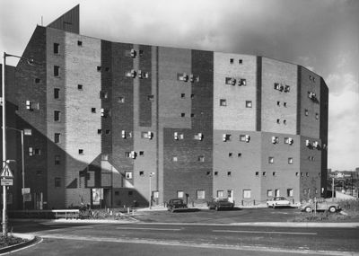
Byker Wall, Building complex in Newcastle upon Tyne, England.
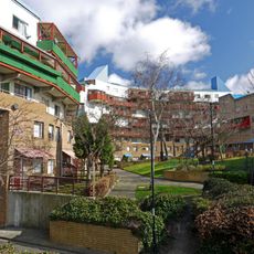
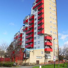
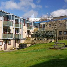
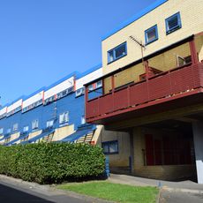
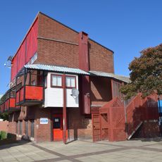
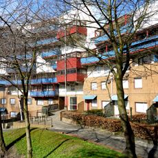
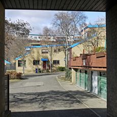
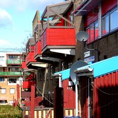
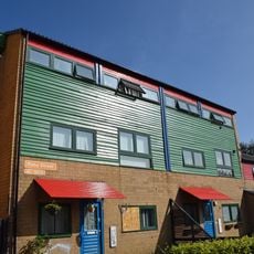
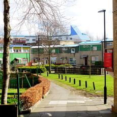
Byker Wall is a continuous residential block in northeast Newcastle upon Tyne comprising 620 maisonettes that stretch in a curving formation across several hundred meters. The complex combines concrete, brick, and timber in a shifting pattern of varied facades, with horizontal brick bands marking floor levels and colored panels adding visual variety throughout.
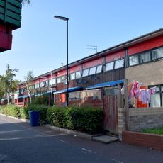
Building work started in 1969 to replace Victorian terraces that were scheduled for demolition due to poor living conditions. Swedish architect Ralph Erskine opened an office directly on site to speak with residents and incorporate their needs into the redevelopment plans.
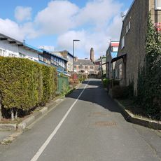
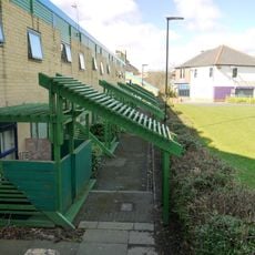
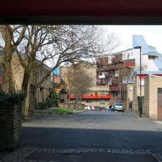
The development displays a strong sense of community visible in the shared courtyards and walkways that connect individual homes throughout the entire length of the complex. Many residents took part in planning their own spaces, which is still evident in the varied design of balconies and entrances along the walkways.
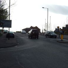
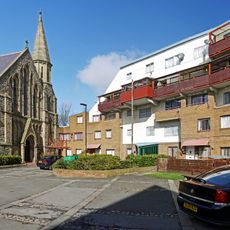
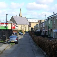
The entire complex remains residential and can only be viewed from outside, though public footpaths pass between sections of the building. Visitors can reach the area on foot or by bus from the city center, with a walk along the outer edge offering the clearest overview of the full length.
The layout was originally planned to shield homes from a proposed motorway that never came to be, leaving the tall wall facing an empty stretch of land. This gives the building an unexpected fortress-like presence that turns toward open ground instead of shielding from traffic.
Location: Newcastle upon Tyne
GPS coordinates: 54.97500,-1.57800
Latest update: December 5, 2025 22:30
Milecastle 2
703 m
Church of St Michael With St Lawrence
200 m
Church of St Silas
500 m
1-52 Raby Gate, 1-55 Shipley Rise, attached walls, seats, fences, pergolas and steps, and Structure Housing District Heating System
59 m
Tom Collins House
418 m
1, 2 and 3 Grace Street
159 m
1-75 Dunn Terrace, including Graham House, Wolseley House, The Cabin, YMCA Byker Neighbourhood Youth Project, 1-66 Northumberland Terrace, Salisbury House
517 m
1-81 Felton Walk, St Lawrence RC Church and Church Hall, 1-28 Byker Crescent, 1-8 Headlam House, 1-12 Felton House, and attached walls, fences and pergolas
225 m
1-89 Gordon Road
187 m
Swimming Baths
143 m
1-17 and Attached Fences and Curbs
165 m
1-39 Mount Pleasant House and Attached Walls and Fences
116 m
East End Library
175 m
Piers, Walls And Railings South Of Former Ouseburn Schools
678 m
39-79 Raby Street with attached bin stores and sheds, and walls and fences to rear
94 m
1-7 Raby Cross
357 m
1-17 Kendal House, 1-21 Gordon House, 1-47 Dalton Crescent, 1-58 Shipley Walk, and 1-18 Brinkburn Court with attached garden walls
307 m
2-38 Kendal Street with retaining walls
277 m
Byker Neighbourhood Estate Office
199 m
Education Committee Distribution Centre Office (ouseburn Schools)
671 m
1, 2 And 3 And Attached Ramps
216 m
18-22 With Attached Fences And Garages To The Rear
189 m
1,3 And 5 And Attached Fences
152 m
No.1 -17, With Kerbs To Front And Attached Fences
270 m
Nos 1 And 2, St Lawrence Court, With Attached Fences And Seats
281 m
85-105 Raby Street with attached fences
223 m
Caretaker's House To Former Ouseburn Schools
687 m
1-11 Winship Terrace with kerbs to front and fences to rear
263 mVisited this place? Tap the stars to rate it and share your experience / photos with the community! Try now! You can cancel it anytime.
Discover hidden gems everywhere you go!
From secret cafés to breathtaking viewpoints, skip the crowded tourist spots and find places that match your style. Our app makes it easy with voice search, smart filtering, route optimization, and insider tips from travelers worldwide. Download now for the complete mobile experience.
A unique approach to discovering new places❞
— Le Figaro
All the places worth exploring❞
— France Info
A tailor-made excursion in just a few clicks❞
— 20 Minutes