Castle Dore

Log in to your account

AroundUs is a community-driven map of interesting places, built by curious explorers like you. It grows with every review, story, and photo you share.
Connect to save your favorite spots, contribute locations, and create personalized routes.
By continuing, you accept our Terms and Conditions and our Privacy Policy
Add to collection
Map
Suggest a change
Share

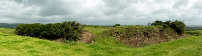
Castle Dore, Iron Age hillfort in Tywardreath, England

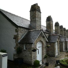
Castle Dore is a hillfort with oval-shaped enclosures set on a prominent ridge in Tywardreath. The site features layered defensive works, with inner ramparts protecting a core area and outer fortifications adding additional barriers for protection.

This fortification began as an Iron Age settlement when people chose the elevated location for protection and control. Centuries later, during the 1600s conflict in England, Parliamentary forces reused the earthworks as a defensive position.

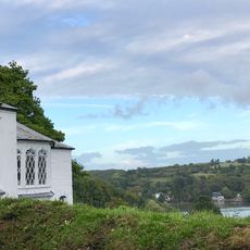
The site's name reflects its ancient roots, and the earthworks show how people organized their settlement for both living and defense. You can walk the ridgeline and sense the strategic position that made this location valuable across different periods.

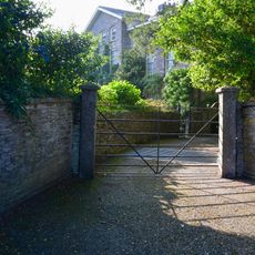
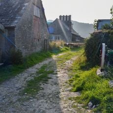
The site is accessible via public footpaths, but the ground is uneven with slopes and ridges. Good walking shoes are important, and visitors should be ready for changing weather since the elevated position offers little shelter.

Excavations in the 1930s uncovered traces of roughly 20 roundhouses, showing that people rebuilt and changed the settlement repeatedly over time. These multiple construction phases suggest the location was abandoned and reoccupied across different generations.

Location: Cornwall

Location: Tywardreath and Par

GPS coordinates: 50.36280,-4.66776

Latest update: December 10, 2025 20:03

Photos
Around this place
Tristan Stone
United Kingdom

Tristan Stone

2.9 km
St Sampson's Church
United Kingdom

St Sampson's Church

1.7 km
Par signal box
United Kingdom

Par signal box

2.8 km
Church of St Winnow
United Kingdom

Church of St Winnow

2.4 km
Church of St Andrew
United Kingdom

Church of St Andrew

1.9 km
Hidden Valley Gardens
United Kingdom

Hidden Valley Gardens

2 km
Young Monument In The Churchyard About 2 Metres South East Of South Aisle Of Church Of St Sampson
United Kingdom

Young Monument In The Churchyard About 2 Metres South East Of South Aisle Of Church Of St Sampson

1.7 km
Rundall Monument In The Churchyard About 15 Metres South West Of South Aisle Of Church Of St Sampson
United Kingdom

Rundall Monument In The Churchyard About 15 Metres South West Of South Aisle Of Church Of St Sampson

1.7 km
Miechel Monument In The Churchyard About 3 Metres South East Of South Porch Of Church Of St Sampson
United Kingdom

Miechel Monument In The Churchyard About 3 Metres South East Of South Porch Of Church Of St Sampson

1.7 km
Avery Monument In The Churchyard About 5 Metres South Of South Aisle Of Church Of St Sampson
United Kingdom

Avery Monument In The Churchyard About 5 Metres South Of South Aisle Of Church Of St Sampson

1.7 km
Milestone On Penpillick Hill, 190M North Of Vine Cottage
United Kingdom

Milestone On Penpillick Hill, 190M North Of Vine Cottage

2.8 km
Lobb Monument In The Churchyard About 4 Metres South West Of South Porch Of Church Of St Sampson
United Kingdom

Lobb Monument In The Churchyard About 4 Metres South West Of South Porch Of Church Of St Sampson

1.7 km
Rashleigh Almshouses
United Kingdom

Rashleigh Almshouses

2 km
Holy Well Attached To The South Side Of The South Aisle Of Church Of St Sampson
United Kingdom

Holy Well Attached To The South Side Of The South Aisle Of Church Of St Sampson

1.7 km
River House
United Kingdom

River House

1.8 km
Chest Tomb, 3 Metres To South Of South Aisle Of St Winnow Church
United Kingdom

Chest Tomb, 3 Metres To South Of South Aisle Of St Winnow Church

2.4 km
Vicarage
United Kingdom

Vicarage

2.7 km
Headstone, 2 Metres South Of South Aisle Of St Winnows Church
United Kingdom

Headstone, 2 Metres South Of South Aisle Of St Winnows Church

2.4 km
St Winnow Barton
United Kingdom

St Winnow Barton

2.5 km
Chest Tomb, 1 Metre To South Of South Aisle Of St Winnow Church
United Kingdom

Chest Tomb, 1 Metre To South Of South Aisle Of St Winnow Church

2.4 km
Golant Methodist Church With Attached Schoolroom
United Kingdom

Golant Methodist Church With Attached Schoolroom

1.8 km
Altarnun
United Kingdom

Altarnun

1.9 km
Hendra
United Kingdom

Hendra

1.9 km
Guide Post At Sx 0753 5485
United Kingdom

Guide Post At Sx 0753 5485

2.8 km
Guide Post At T Junction With Driving Lane
United Kingdom

Guide Post At T Junction With Driving Lane

2.8 km
Farmbuilding 10 Metres East Of St Winnow Barton
United Kingdom

Farmbuilding 10 Metres East Of St Winnow Barton

2.5 km
Upper Fowey and Pont Pill Marine Conservation Zone
United Kingdom

Upper Fowey and Pont Pill Marine Conservation Zone

2.2 km
Quay 70 Metres West Of Church Of St Winnow
United Kingdom

Quay 70 Metres West Of Church Of St Winnow

2.4 km
Show the full map
Reviews

Visited this place? Tap the stars to rate it and share your experience / photos with the community! Try now! You can cancel it anytime.

« Castle Dore - Iron Age hillfort in Tywardreath, England » is provided by Around Us (aroundus.com). Images and texts are derived from Wikimedia project under a Creative Commons license. You are allowed to copy, distribute, and modify copies of this page, under the conditions set by the license, as long as this note is clearly visible.

Discover hidden gems everywhere you go!

From secret cafés to breathtaking viewpoints, skip the crowded tourist spots and find places that match your style. Our app makes it easy with voice search, smart filtering, route optimization, and insider tips from travelers worldwide. Download now for the complete mobile experience.

Around Us App Screenshot

A unique approach to discovering new places

Le Figaro

All the places worth exploring

France Info

A tailor-made excursion in just a few clicks

20 Minutes