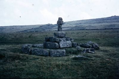
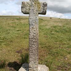
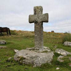
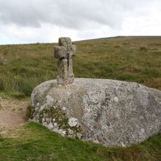
Childe's Tomb, Ancient stone cross in Dartmoor, England
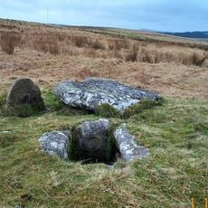
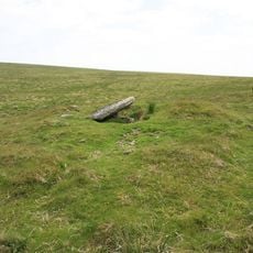
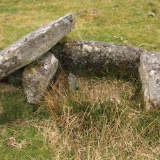
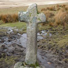
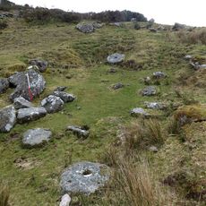
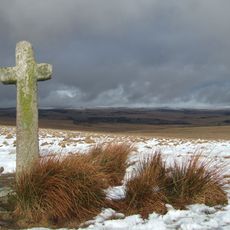
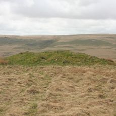
Childe's Tomb is a granite stone cross standing on Dartmoor's Fox Tor Mires, rising over two meters tall with a square socket stone and burial chamber beneath. Granite stones form a circle around the grave, creating a recognizable monument that has remained on this moorland plateau for centuries.
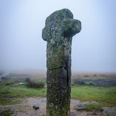
The original monument dates from the 11th century but was taken apart in 1812 when a local resident used the stones for building Fox Tor Farm. Some of the site was later reconstructed, allowing part of the original structure to remain visible on the moor.
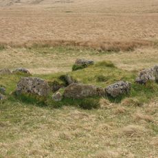
The site is linked to a Saxon figure who held importance in the area, and shows how Dartmoor has long been a place where communities marked their dead with stone. The way stones form a circle and frame the burial reflects how people here honored those who had passed.
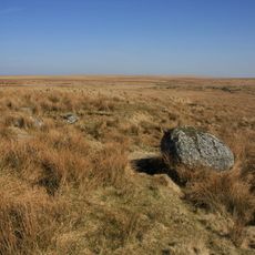
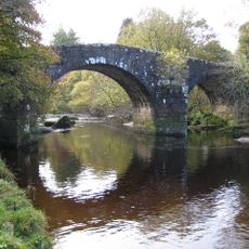
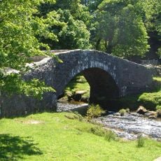
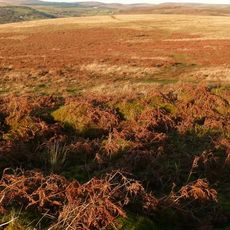
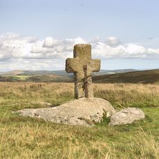
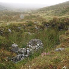
The monument sits roughly 500 meters north of Fox Tor and can be reached via the ancient Monks' Path that links Buckfast and Tavistock Abbey. The route crosses open moorland, so visitors should expect changing weather and uneven ground.
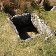
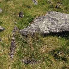
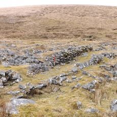
The burial site contains a kistvaen, a prehistoric stone burial box, surrounded by granite blocks set upright on their edge in a distinctive arrangement. Nine of the twelve original pedestal stones that once framed the grave are still standing in place.
Location: Devon
GPS coordinates: 50.51623,-3.93980
Latest update: December 10, 2025 20:02
Tor Royal
3.8 km
Duck's Pool, Dartmoor
2.5 km
Grim's Grave cairn with a cist, Langcombe
4.1 km
Crock of Gold
3.1 km
Hexworthy Or Huccaby Bridge
4.2 km
Prince Hall
3.9 km
Bridge At Sx 625738
3.6 km
Platform cairn and cist 80m south east of Calveslake Tor
3.2 km
Partially enclosed stone hut circle settlement 350m south west of Horn's Cross
4.2 km
Two cairns and a cist 300yds (270m) NW of Swincombe intake
1.9 km
Blowing houses at Week Ford
4.1 km
Wayside cross 1120m ENE of Childe's Tomb
1.1 km
Siward's or Nun's Cross
2.1 km
Round cairn on the summit of Great Gnat's Head
2.6 km
Wayside cross on Down Ridge 730m south west of Saddle Bridge
3.6 km
Hexworthy Farmhouse
3.8 km
Blowing house and mill at Gobbet
3.2 km
Wayside cross 910m ESE of Crazy Well Pool
3.4 km
Foxton Cross
1.6 km
One of several cairns with cists south of Langcombe Brook
4.2 km
Stone cross on Ter Hill
1.6 km
Cairn with cist S of Royal Hill
1.9 km
Crazywell Cross
4.2 km
Wayside cross on Down Ridge 1.1km south west of Saddle Bridge
3.1 km
Cairn S of Royal Hill
1.8 km
A prehistoric settlement with cairns and a historic tin mill, streamwork and buildings lying adjacent to the Langcombe Brook
3.9 km
Cross NE of Nun's Cross
848 m
Blowing house on Down Ridge
2.3 kmVisited this place? Tap the stars to rate it and share your experience / photos with the community! Try now! You can cancel it anytime.
Discover hidden gems everywhere you go!
From secret cafés to breathtaking viewpoints, skip the crowded tourist spots and find places that match your style. Our app makes it easy with voice search, smart filtering, route optimization, and insider tips from travelers worldwide. Download now for the complete mobile experience.
A unique approach to discovering new places❞
— Le Figaro
All the places worth exploring❞
— France Info
A tailor-made excursion in just a few clicks❞
— 20 Minutes